As of this evening our region is under a Winter Storm Watch, and we are on track for our area to experience our first winter storm of the season beginning on Wednesday afternoon and lasting overnight until early Thursday morning. Since my post yesterday, the models have continued to come in to alignment in regards to what should expect on Wednesday.
Snow will begin to overspread our region from west to east in the mid to late afternoon hours; snow will begin light and pick up in intensity during the evening. At the height of the storm, we can expect to see snowfall rates in excess of 2″ per hour with blizzard conditions occurring. Winds will likely be gusting over 40MPH at the height of the storm. The snow will begin to taper off around or just before sunrise on Thursday.
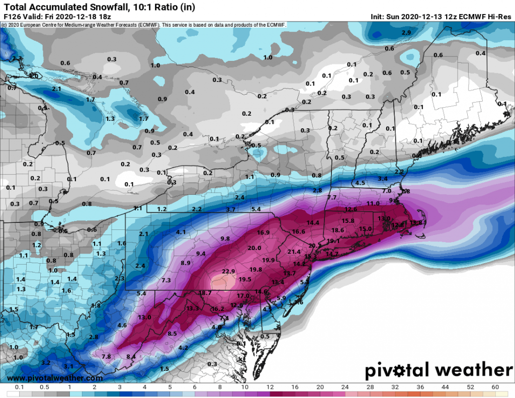
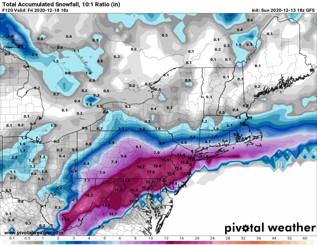
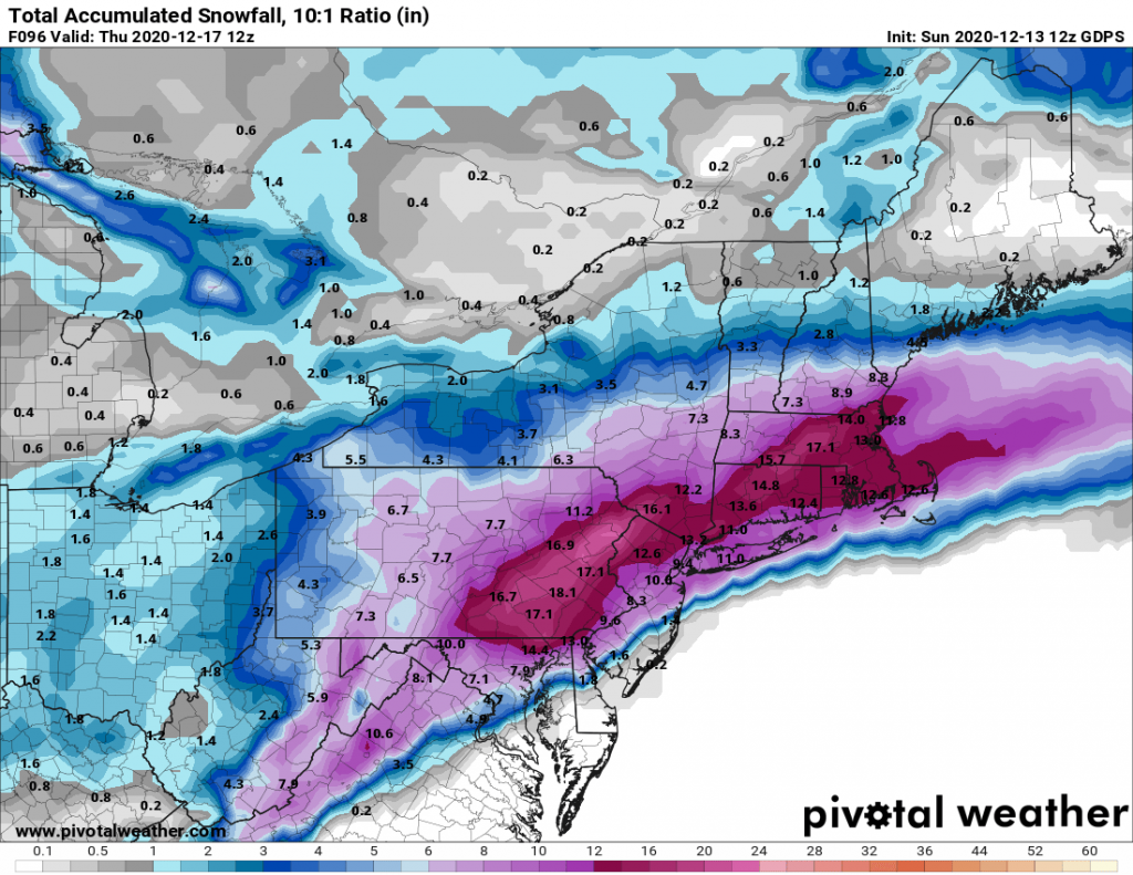
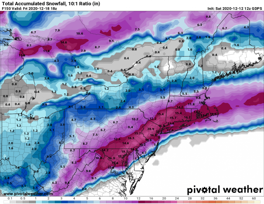
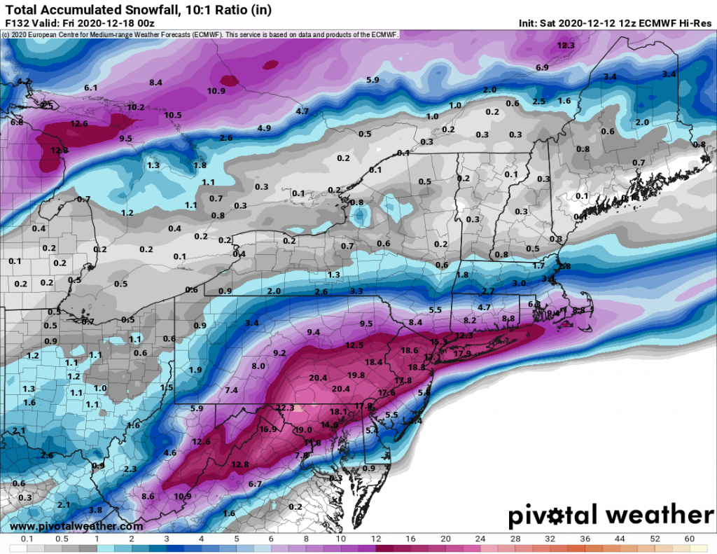
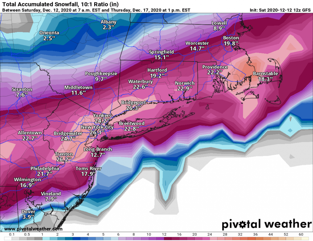
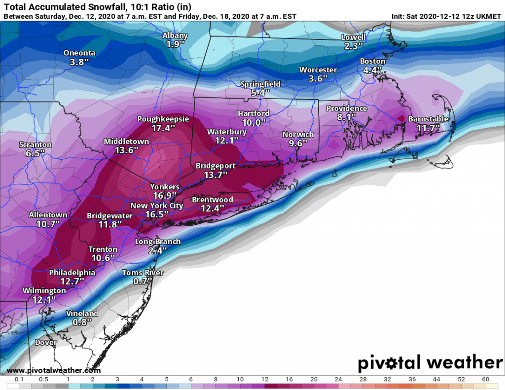
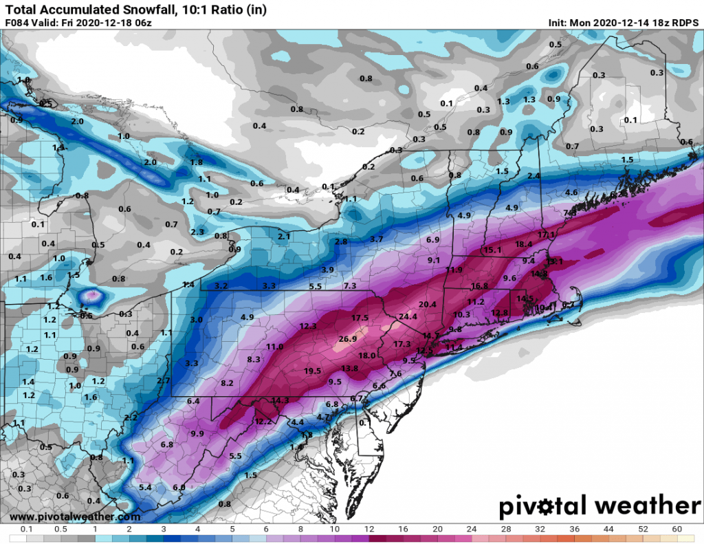
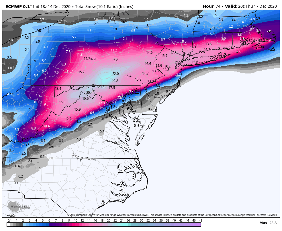
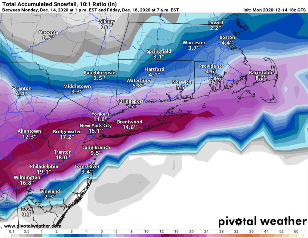
Snowfall totals will likely be the highest just North and West of NYC. However, Long Island will be impacted as well. Some models are hinting at some mixing of snow and rain along the immediate south shore of Long Island and towards the east end. However a majority of Long Island should remain all snow for the duration of the event.
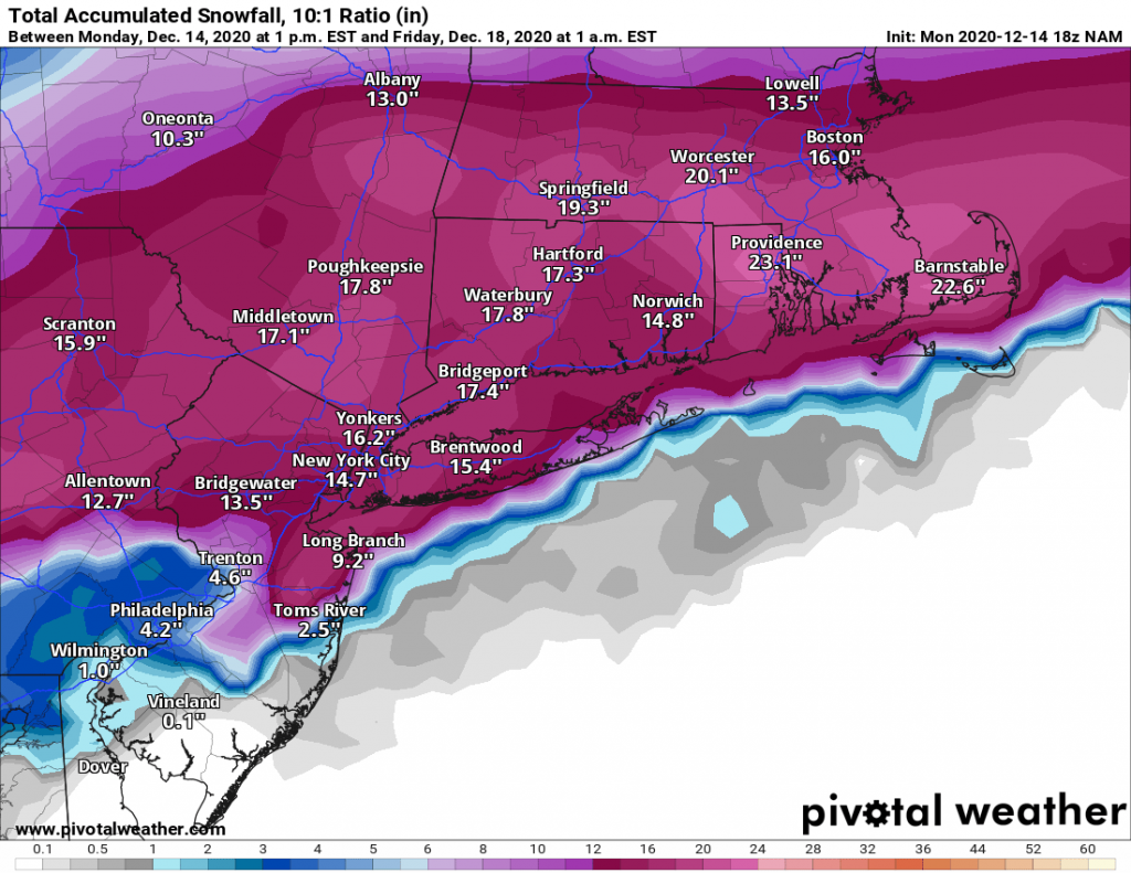
Snowfall totals remain in-line with my first guess of 8-14″ for Long Island with less on the immediate south shore. North and West of NYC will see slightly higher totals of 12-18″.

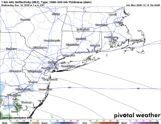
NAM Simulated Radar RDPS Simulated Radar
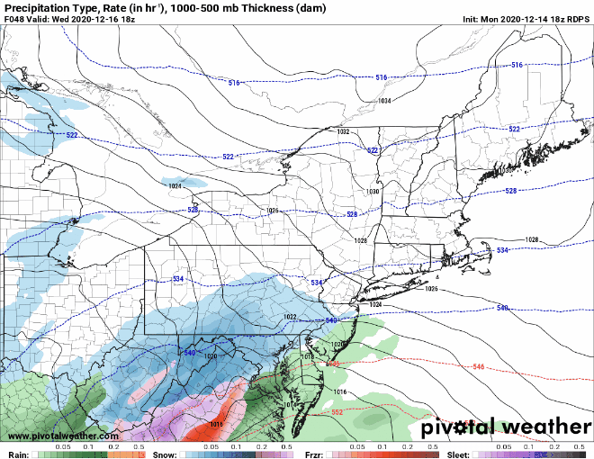

NAM RDPS 
EURO GFS
 It continues to look likely that we will be impacted by a significant snowstorm Wednesday evening through Thursday morning. The weather models while divergent in totals, generally agree that a significant storm will impact our area. The only question that exists as of this evening is in regards to the exact track of the low. A few models on their runs this afternoon trended slightly North which brought more mixed precipitation to Long Island while leaving the city and areas North and West of the city in heavy snow bands. We will have to wait until either tomorrow evening or Tuesday to make a better determination in regards to these slight shifts in track.