1/15/24-1/16/24 Snowfall

first snow Memes & GIFs - ImgflipBeginning this evening and overnight, we will see our first measurable snowfall in a LONG time. The event itself will not be a major one, but it will feature the return of winter weather.

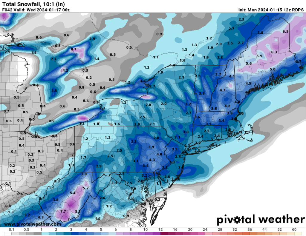
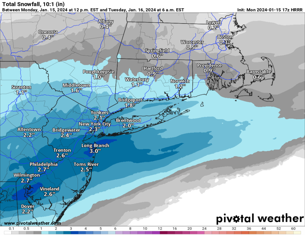
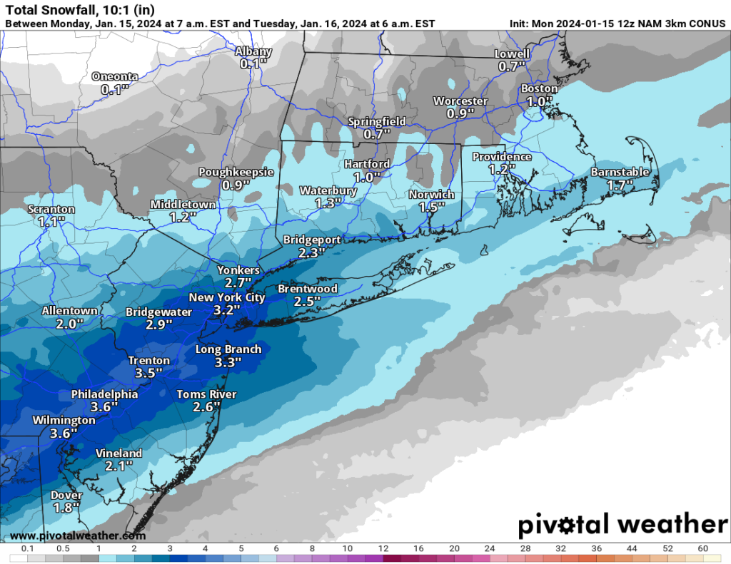
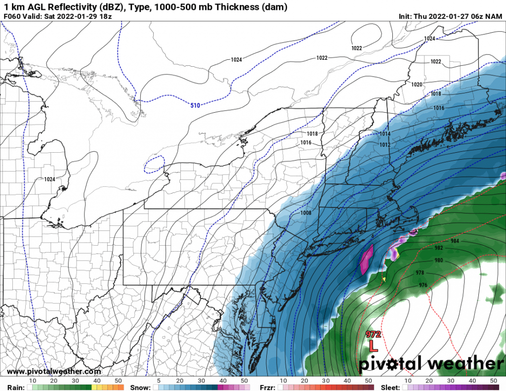
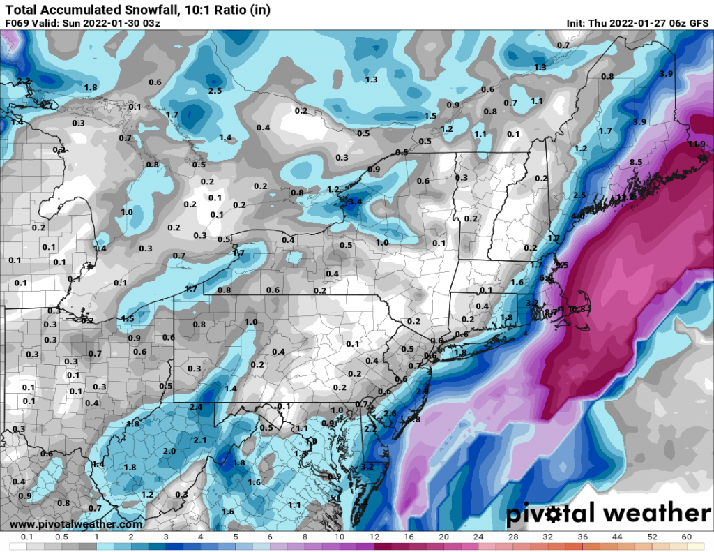
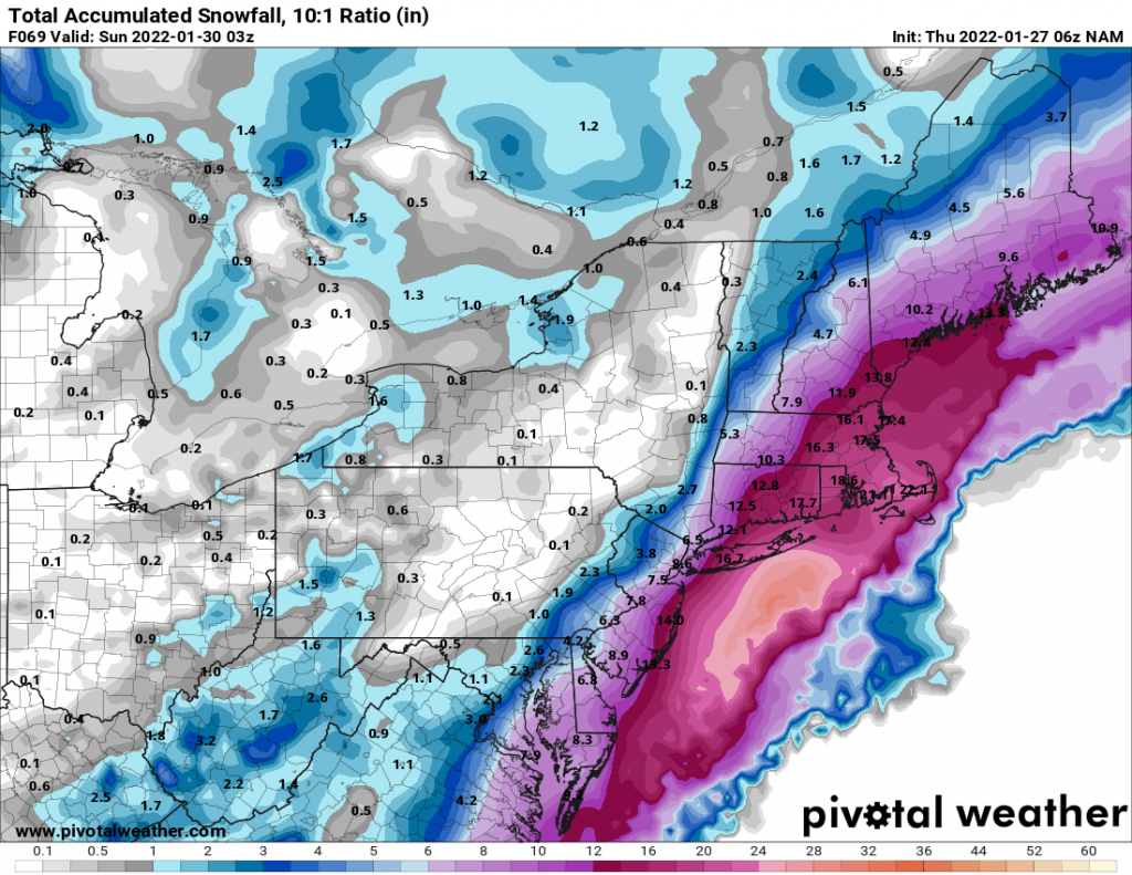
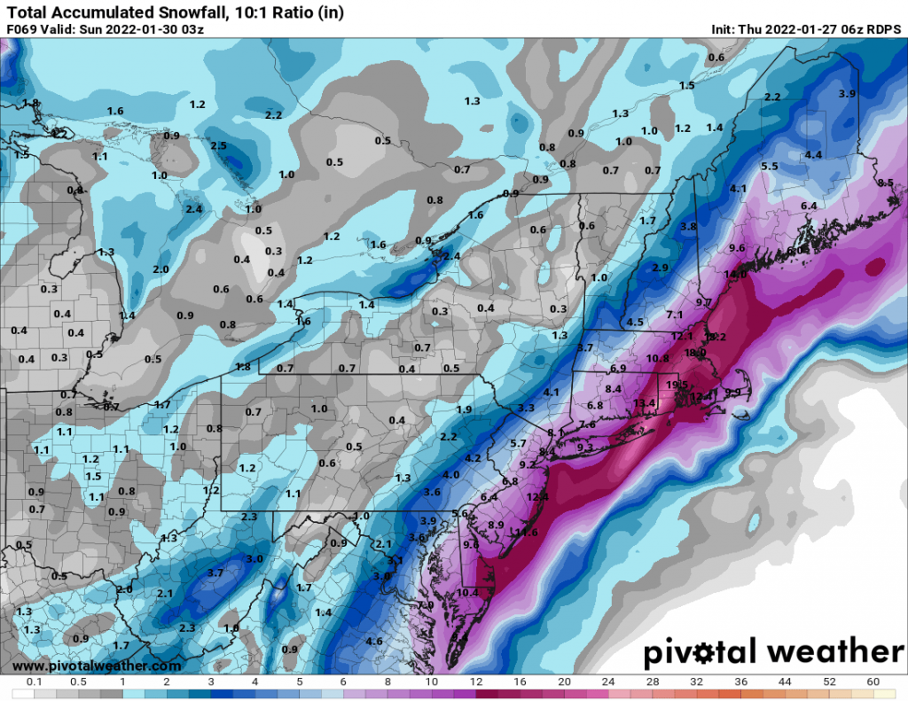
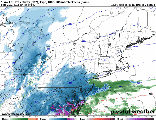
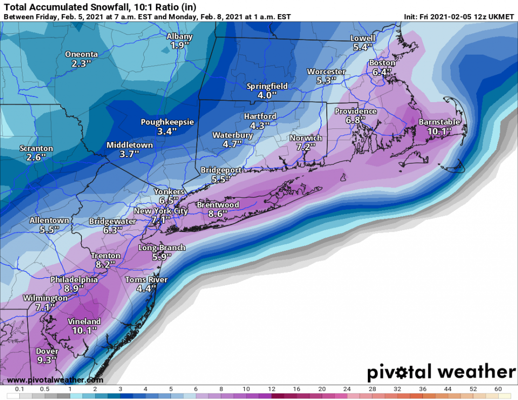
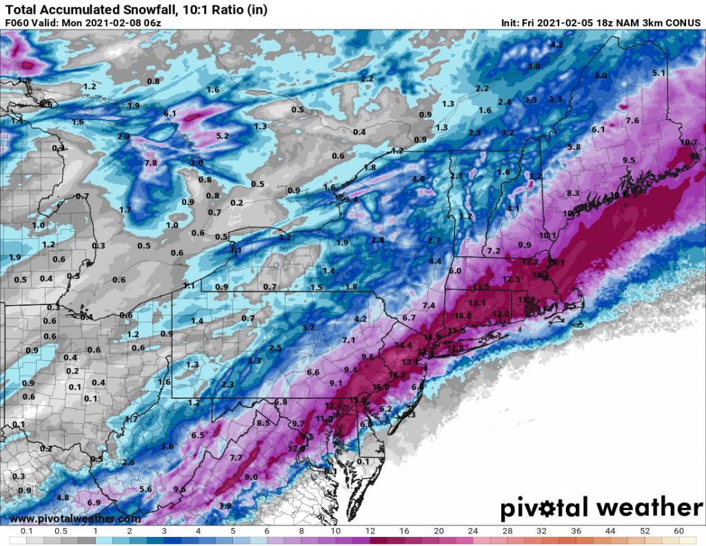
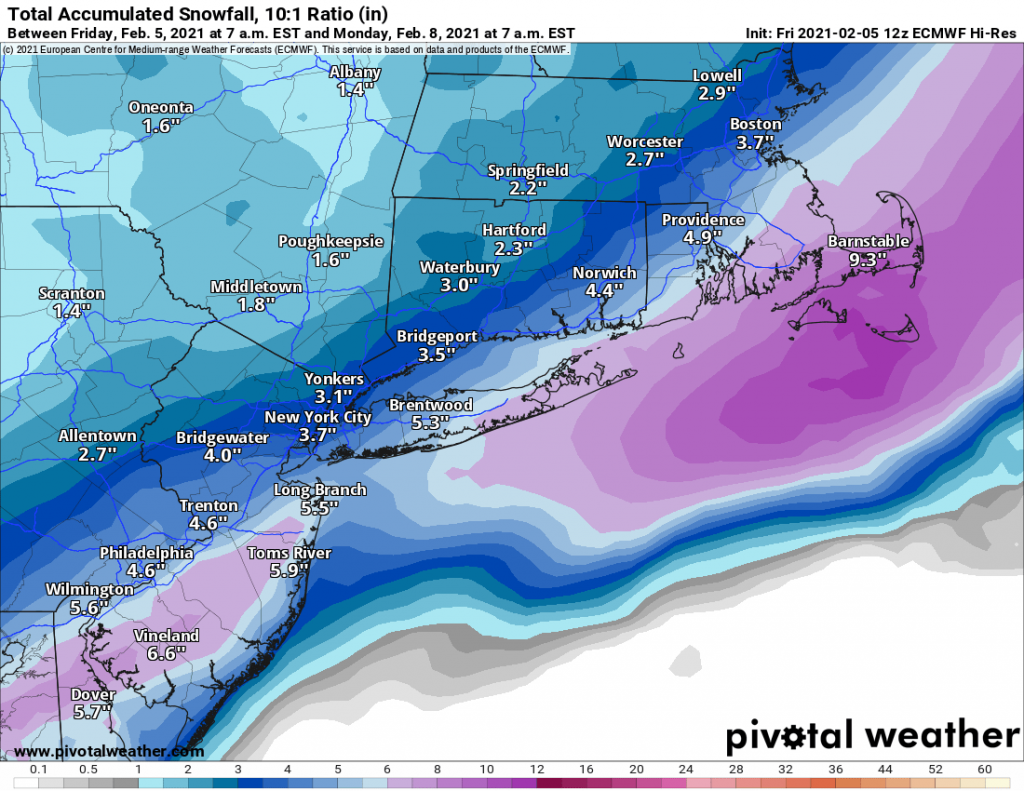
The snow will begin this evening between 8-10PM and overspread the region. Generally, snowfall will be light to moderate throughout. The snow will then end from south to north in the morning hours. Long Island MAY switch to sleet or some light rain at the end of the storm. Overall, accumulations will be in the area of 1-3 inches. 

1/6/24-1/7/24 Event

I’m sure by now you’ve heard the news hyping up a potential storm for this weekend. As of this afternoon and evening, most models have trended away from a significant snow event for Long Island and the city. 

The forecast is still subject to change and minor deviations to the track could place us back into a 6-10inch type of snow event. However with where the models have trended I am leaning against this possibility. 


I’ll post an update tomorrow evening or possibly earlier if there are significant changes in modeling. 

First Snow of the Season?

And we’re back for another winter season! As of this evening, it looks like there is a chance for our region to see the first snow of the season on Sunday evening. The good news is that I don’t think it will accumulate much if at all on Long Island. However, North and West of the city and Connecticut could see several inches of snow. 

The big wild card is how quickly the cold air pulls into the system, which right now most models are showing only enough cold making its way down for mood flakes but no accumulating snowfall.

Either way winter weather is officially here!

1-29-22 Storm

After a long pause due to the addition of two little nuggets to our clan and the associated exhaustion, I am back with an update for you!

As you may have have heard, we are now under a Winter Storm Watch for a potential snow storm from late Friday night through Saturday evening. What you also may have heard is that no one truly knows how much snow we can expect yet and the timing.

The main reason for this is a piece of upper air energy over Canada that is currently not well sampled, and the models are only guessing at how strong it is based on limited data. This area of energy is what will make the difference between a strong storm for our area and a minor light snow event. The NAM has the area of energy much stronger, driving in to the trough and strengthening the system while the GFS has it much weaker, and holding back not interacting with our storm. Below, you can see the impact this different handling of the energy is having on the models. We likely won’t know much more until later this afternoon or evening as the energy becomes better sampled.

The key takeaway for now is that we currently should expect a 6-12 inch snowstorm, but I would only put this forecast at 60% confidence as of now. The other 40% is split on either side of more or less snow, all depending on the energy in Canada. This is a thread the needle situation, that may not be fully settled for another 24 hours.


Super Bowl Storm Update

With the storm on our doorstep I wanted to provide a quick update: Trends over the last 24hrs have been towards less snow for our area. Instead of the storm beginning as snow, we are likely to see some light rain and with a changeover to snow later this morning. Snow will end by early evening. Totals will generally be 2-5” with slightly more towards the East End. Overall this will prove to be a low impact event for the region.

Moving forward I am keeping my eye on several threats for the coming week and beyond. More on that later today or tomorrow.

Superbowl Sunday Storm

In what has come as a bit of a surprise it looks like our area will be impacted by a snowstorm beginning on early Sunday morning. As recently as yesterday morning the storm was looking to track far off the eastern seaboard. However, with yesterday’s model runs and continuing in to today, models are indicating that we will in-fact be impacted by the system.

As of now there are two camps, one that brings anywhere from 4-8 inches of snow to our area by early Sunday evening. The other camp led by the NAM brings closer to a foot of snow to Long Island with slightly less in NYC and areas North and West. 

For now, I am predicting a general 4-8 inches of snow area wide, with the snow beginning before sunrise on Sunday and ending in the late afternoon before kick-off of the Superbowl. We will have to keep an eye on the trends tonight and tomorrow as another bump Northwest in the track would solidly put the region in the 8-12+ range.