Super Bowl Storm Update

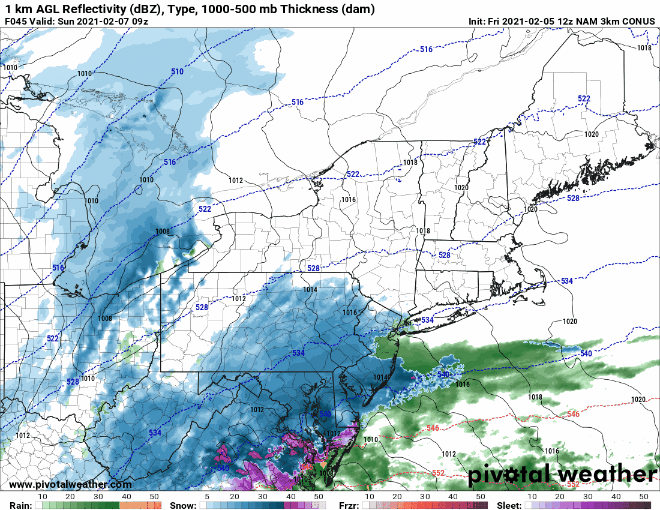
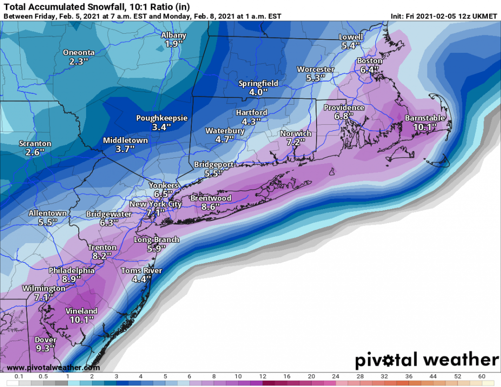
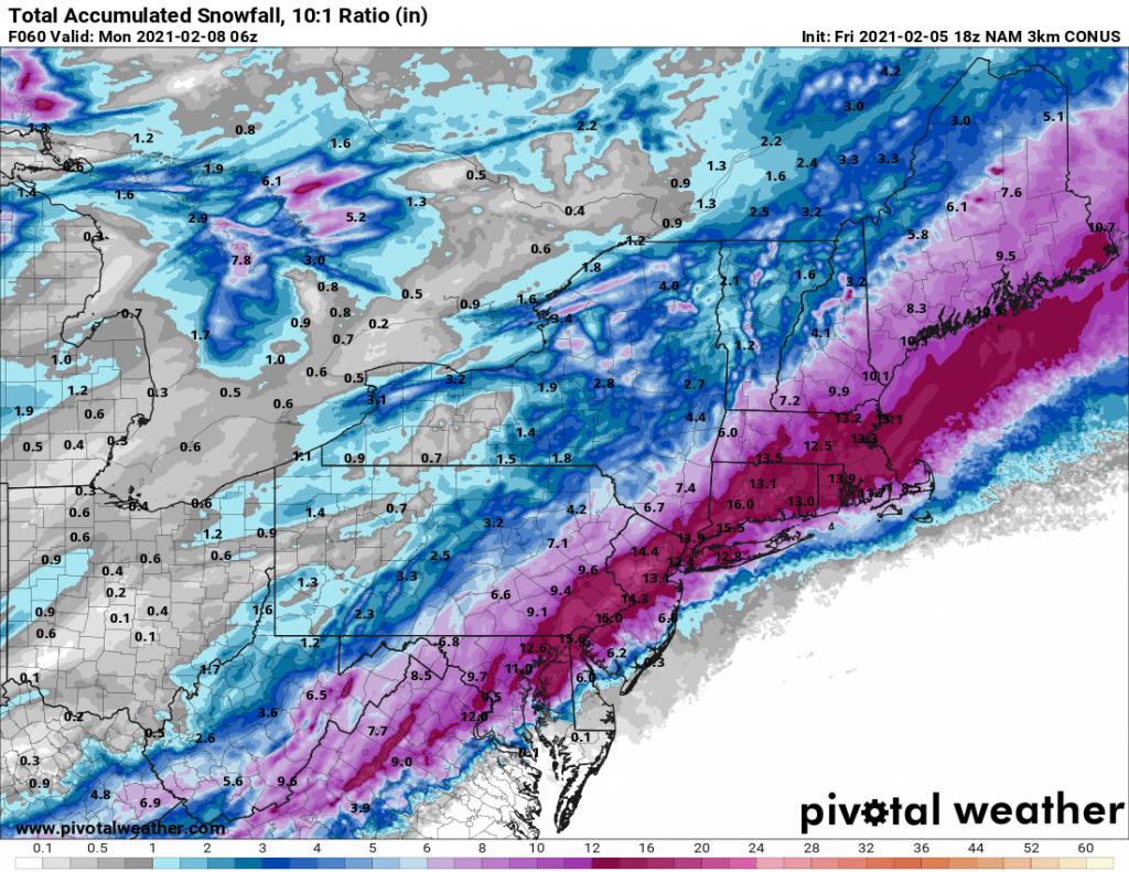
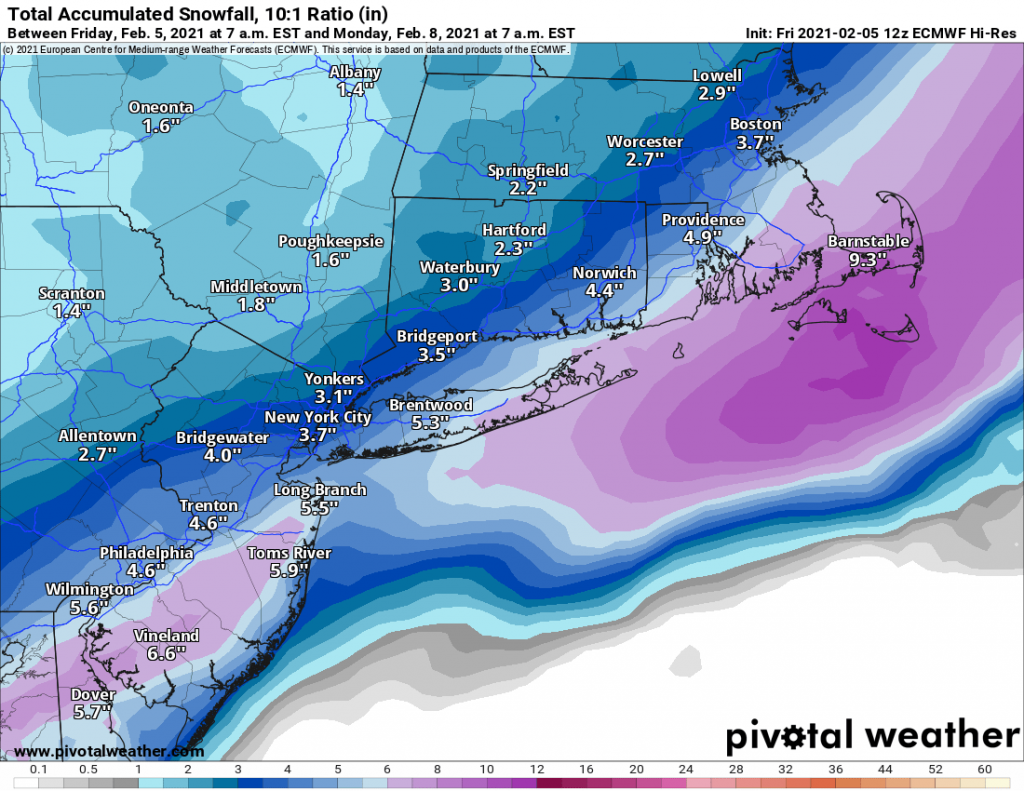
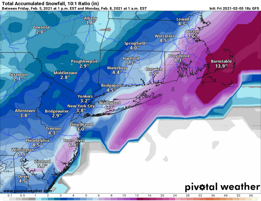
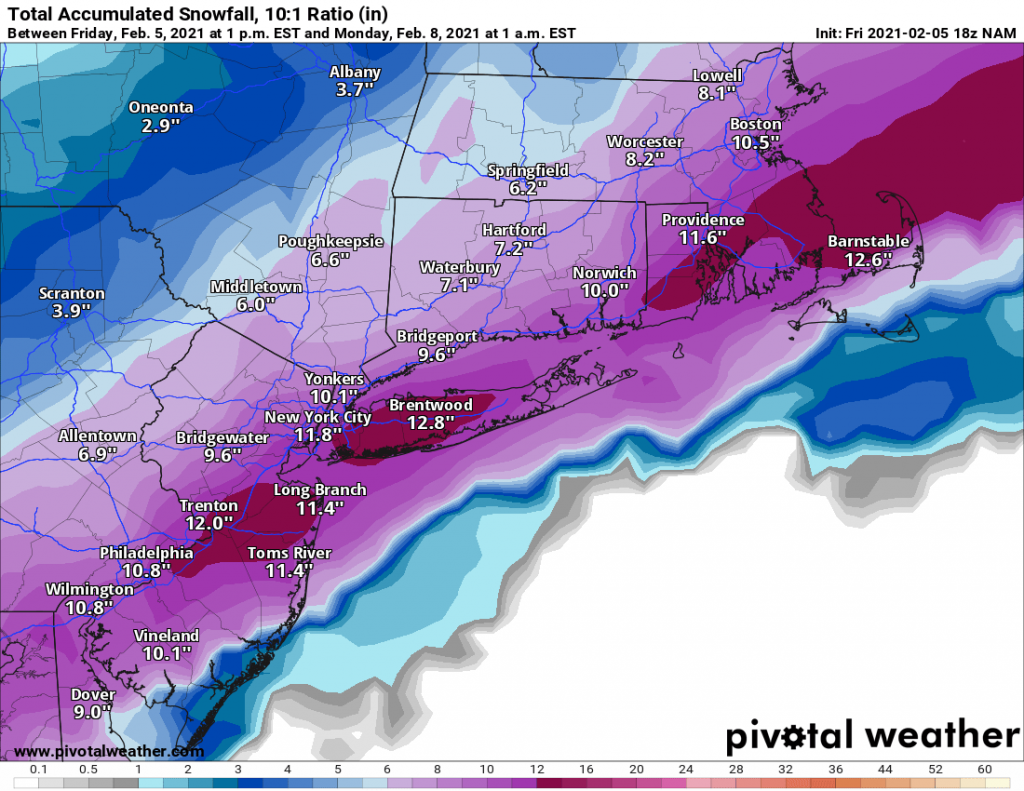
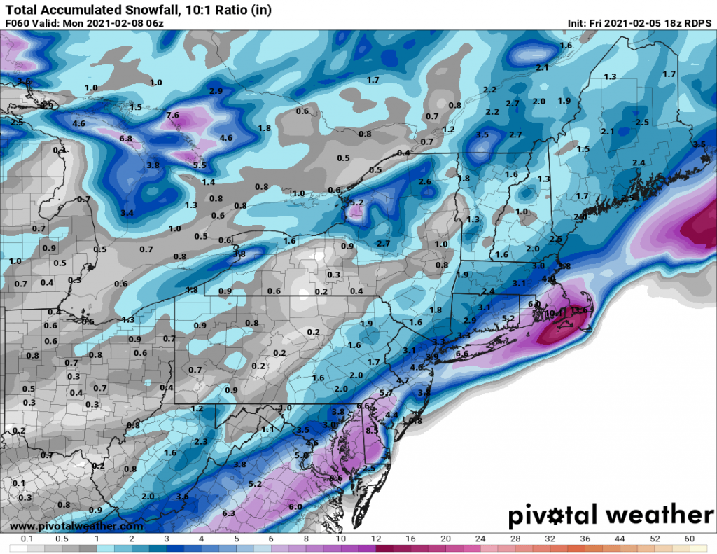
With the storm on our doorstep I wanted to provide a quick update: Trends over the last 24hrs have been towards less snow for our area. Instead of the storm beginning as snow, we are likely to see some light rain and with a changeover to snow later this morning. Snow will end by early evening. Totals will generally be 2-5” with slightly more towards the East End. Overall this will prove to be a low impact event for the region.

Moving forward I am keeping my eye on several threats for the coming week and beyond. More on that later today or tomorrow.

Superbowl Sunday Storm

In what has come as a bit of a surprise it looks like our area will be impacted by a snowstorm beginning on early Sunday morning. As recently as yesterday morning the storm was looking to track far off the eastern seaboard. However, with yesterday’s model runs and continuing in to today, models are indicating that we will in-fact be impacted by the system.

As of now there are two camps, one that brings anywhere from 4-8 inches of snow to our area by early Sunday evening. The other camp led by the NAM brings closer to a foot of snow to Long Island with slightly less in NYC and areas North and West. 

For now, I am predicting a general 4-8 inches of snow area wide, with the snow beginning before sunrise on Sunday and ending in the late afternoon before kick-off of the Superbowl. We will have to keep an eye on the trends tonight and tomorrow as another bump Northwest in the track would solidly put the region in the 8-12+ range.