1/19/2024 Snow Event- Final Call

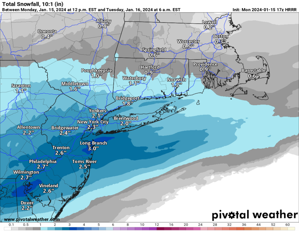
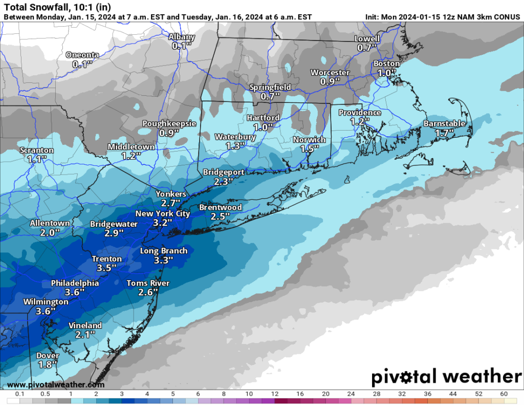
Tomorrow’s snow event is looking to be very minor. Snow will begin falling lightly tomorrow morning around sunrise and continue into the afternoon and early evening. I am not expecting it to fall heavily at all during the day as there is limited forcing and upper air energy to cause significant snowfall rates.

By tomorrow evening, the City and Nassau County should expect anywhere from a coating to two inches. Suffolk will likely be a dusting to an inch at most.

Overall, this event will be relatively low impact outside of the inconvenience of some snow covered roads and walkways. 

1/19/24 Snow Event

Believe it or not we’re about to have our second snow event in less than a week! After almost 2 years of no snow, we’re now having back to back events. Like our last event, this one will be relatively minor, but enough to cause some headaches.

Snow is expected to start early Friday morning between 6-9am and continue throughout the day into the evening. Snowfall rates will generally be light to moderate, but temperatures will be below freezing during the storm so the snow will not have an issue sticking. 

By the time the snow ends late Friday night a total of 2-4 inches of snow will have fallen, with less expected over Eastern Long Island. I will post a final update tomorrow night with any changes to the forecast.

1/15/24-1/16/24 Snowfall

first snow Memes & GIFs - Imgflip
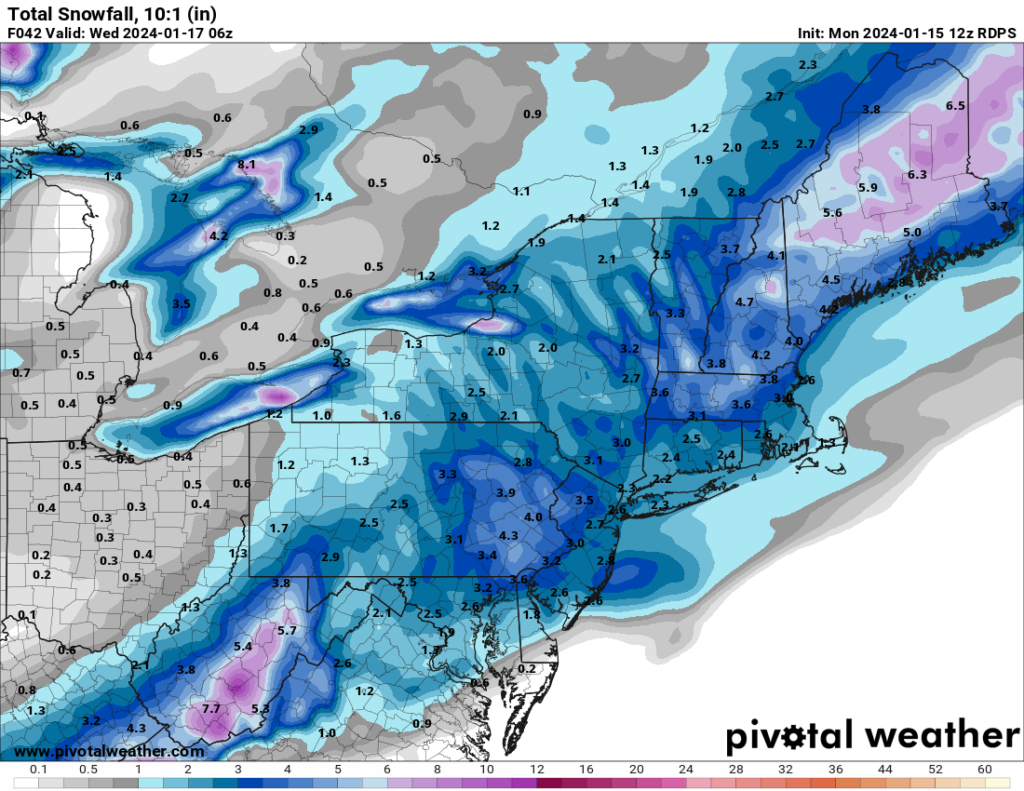
Beginning this evening and overnight, we will see our first measurable snowfall in a LONG time. The event itself will not be a major one, but it will feature the return of winter weather.

The snow will begin this evening between 8-10PM and overspread the region. Generally, snowfall will be light to moderate throughout. The snow will then end from south to north in the morning hours. Long Island MAY switch to sleet or some light rain at the end of the storm. Overall, accumulations will be in the area of 1-3 inches. 

1/6/24-1/7/24 Event

I’m sure by now you’ve heard the news hyping up a potential storm for this weekend. As of this afternoon and evening, most models have trended away from a significant snow event for Long Island and the city. 

The forecast is still subject to change and minor deviations to the track could place us back into a 6-10inch type of snow event. However with where the models have trended I am leaning against this possibility. 


I’ll post an update tomorrow evening or possibly earlier if there are significant changes in modeling.