With the runs over night, the models have locked in. What was a highly uncertain situation just 24 hours ago has come into much clearer focus, and the picture they’re painting is significant. This will be the most impactful snowstorm our area has seen in years. Our whole area is now under Blizzard Warnings that take effect tomorrow morning.
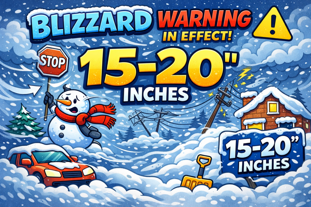
TLDR: Expect 15–20″ of snow area-wide, blizzard conditions for several hours, and wind gusts exceeding 50 mph. HEAVY snow develops Sunday afternoon and continues through Monday morning.
What the Models Are Saying
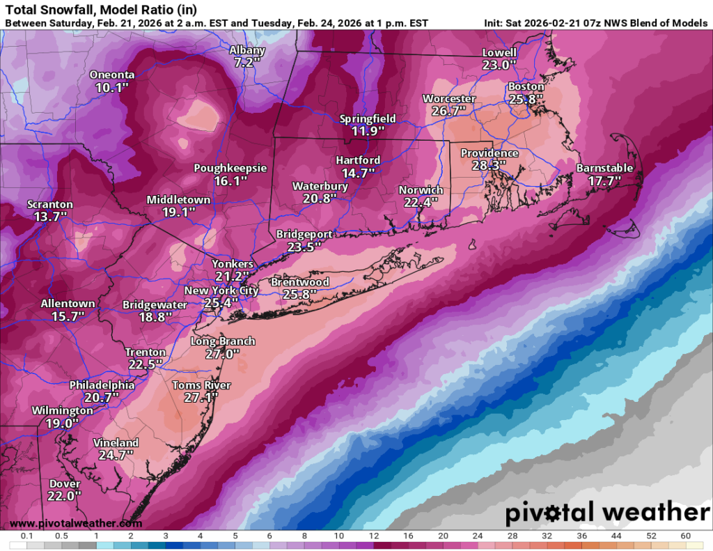
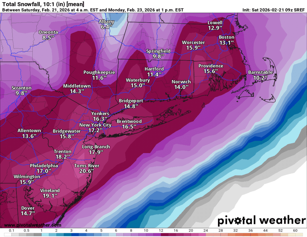
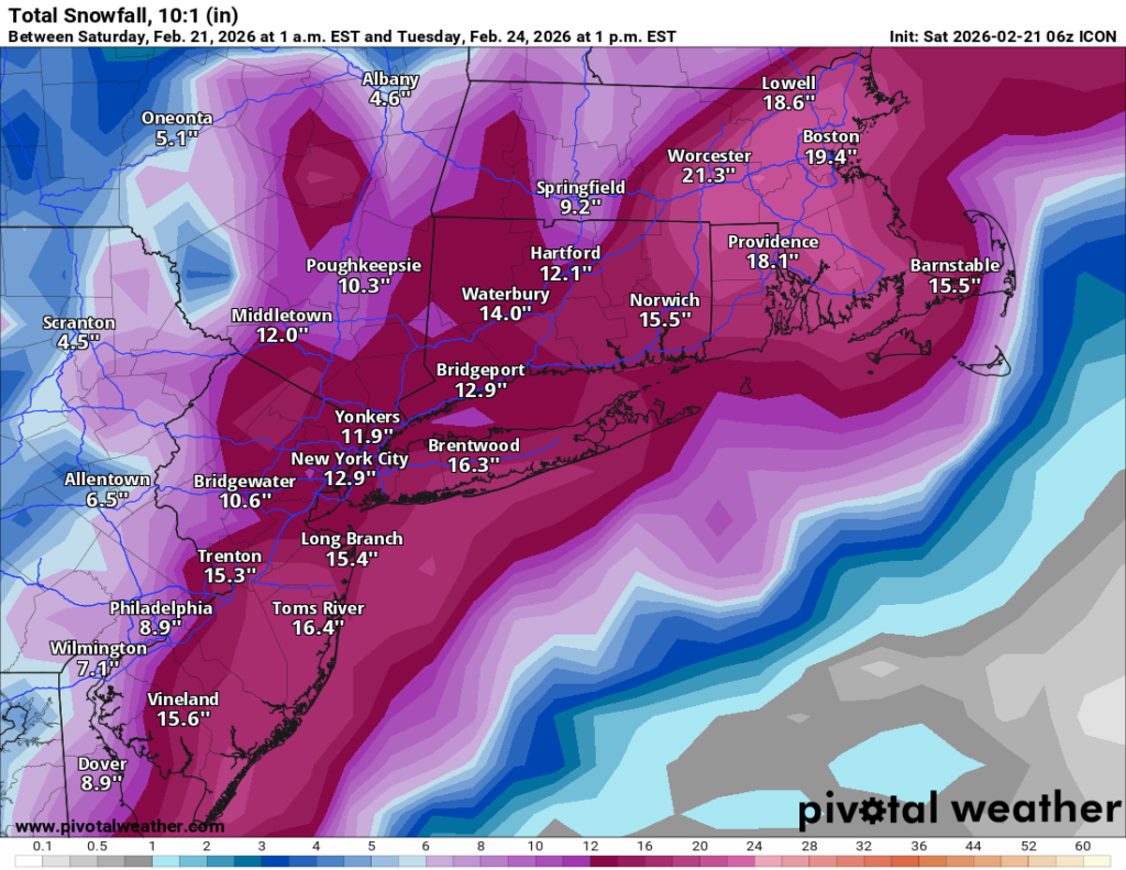
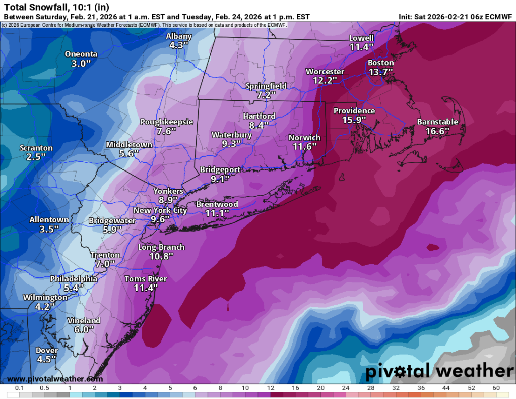
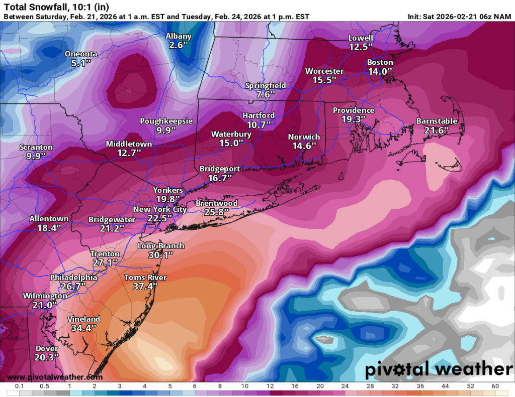
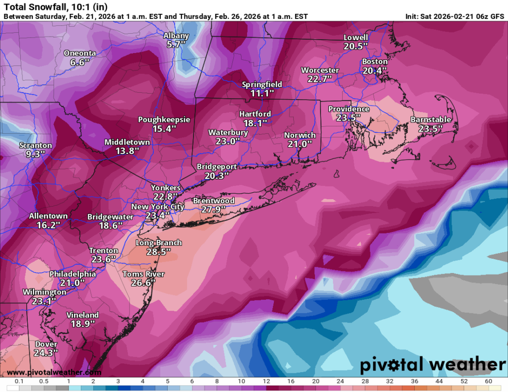
The model spread has tightened considerably, though there’s still a meaningful range. Here’s where things stand for Long Island, with notes on neighboring areas below:
| Model | LI Snowfall |
|---|---|
| GFS | 28″ |
| NAM | 26″ |
| SREF | 18″ |
| ICON | 16″ |
| NWS Blend | 14″ |
| Euro | 12″ |
The Euro remains the lone holdout on the conservative end. That said, it’s worth remembering the Euro was insisting this storm would go out to sea as recently as Friday night — so take its 12″ with a grain of salt. The GFS and NAM are clearly on the aggressive end and may still be overdoing it, but the middle of the pack is firmly in the significant storm category.
For our readers further north and west, totals fall off a bit as you head north toward the Hudson Valley and into Connecticut.
Snowfall totals alone don’t tell the full story here. Wind gusts are expected to exceed 50 mph, combine that with heavy snow rates, you get blowing and drifting snow, whiteout conditions, and potentially zero visibility for periods during the storm. Blizzard conditions appear likely for much of the area. Do not plan to be on the roads Sunday evening or overnight into Monday.
Timing
Some light snow may arrive as early as late Sunday morning, but the core of the storm kicks in Sunday afternoon. Heavy snow and peak winds continue through the overnight hours, with the storm winding down by Monday morning.
As of now, my forecast is for 15–20″ area-wide, acknowledging that the GFS and NAM are suggesting the potential for more. If those models verify, totals above 20″ are entirely possible, particularly across Long Island and the metro. The Euro’s 12″ keeps the lower end in play, but at this point the weight of the evidence supports a major storm.