12/16/2020 Storm Update- Forecast Mayhem

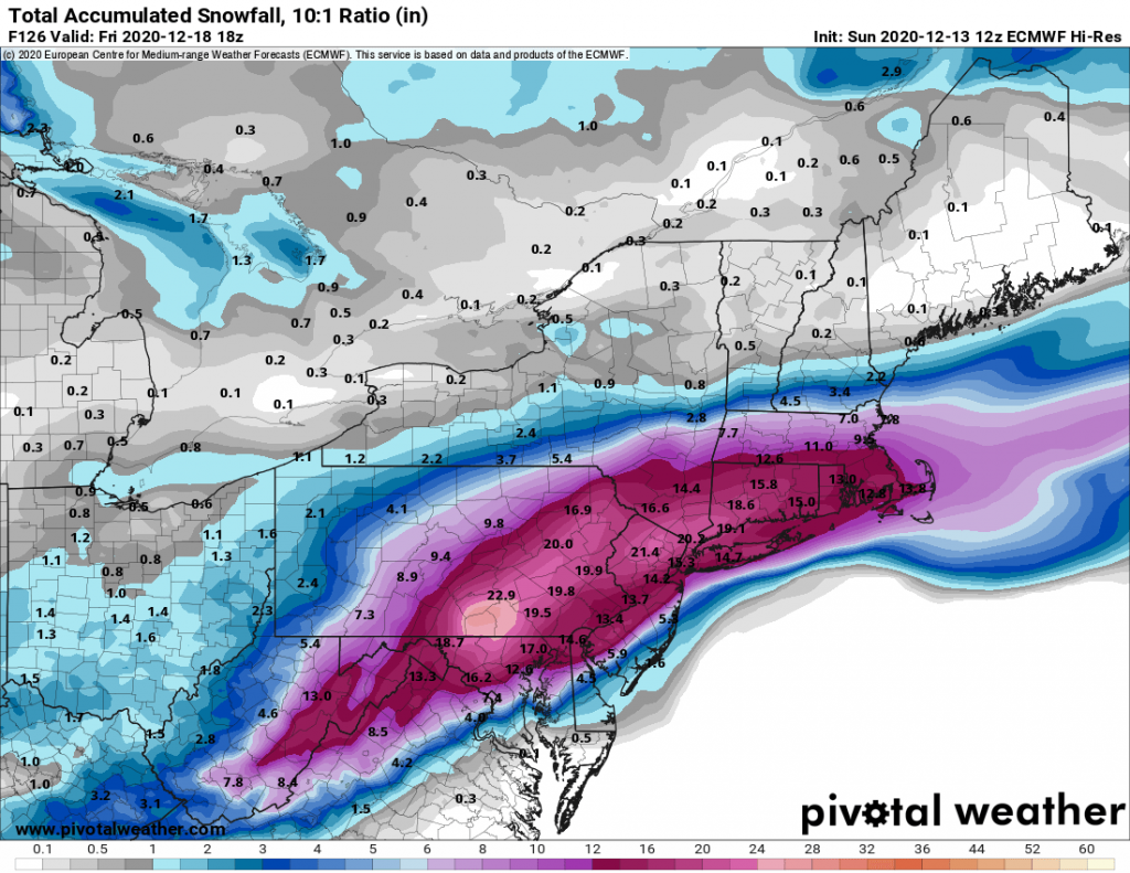
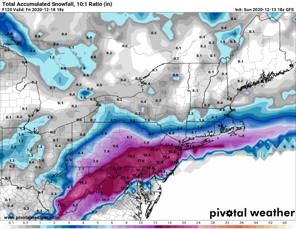
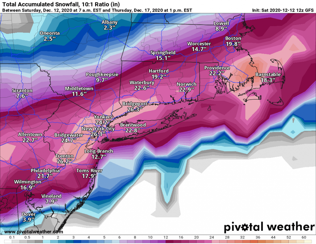
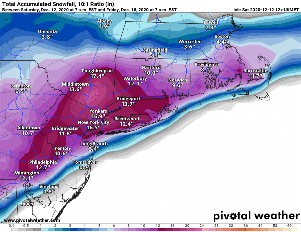
Today has been a wild day in storm tracking. We went from the totals exceeding 12-16″ on models for our region this weekend to some models this morning showing only 2-4″ this morning. It all comes down to just how far north the low pressure system tracks tomorrow evening in to Thursday. A shift of 25-50 miles means the difference between Long Island seeing 4-8″ of snow and seeing 6-12″+ of snow. As of this evening I am leaning towards the 4-8″ camp of models based on climatology and modeled evolution of the low pressure system. However, today has shown this is subject to significant change tomorrow morning and afternoon. 

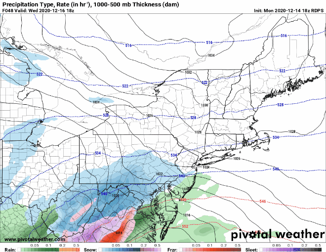
Timing of the system arriving remains the same with snow overspreading our region by late afternoon and early evening tomorrow. It is still expected that we will see heavy snowfall rates over-night potentially exceeding two inches an hour. The biggest area of uncertainty comes overnight where some models are tracking the low close to the south shore of Long Island, leading to Long Island and possibly NYC to change over to sleet and/or rain for a few hours. Afterwards a second band of light snow is expected, and this may lead to a few more inches of accumulation. 
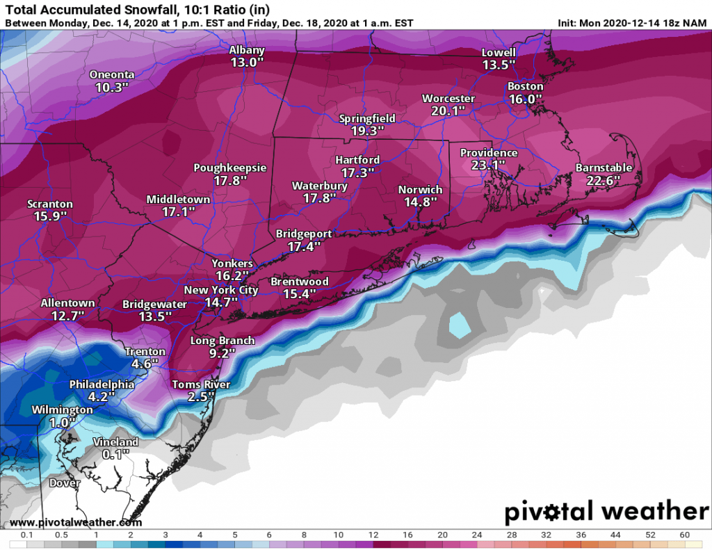
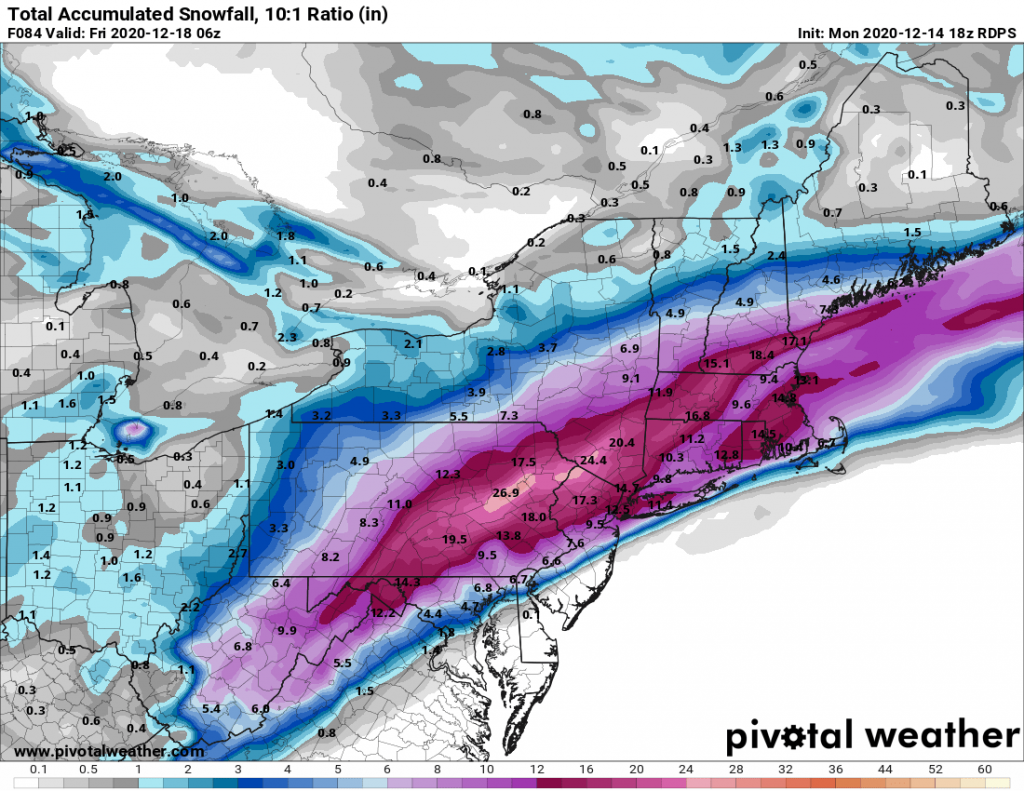
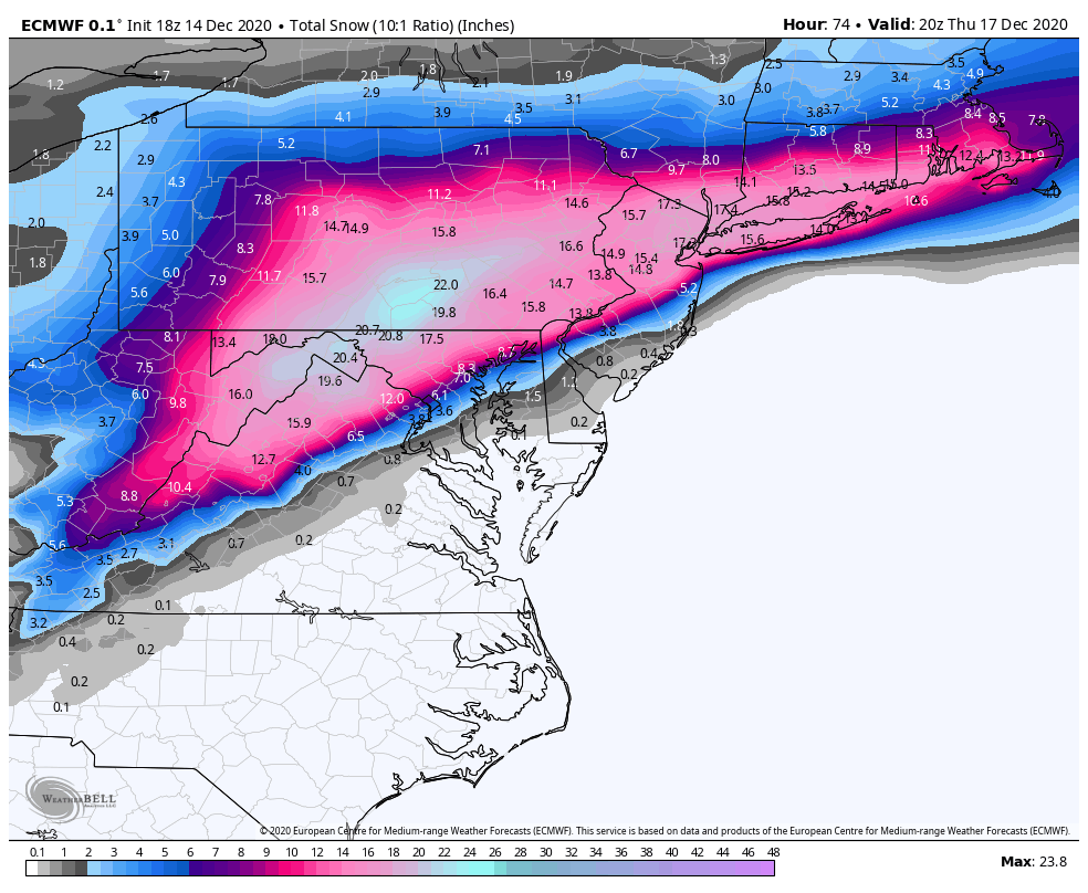
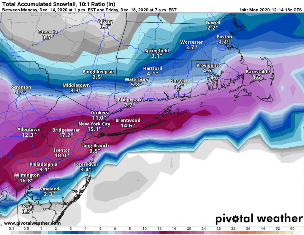
Forecast Totals:

Suffolk: 3-6″
Nassau: 4-8″
Queens and Brooklyn: 6-10″
Areas north and west of NYC: 8-14″

Overall this will be an impactful system that will disrupt Thursday mornings commute. Even if we are on the low end of the snowfall forecast, the snow itself will be heavy and hard to clear due to the potential sleet and rain mixed in. 

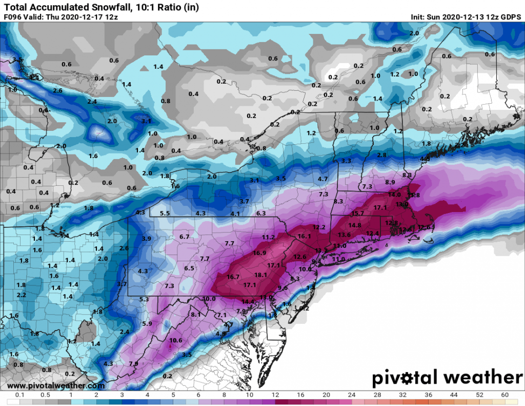
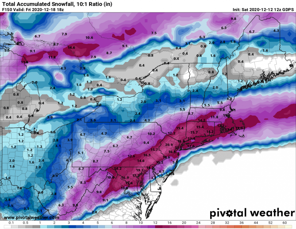
I am holding back on posting further snow-maps this evening as they are truly all over the place, and not indictive of what to expect tomorrow and Thursday.


12/16/2020- Quick Morning Update

I wanted to put out a quick update this morning since there has been a slight shift in modeling. Models last night and this morning are indicating that the low will track slightly further north than originally projected. This will lead to some potential mixing of snow and sleet on Long Island. Therefore I am lowering my total forecast to 6-12 for Long Island with even less in Central Suffolk and East from there. NYC and areas north and west are unlikely to see the mixing issues and continue on track for over a foot of snow accumulations. Some areas may see as much as 18”.

I will post an update later today or this evening based on the latest guidance.

12/16/20 Snowstorm Update- It’s Definitely Coming

As of this evening our region is under a Winter Storm Watch, and we are on track for our area to experience our first winter storm of the season beginning on Wednesday afternoon and lasting overnight until early Thursday morning. Since my post yesterday, the models have continued to come in to alignment in regards to what should expect on Wednesday.

Snow will begin to overspread our region from west to east in the mid to late afternoon hours; snow will begin light and pick up in intensity during the evening. At the height of the storm, we can expect to see snowfall rates in excess of 2″ per hour with blizzard conditions occurring. Winds will likely be gusting over 40MPH at the height of the storm. The snow will begin to taper off around or just before sunrise on Thursday.

Snowfall totals will likely be the highest just North and West of NYC. However, Long Island will be impacted as well. Some models are hinting at some mixing of snow and rain along the immediate south shore of Long Island and towards the east end. However a majority of Long Island should remain all snow for the duration of the event. 

Snowfall totals remain in-line with my first guess of 8-14″ for Long Island with less on the immediate south shore. North and West of NYC will see slightly higher totals of 12-18″. 

12/16/2020 Snowstorm Update- First Guess Snowfall Totals

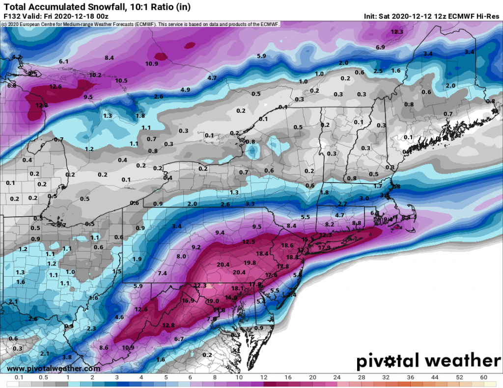
It continues to look likely that we will be impacted by a significant snowstorm Wednesday evening through Thursday morning. The weather models while divergent in totals, generally agree that a significant storm will impact our area. The only question that exists as of this evening is in regards to the exact track of the low. A few models on their runs this afternoon trended slightly North which brought more mixed precipitation to Long Island while leaving the city and areas North and West of the city in heavy snow bands. We will have to wait until either tomorrow evening or Tuesday to make a better determination in regards to these slight shifts in track.

With that being said light snow should start Wednesday afternoon and pick-up in intensity through the evening. The snow will be heavy overnight, with a chance for thundersnow, as the low pressure system will be intensifying rapidly south of Long Island. Blizzard conditions will also likely occur overnight, and I would not be surprised to see Blizzard Warning’s issued for parts of our region. The snow will begin to wind down around sunrise on Thursday morning.

My initial snow total forecast is as follows and is likely to be revised as we get closer in:

NYC and Long Island: 8-14″
Areas North and West of NYC 14-20″

12/16/2020 Potential Snowstorm

As of this afternoon, the models continue to be in agreement in regards to a major snowstorm impacting our region beginning on Wednesday afternoon continuing overnight into Thursday. Currently all of the major models are projecting that our region will see 12″+ of snow. While, I am not yet ready to pull the trigger and say that is what we should expect, everything is certainly trending that way. For now we will have to continue to watch the evolution of the storm, and wait for the short-range models to come in to range beginning on Sunday and Monday. 

In addition to the major storm that we are tracking, there is a chance for some light snow on Monday afternoon. However, the setup for Monday is a rain to light snow scenario where we do not often see significant accumulations. 

And We’re Back

Don’t look now but it looks like we may experience our first winter storm of the season next Wednesday in to Thursday. This is still in the extended range, but multiple models are in alignment showing at least a moderate snow storm impacting our area beginning on Wednesday afternoon.

It is far too early to get in to any specifics, but at this time it looks likely that we will see our first winter weather of the season. I’ll post more updates over the next few days.