Here’s the latest update on the storm that will impact our region on Sunday:
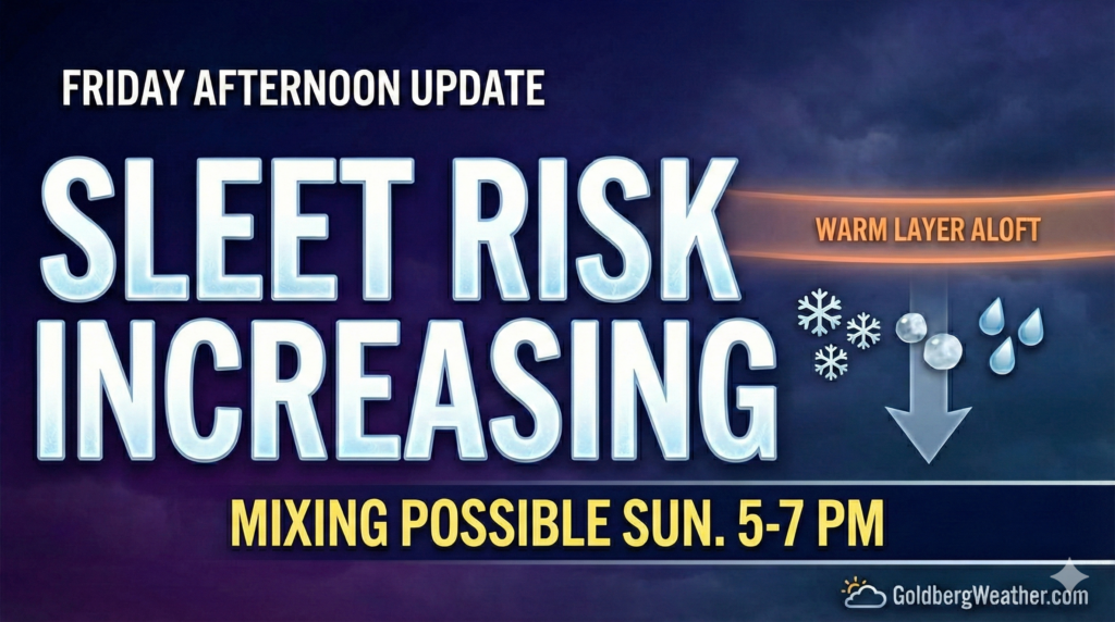
This afternoon’s model runs are starting to hint at a warm layer aloft, which would mean sleet mixing in later Sunday. The problem is the models still don’t agree on how soon that happens or how much sleet we actually see.
-
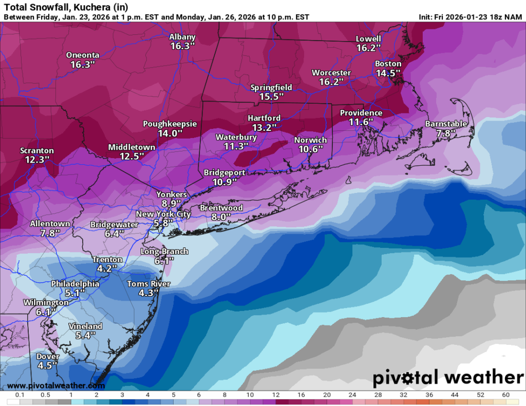
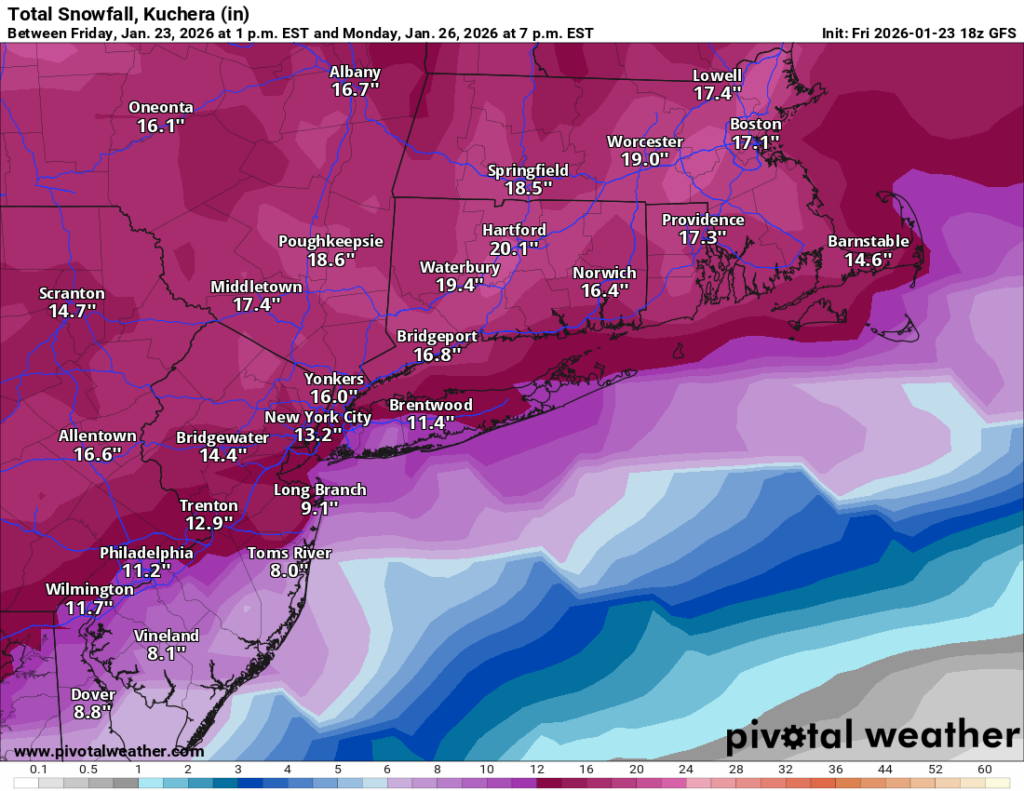
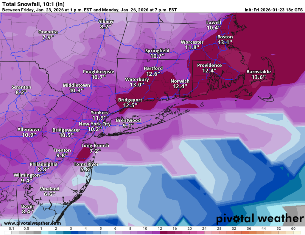
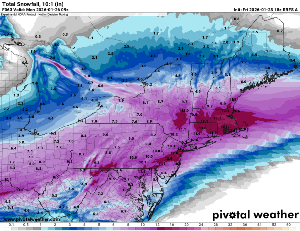
GFS / RRFS hold the mix off longer, which would support higher totals (10–15″).
-
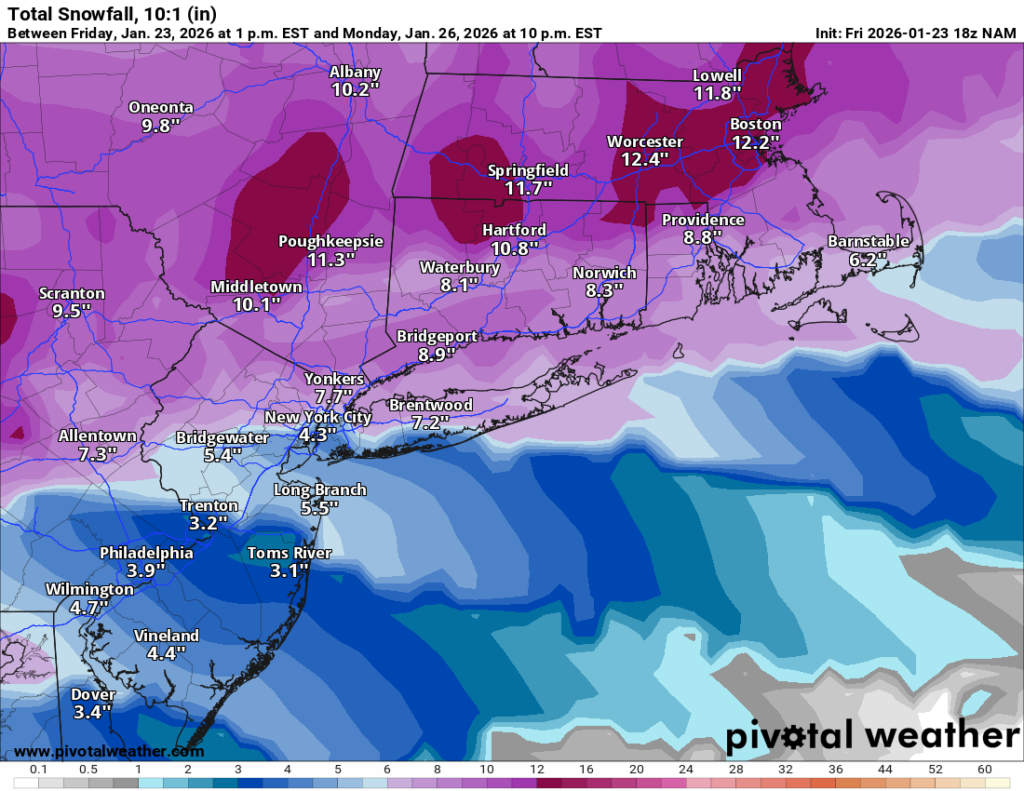
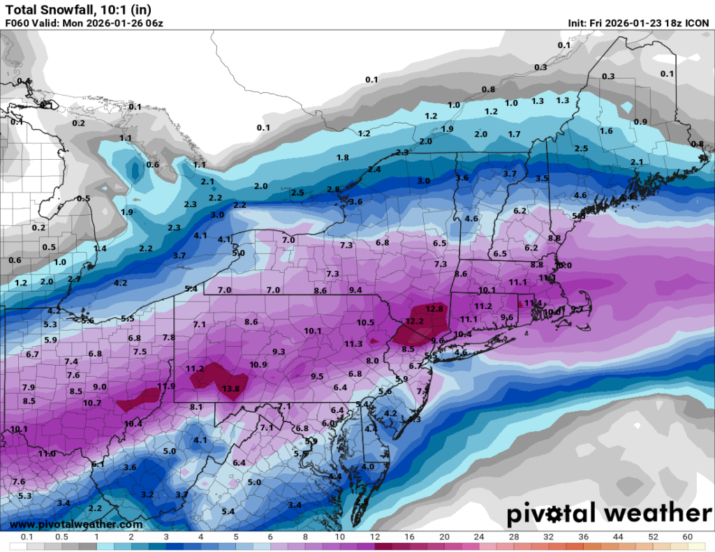
NAM / RDPS / ICON bring mixing in earlier, which knocks totals down into the 5–10″ range.
In terms of timing, snow overspreads the area around sunrise Sunday, continues through the day, and then we watch for a possible change to sleet around 5–7 PM.
Right now I’m leaning toward the changeover happening, and that would cap snow totals. Models also show a pretty meaningful amount of sleet, so at the moment I’m going with 4–8″ of snow area-wide plus a significant sleet layer on top, expect higher totals north and west of the city where mixing is less likely.
One important note: that warm layer is very shallow and barely warm enough to changeover to sleet, only about 1–2° above freezing. So a small shift over the next 24 hours could easily swing us back toward mostly or all snow, and the 10–15″ scenario would come right back into play.
Precipitation should end overnight Sunday night, wrapping up before sunrise Monday (ending southwest to northeast).