I know many of you have been wondering why I haven’t posted an update about the storm that will impact our area on Sunday into Monday. To be honest, this one caught me by surprise. As recently as last night, only the GFS was signaling a major storm for our region. Every other model had this tracking out to sea, so I held off. Overnight, that changed dramatically.
The model consensus has done a dramatic about-face, and now the GFS is no longer the odd one out.
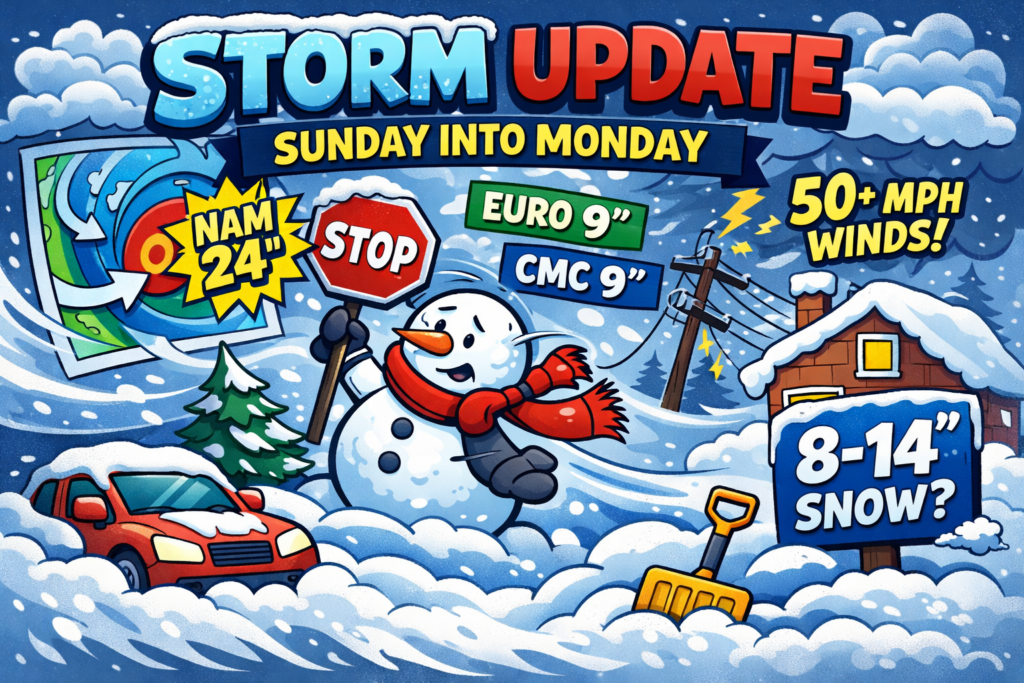
TLDR; Expect 8-14″ of snow area-wide with the potential for far more if the NAM and GFS are correct. Snow develops Sunday afternoon and continues through the overnight hours, winding down by Monday morning.
Here’s where things sit as of the latest runs:
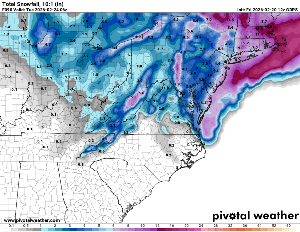
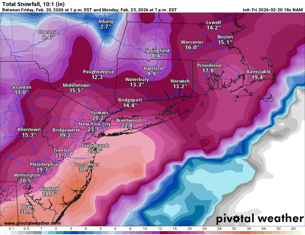
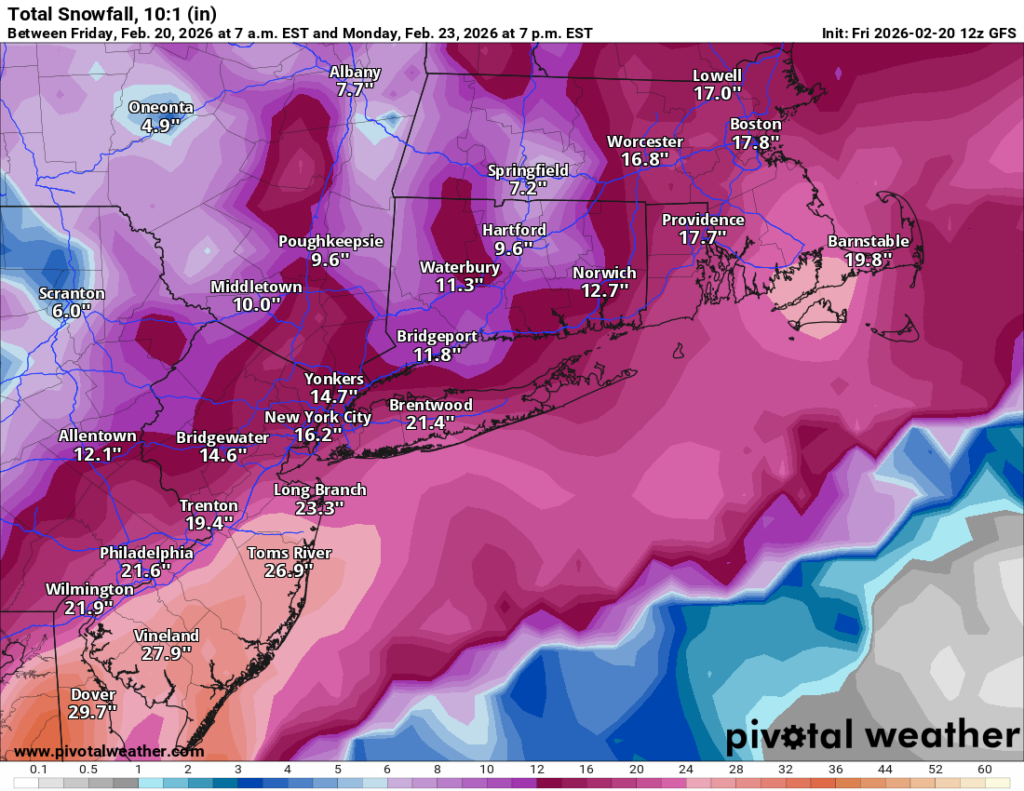
GFS / NAM: The aggressive camp. The NAM just came in showing 24 inches, which is an eye-popping number that demands attention. The GFS has been the drummer beating this storm into existence all along and continues to support a major event.
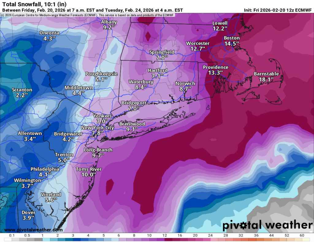
Euro / CMC: More conservative, both sitting around 9 inches. The Euro in particular has a strong track record with systems like this, so that number keeps the high-end scenario from being a sure thing. BUT the Euro also was insisting on this going out to sea as recently as last night. So it may be VERY wrong on this one.
The spread between 9″ and 24″ tells you everything you need to know about confidence levels right now: this is a rapidly evolving, low-confidence forecast. Trends are moving in the higher direction, but we’re not there yet.
Snowfall totals are only part of the story here. Models are in solid agreement that wind gusts will exceed 50 mph during this event, which opens the door to blizzard conditions for a period of several hours. Blowing and drifting snow, near-zero visibility at times, and the kind of conditions that make travel not just difficult but dangerous. This is worth taking seriously even if you end up in the lower end of the snow range.
Given the aggressive model trends but the still-meaningful Euro/CMC signal, I’m going with 8 to 14 inches area-wide for now, with the possibility that the higher end of the NAM/GFS scenario is entirely possible if that solution verifies.
Right now this is a very low-confidence forecast and I’ll be updating as new runs come in. Do not finalize your plans or prep around these numbers just yet — watch for updates over the next 24 hours as the picture sharpens.
Bottom line: there’s a real storm coming. How big? Still being decided. Stay tuned.