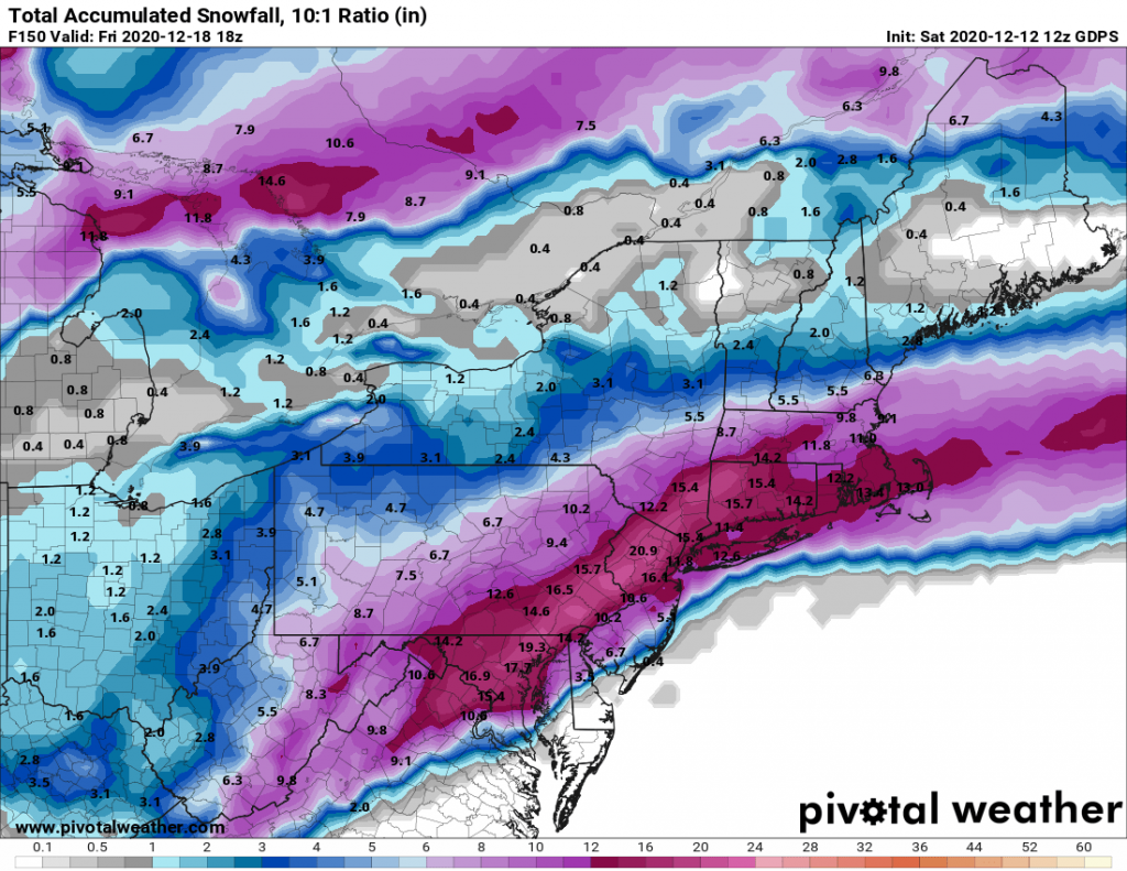
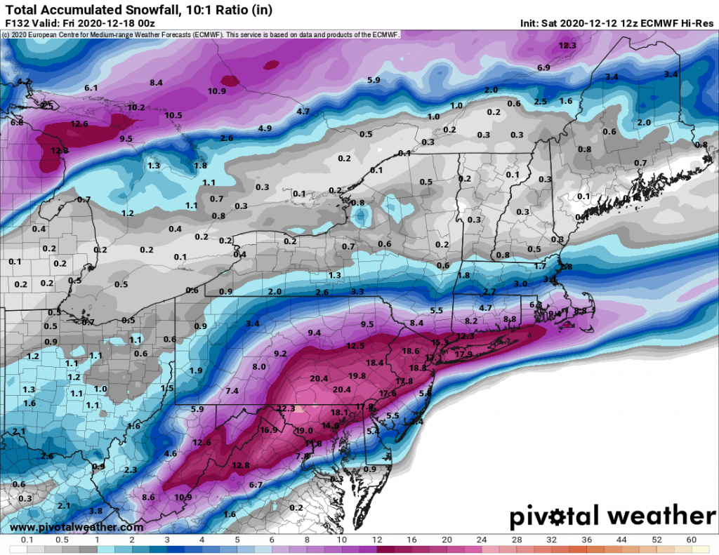
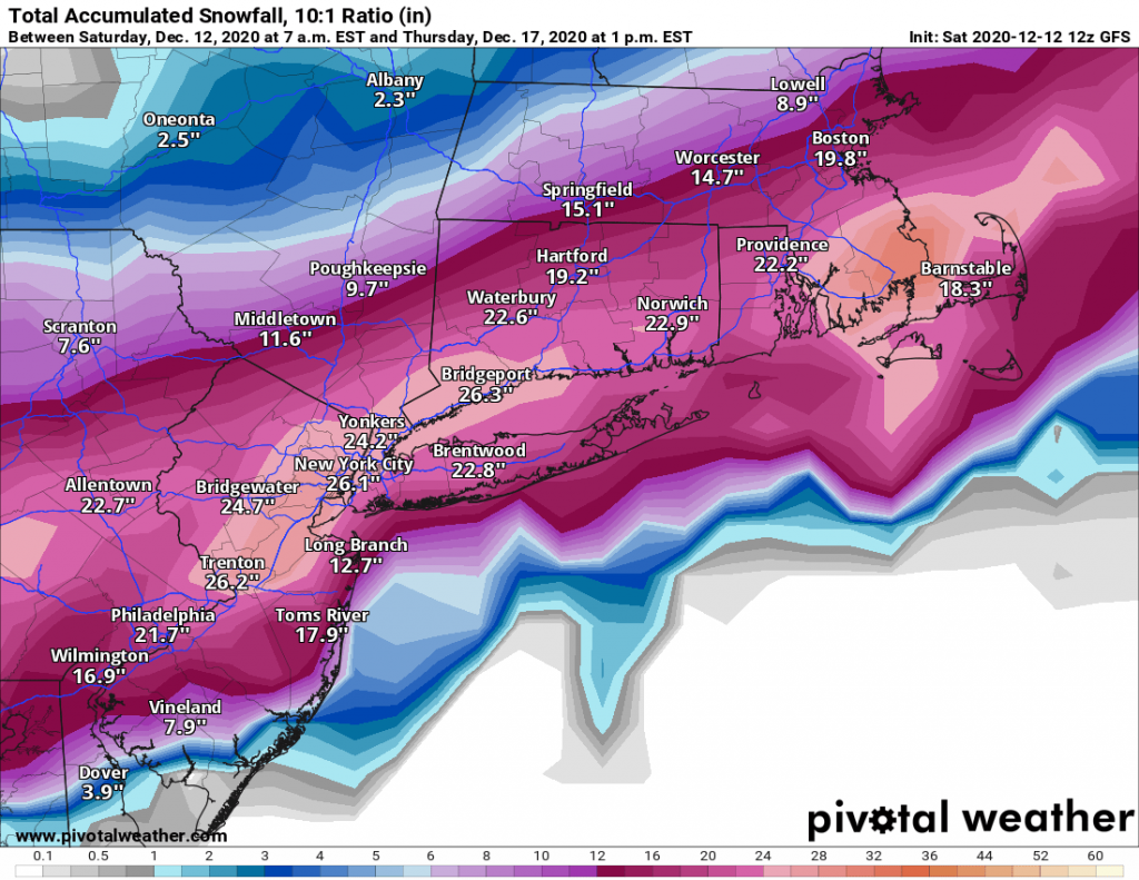
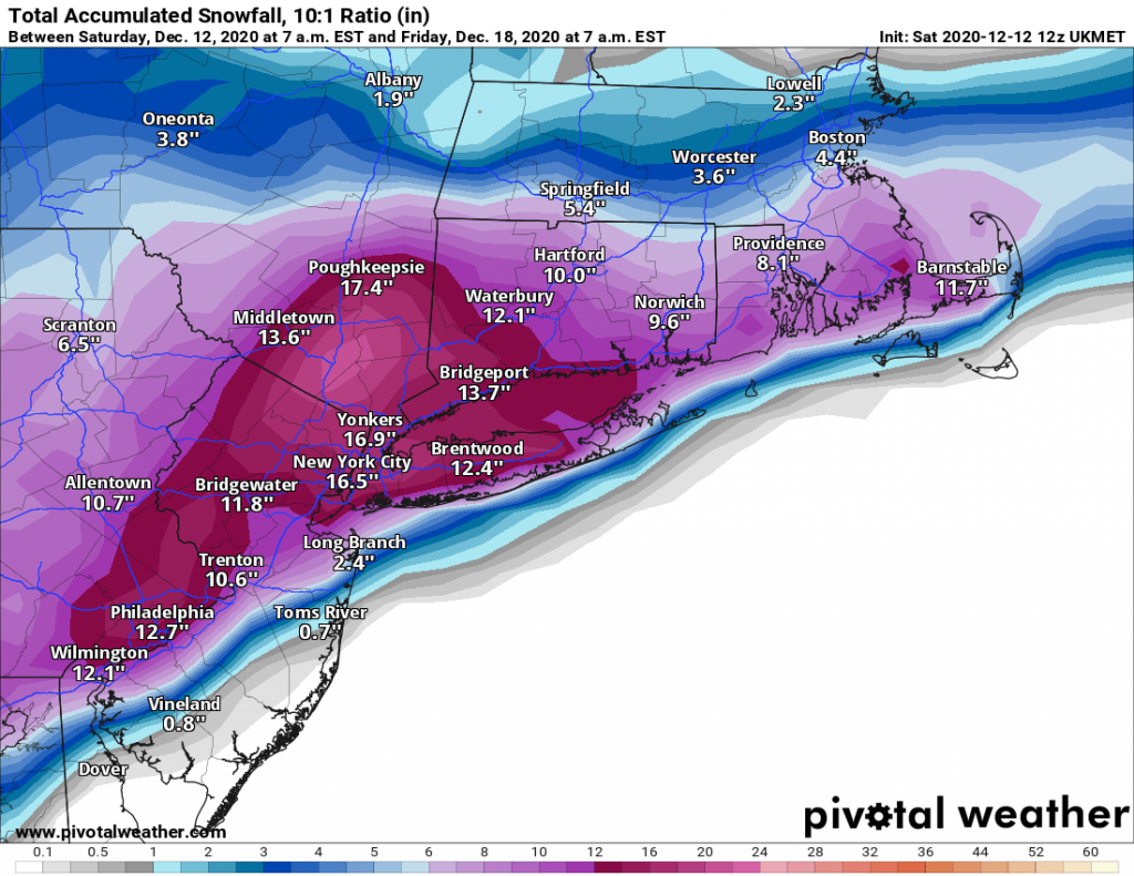
As of this afternoon, the models continue to be in agreement in regards to a major snowstorm impacting our region beginning on Wednesday afternoon continuing overnight into Thursday. Currently all of the major models are projecting that our region will see 12″+ of snow. While, I am not yet ready to pull the trigger and say that is what we should expect, everything is certainly trending that way. For now we will have to continue to watch the evolution of the storm, and wait for the short-range models to come in to range beginning on Sunday and Monday.
In addition to the major storm that we are tracking, there is a chance for some light snow on Monday afternoon. However, the setup for Monday is a rain to light snow scenario where we do not often see significant accumulations.

CMC 12Z EURO 12Z GFS 12Z UKMET 12z