Sunday Storm Update: Significant Snowfall on the Way (8–14” Predicted)

As of this evening, we are still on track for a significant snowfall to impact the whole region.

The snow looks to begin on Sunday morning, spreading from South to North by sunrise. At the start, temperatures will be VERY cold (teens), which is a key ingredient here. That cold air means we will see good snow growth and high ratios; in other words, this will likely be the fluffy kind of snow that accumulates quickly. The snow is expected to continue right through until early Monday.

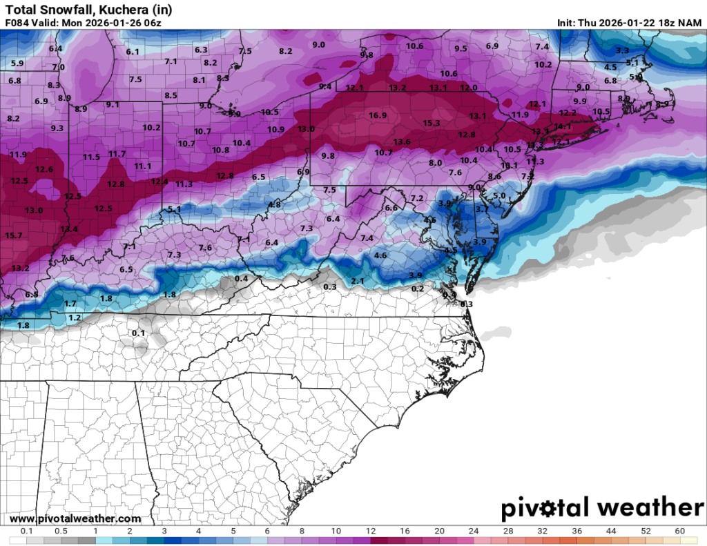
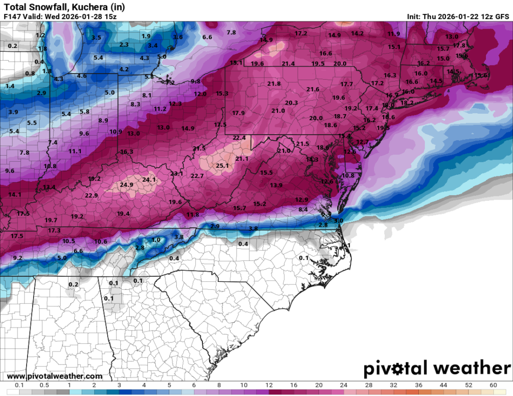
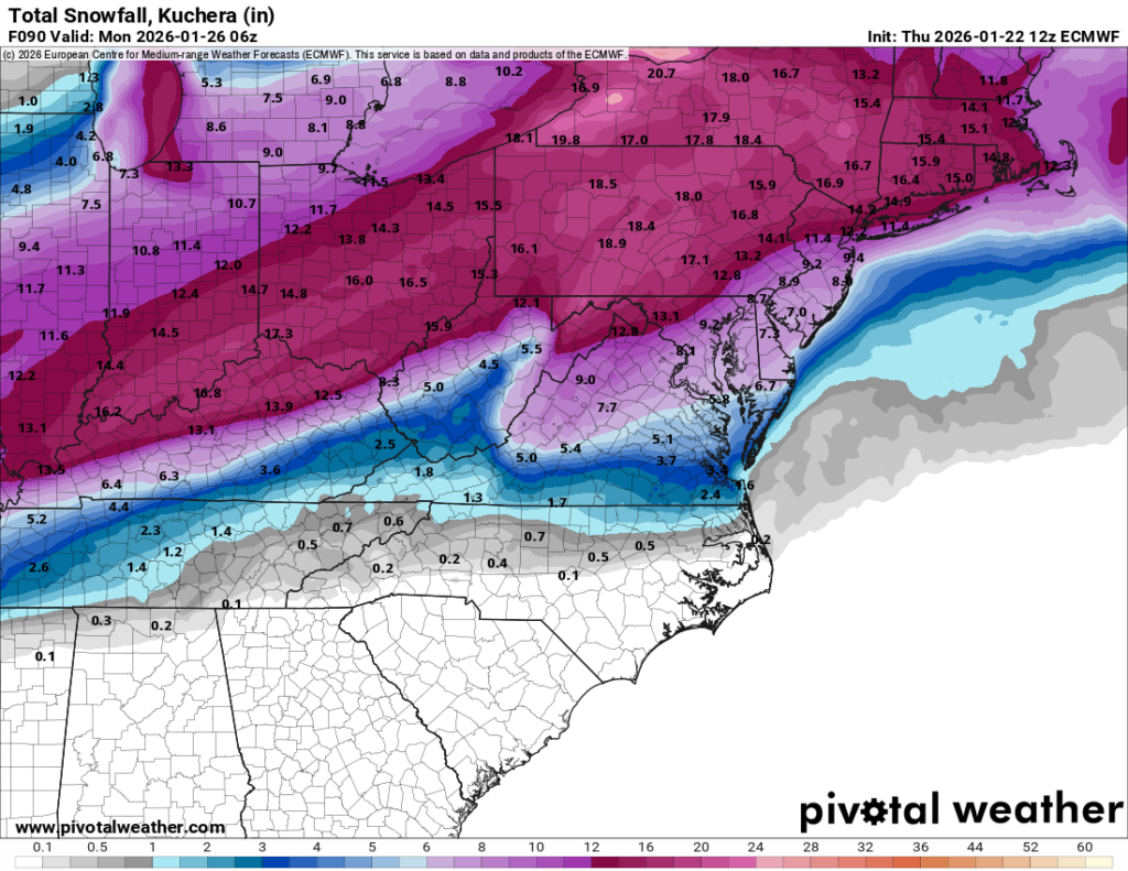
One outstanding question with the storm is if and when the snow changes over to sleet. Some models are introducing sleet towards the end of the storm. If that mixing occurs, it will reduce the overall snowfall, likely holding totals to the 7–9 inch range. Other models keep the cold air locked in with snow throughout the entire event. These non-mixing solutions are maxing out as high as 18 inches.

My Forecast Right now, my initial call is for a general 8–14 inches area-wide, with slightly higher amounts likely north of Long Island and the city.

We still need to work out if and when the snow mixes with sleet. That mixing line will have a direct impact on the final totals. But the bottom line remains: we are expecting a significant snowfall on Sunday into Monday morning
Sunday Into Monday Potential Storm

While it’s still a long way out in the weather world, the major models are starting to raise eyebrows for Sunday into Monday, showing the potential for a significant snowfall across the entire region.

It’s far too early to lock in specifics, but this is definitely a timeframe worth watching closely. The potential setup here gives this storm a very high ceiling. If some of the more aggressive solutions (looking at you, Euro) end up verifying, we could be talking well over a foot of snow by Monday.

As we get closer, I’ll start posting more detailed updates, including model trends and timing.

And yes, I’ve already started acting like my job is to refresh model runs and live and die by every run.

Friday Morning Storm Update

I only have time for a quick update this morning on the road to NYC:

As of this morning we remain on track for an area wide snowfall of 5-10”. You will notice that I am being broad in expected accumulations as there are still two camps of models. Camp 1 including the Euro is holding fast on lower totals of 5” max. While a majority of others are on the higher end of 8-10” across the area. I lean towards splitting the difference and would expect 6 or 7 inches with a chance of exceeding that.

Snow will begin this afternoon around sundown or just after. Expect the heaviest snow later this evening and overnight. Snow should end from Northwest to Southeast by sunrise.

Updated Forecast: Friday Night Snowstorm Taking Shape 5–10 Inches Expected


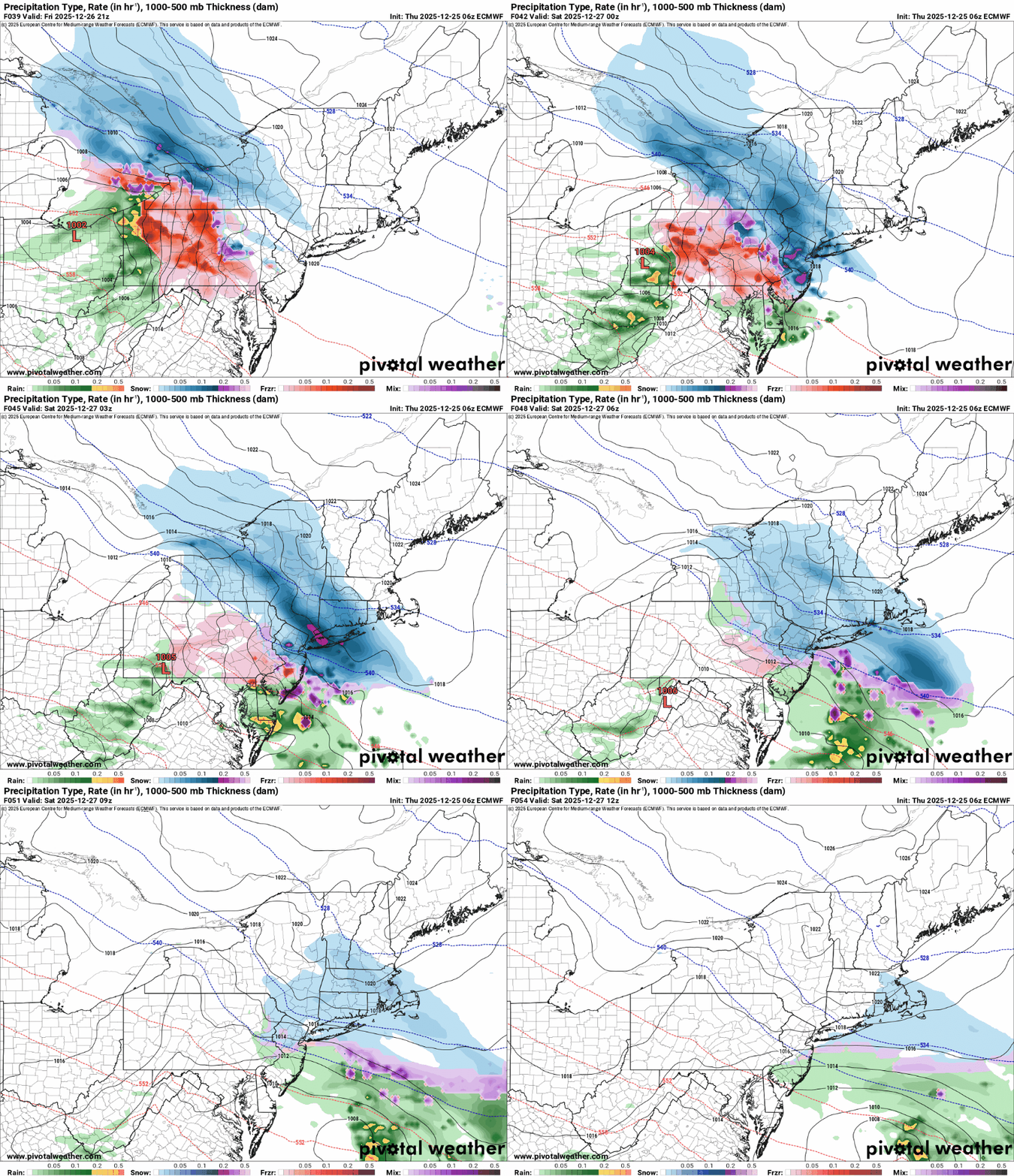
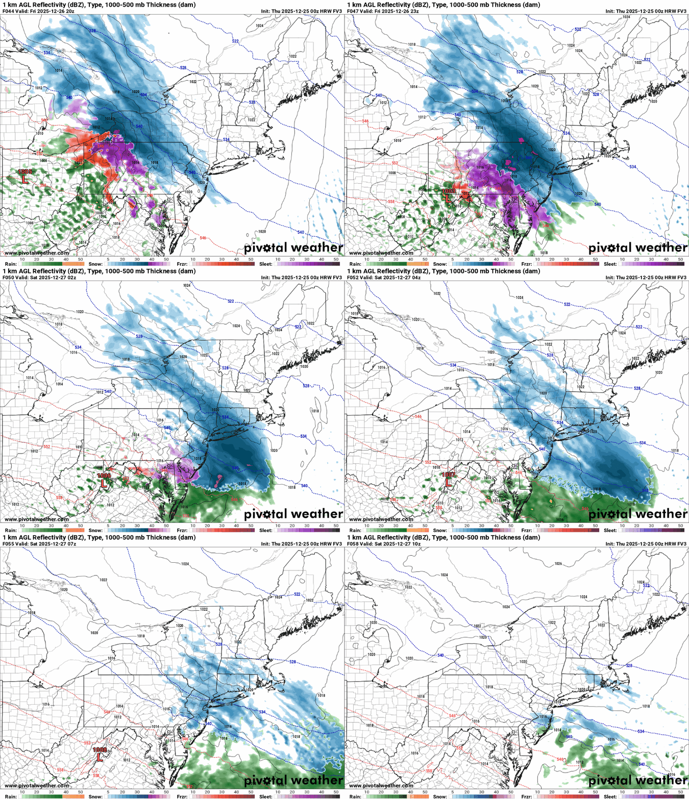
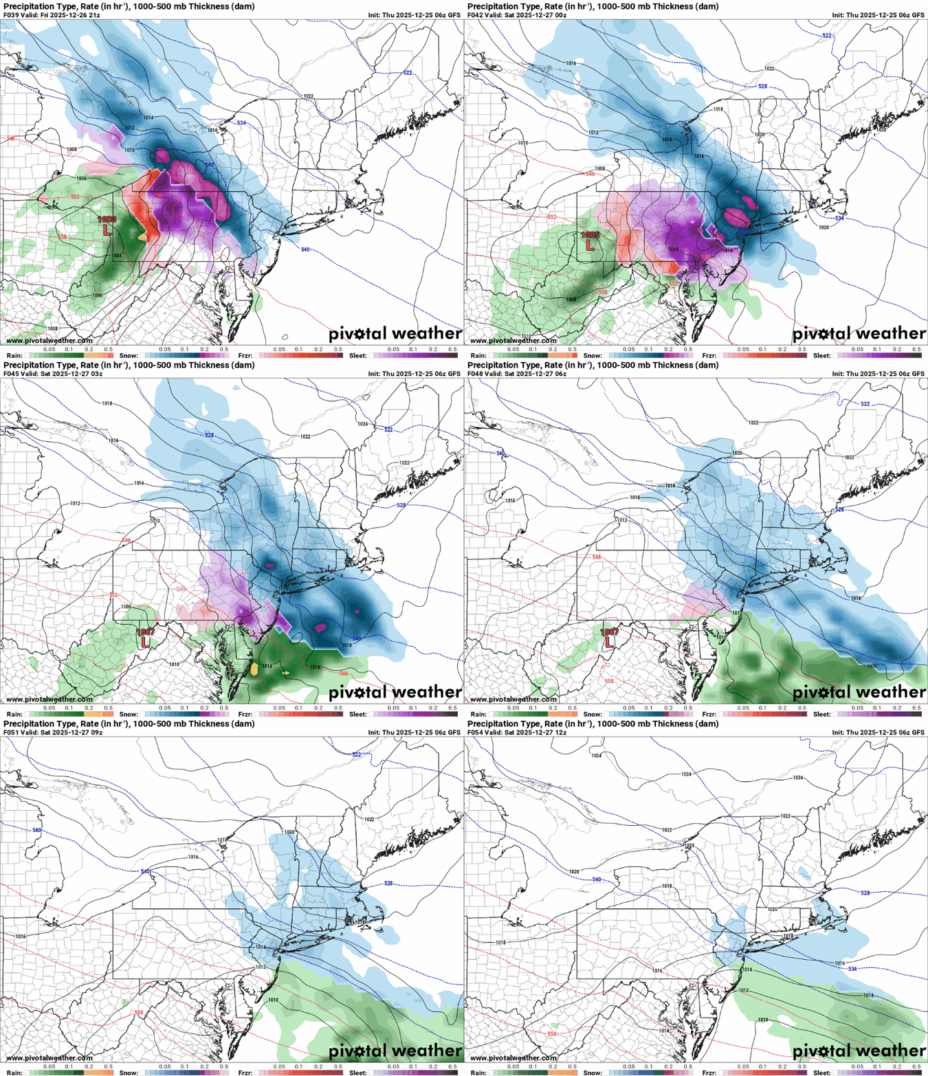
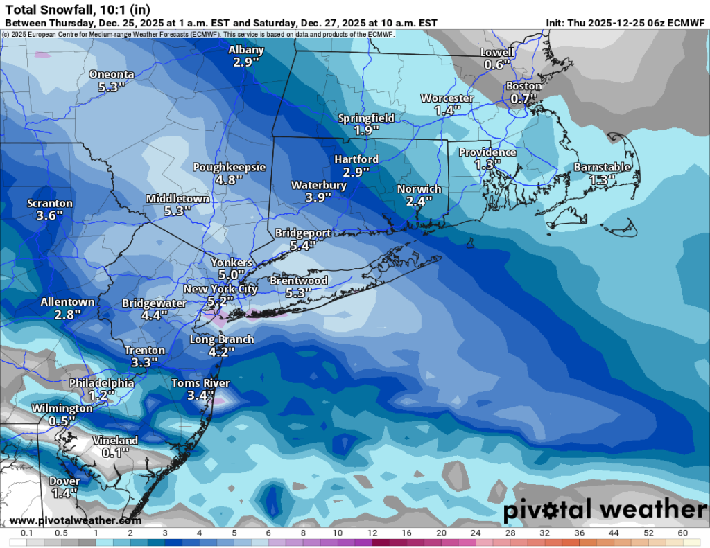
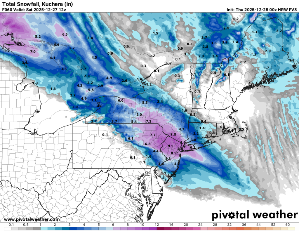
The models have come into much better agreement overnight, and confidence is growing that we’re looking at a solid winter storm for Friday night into Saturday morning. Both the Euro and GFS now show a widespread 6 to 10 inches of snowfall across Long Island and NYC. The RDPS is close to that as well at around 6 inches. The NAM is still insisting the storm tracks much farther north, but at this stage in the game the NAM often likes to go rogue before coming back to reality. The newly-arriving FV3 matches the Euro and GFS pretty closely, with snow starting earlier in NYC—around 5 PM—and tapering off near sunrise on Saturday. It also paints that same broad 6 to 10 inch swath over the region.

For Long Island and the city, that means a significant snowfall is looking more likely. Snow should begin between 5 and 7 PM depending on location, quickly becoming steady and then heavy through the nighttime hours. With temperatures staying well below freezing from start to finish, this will be an all-snow event—no rain line or sleet drama to worry about. Travel Friday night could become hazardous pretty quickly once the heavier bands move in.

My forecast remains 5 to 10 inches area-wide, with the highest totals likely in western Long Island and NYC. Suffolk County still looks to sit closer to the lower end of that range. The dividing line between the “wow, that’s a lot of snow” zone and the “ugh, we missed the best stuff” zone appears to set up somewhere near the Nassau/Suffolk border. As always, that exact line will shift as we get closer, and it only takes a small move east or west to change totals for a lot of people.

I’ll keep tracking and will post again later today or tomorrow morning as the picture sharpens. In the meantime, enjoy the holiday week and prepare the shovels—or kids—accordingly. Snow is coming. 

Friday Night into Saturday: Another Round of Snow (Christmas Weekend Edition)

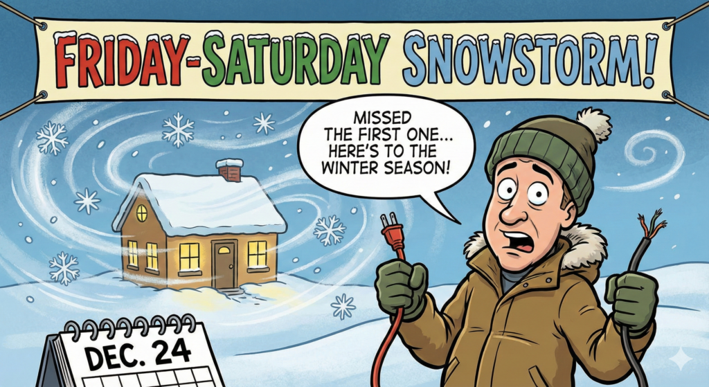
I’m back from a little summer hiatus (and yes, I managed to miss the first winter storm… because life has a habit of scheduling itself like a chaotic toddler).

Here’s what we’re working with: A winter weather event is expected Friday night into Saturday morning.

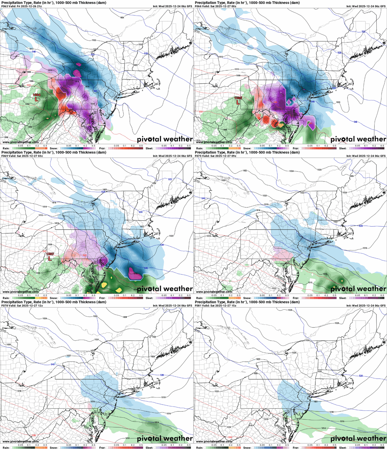
As of this morning, the major forecast models are on the same page that accumulating snow is likely, kicking off early Friday evening and continuing into Saturday morning.

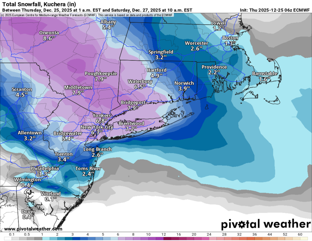
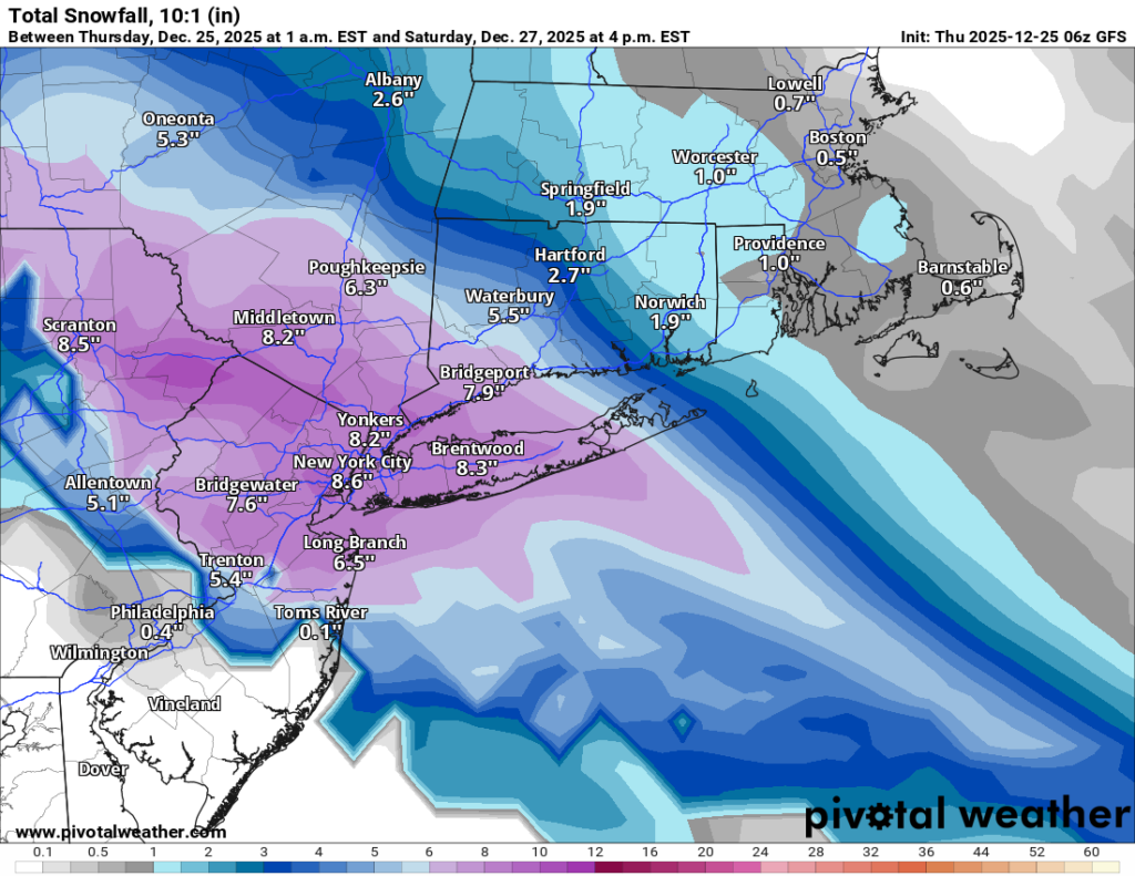
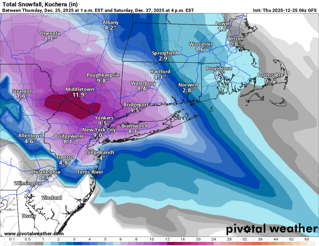
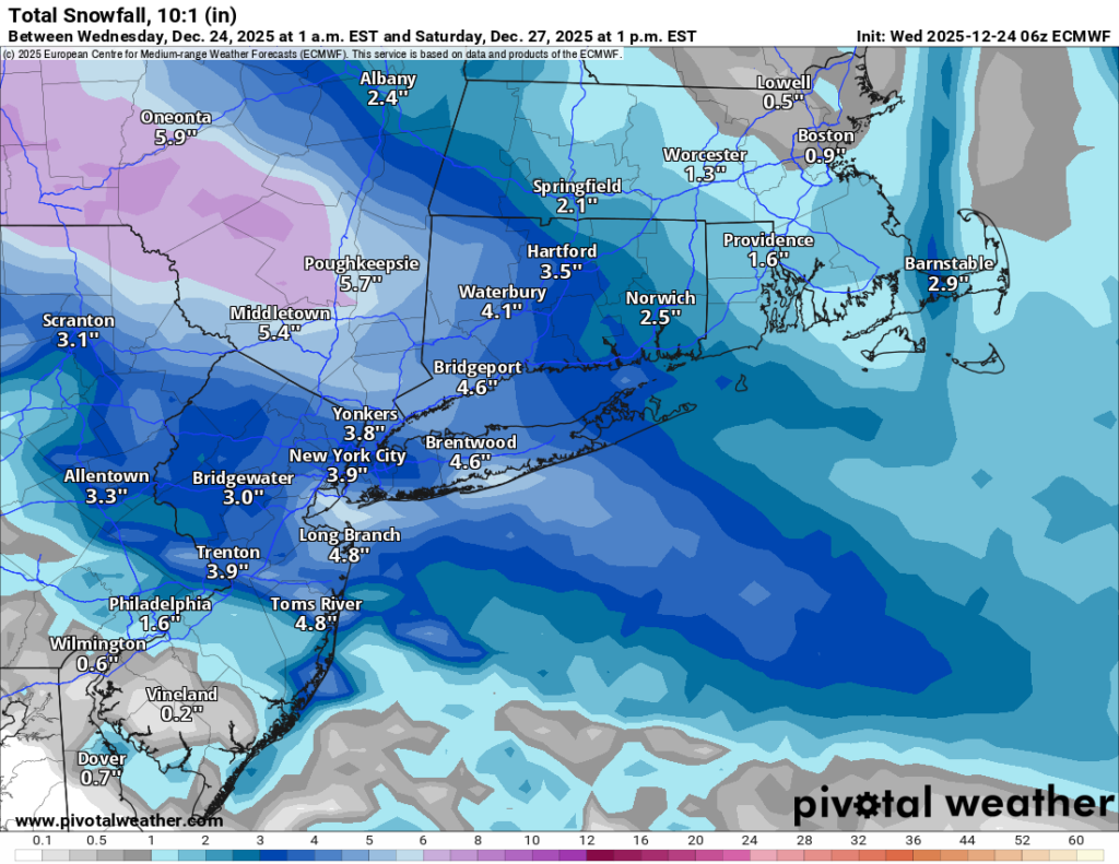
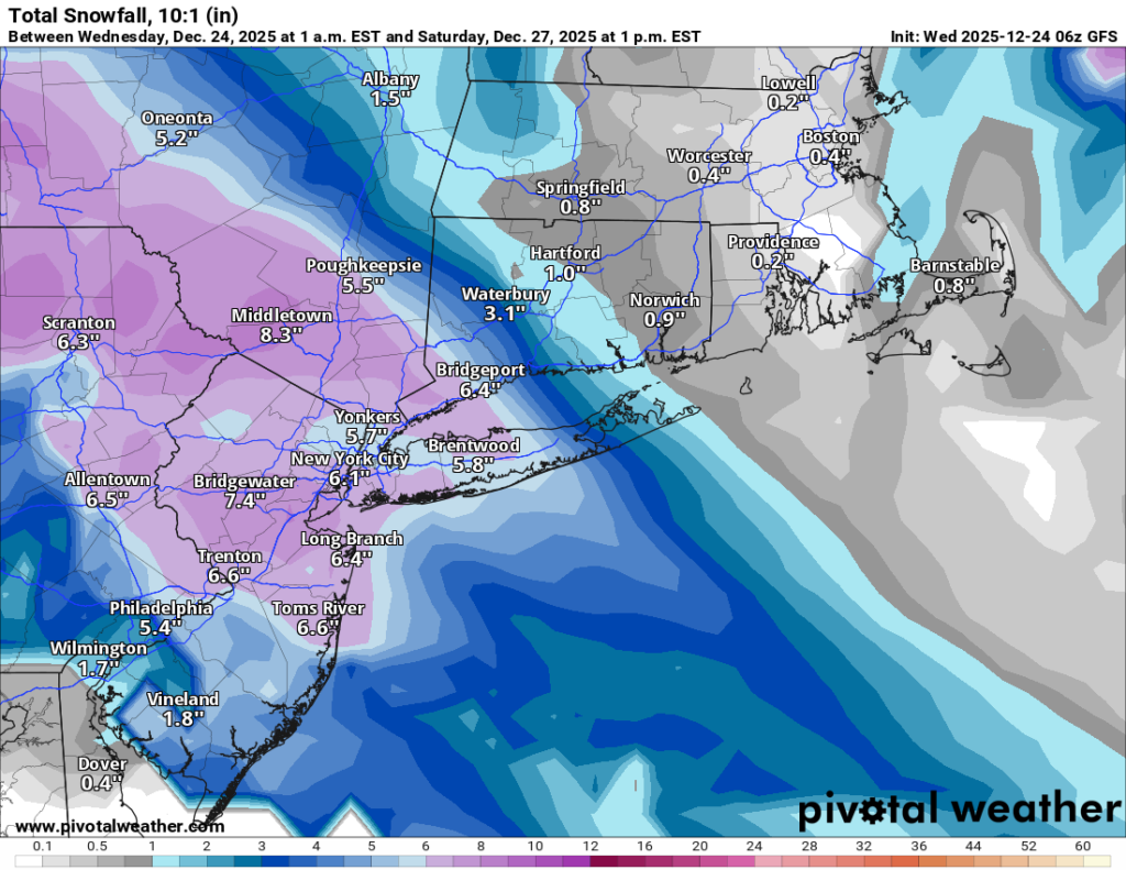
Where they don’t agree (yet) is the total snowfall:

  • European model (Euro): roughly 3–4 inches area-wide

  • GFS (American model) + CMC (Canadian model): closer to around 7 inches area-wide

So yes, the snow is coming. The only argument left is whether it’s a “shovel a little” storm or a “shovel and pop an Advil” storm.

One other important ingredient: It’ll be more than cold enough for all snow. Temperatures should sit in the mid to upper 20s for most of the event. The air higher up in the atmosphere looks to be very cold, which matters because colder storms can produce fluffier snow that piles up faster. If it does end up colder as forecast, would mean more accumulation for the same amount of moisture (higher ratios). We’ll have a better read on that as we get closer to Friday.

I’ll post another update later today or this evening.

Merry Christmas to everyone who celebrates! 🎄❄️

Storm Update: Why the Big Snowstorm is Now Unlikely

As of this afternoon, the winter storm we’ve been tracking since Friday appears increasingly unlikely to materialize. While early projections suggested a significant snowfall event, the latest model trends continue to weaken the system—some even indicating a complete miss. What once looked like a blockbuster storm is now shaping up to be, at best, a minor inconvenience.

The key shift in the forecast comes down to how energy over the Pacific is interacting with the atmosphere. Initially, conditions seemed favorable for a strong low-pressure system to develop along the East Coast and merge with energy diving in from Canada. However, over the past 48 hours, updated models show the Pacific energy pushing ahead too quickly, preventing the necessary phasing of these systems. Without this connection, the storm loses its punch, reducing the chance of a significant snow event.

While I’ll continue to monitor developments, as it stands now, expect only a few inches of snow late Wednesday night into Thursday morning. Stay tuned for further updates!