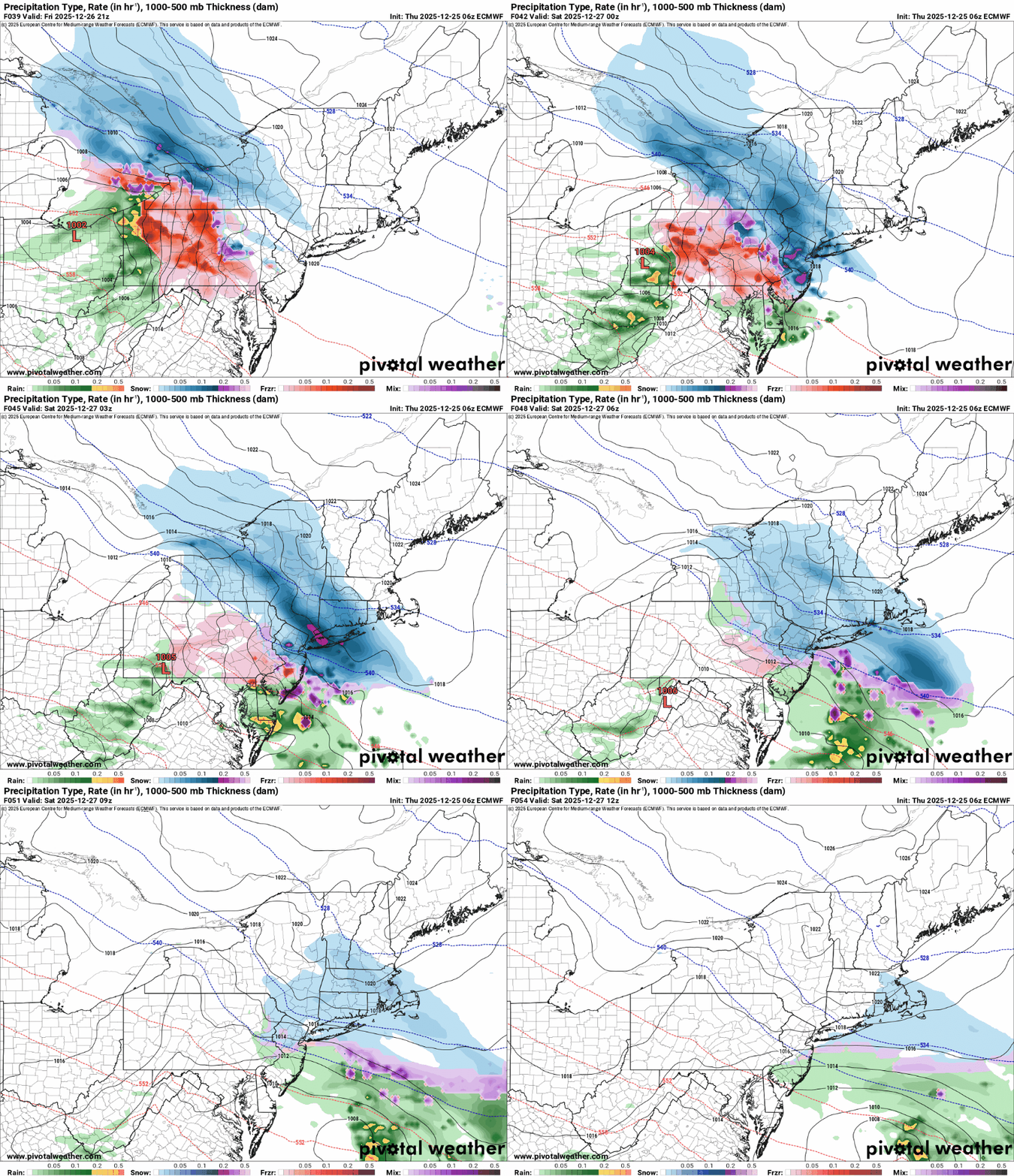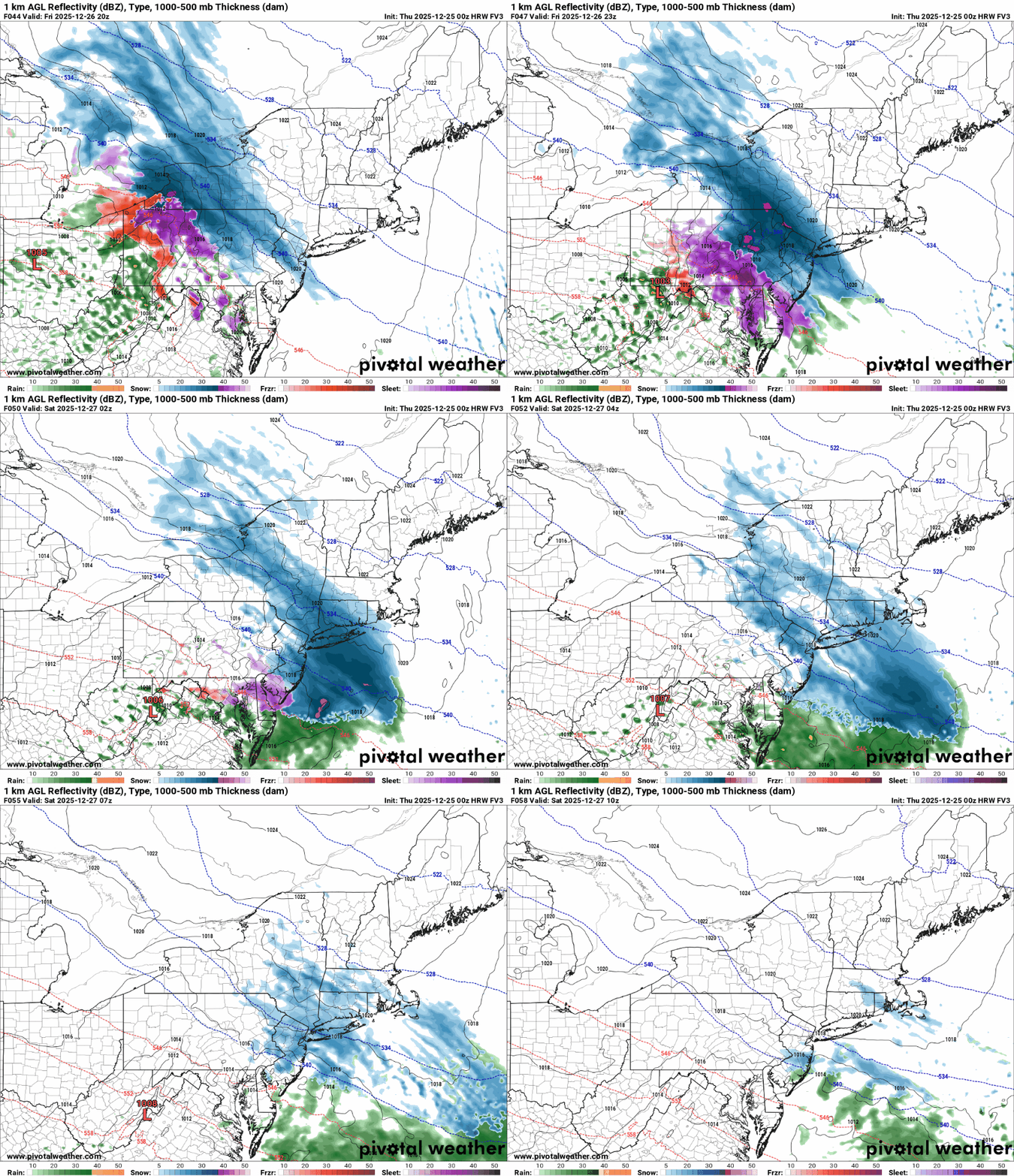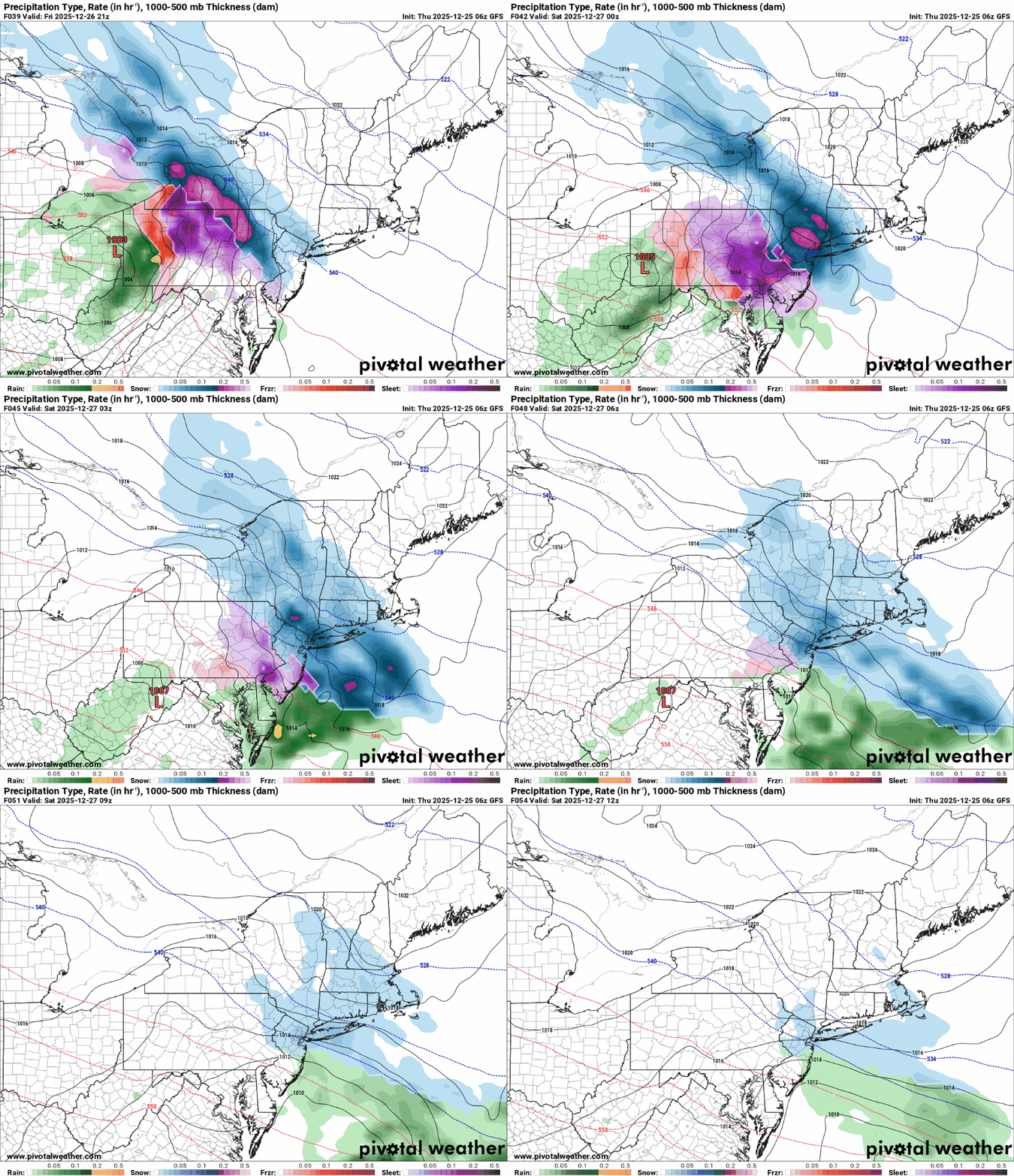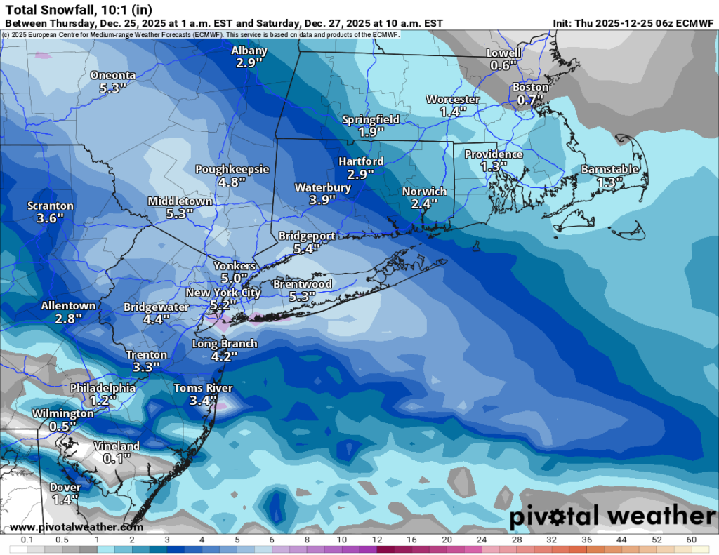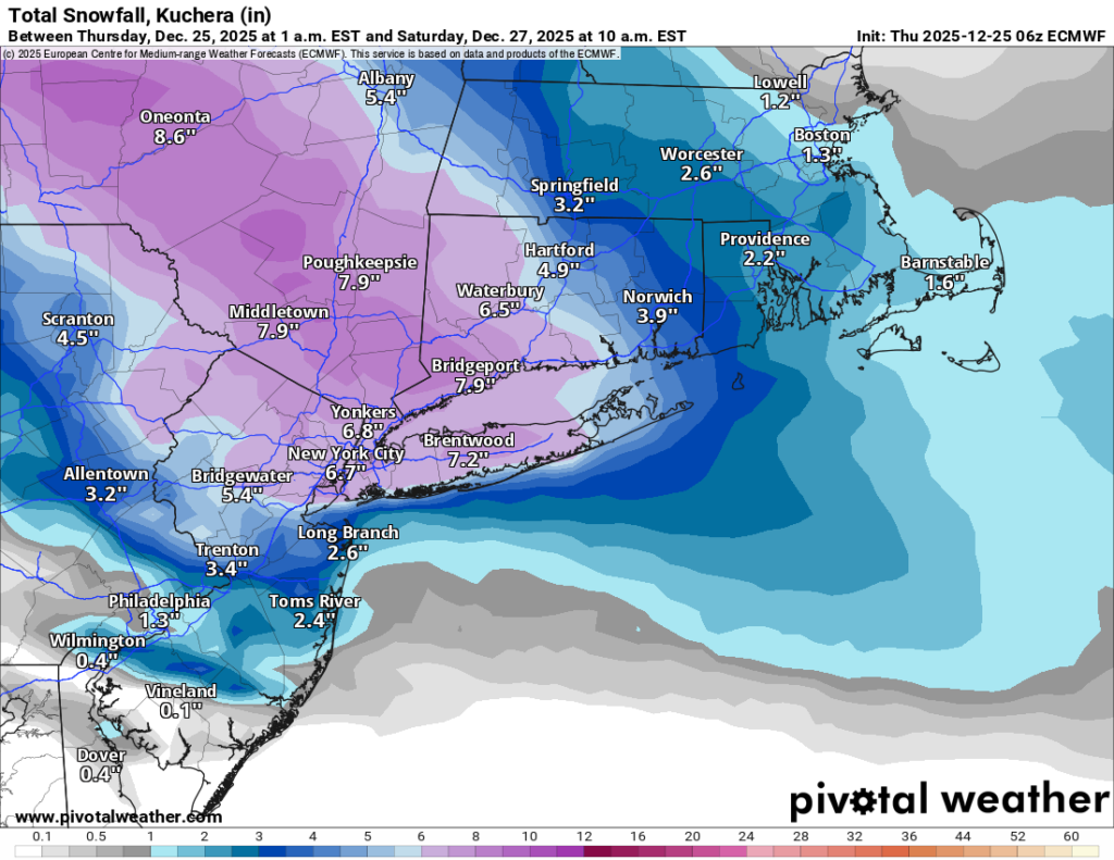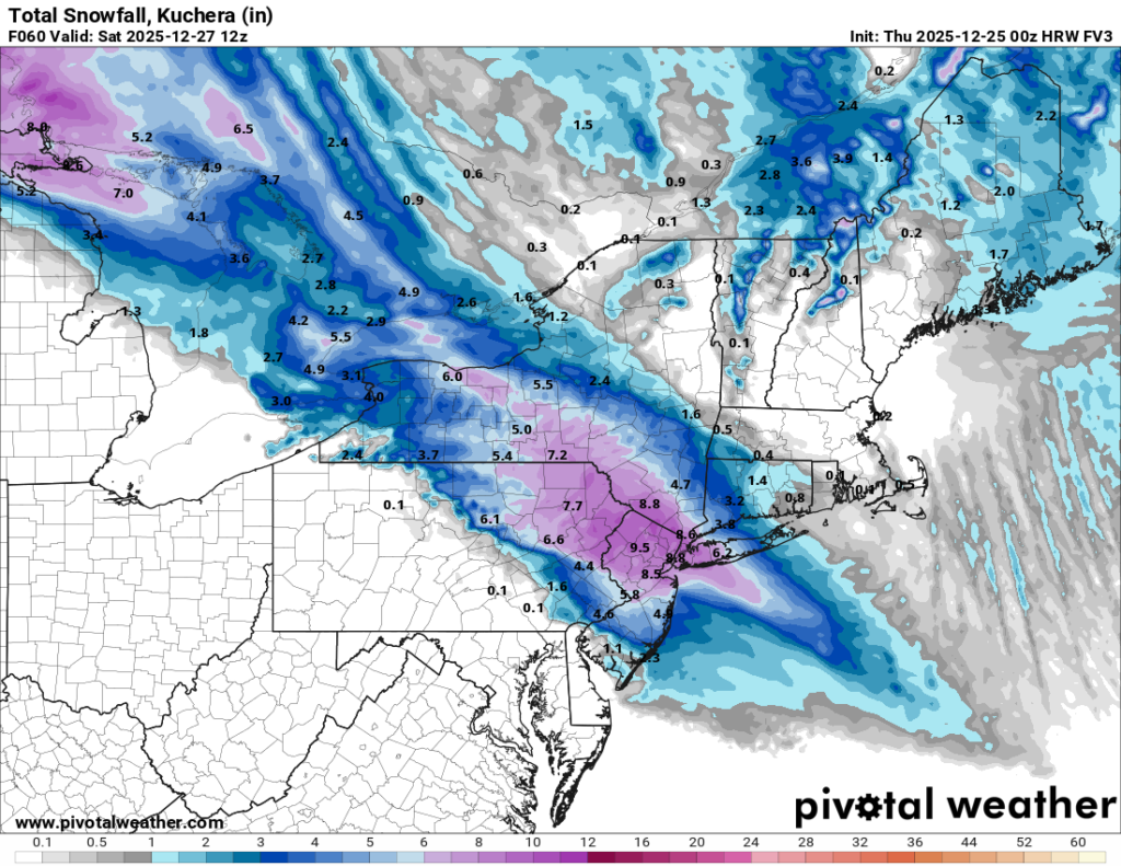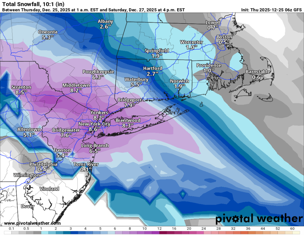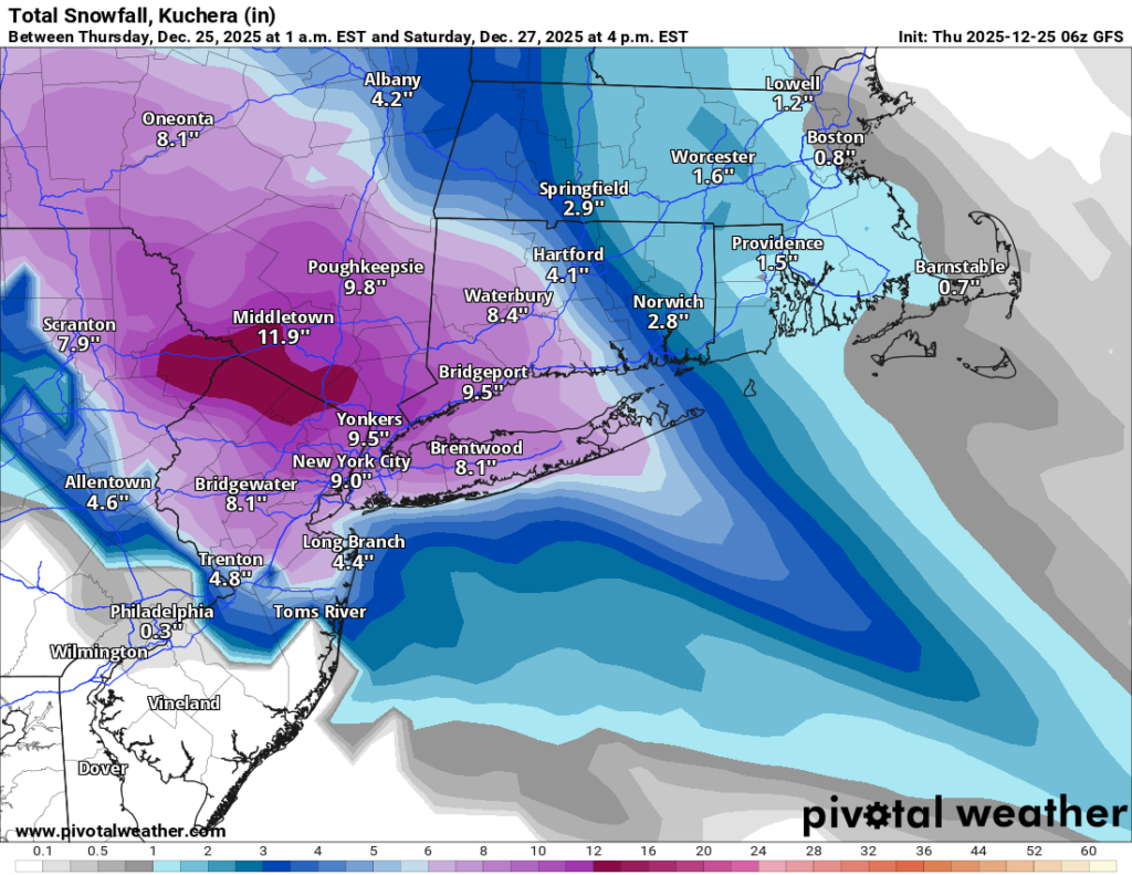
The models have come into much better agreement overnight, and confidence is growing that we’re looking at a solid winter storm for Friday night into Saturday morning. Both the Euro and GFS now show a widespread 6 to 10 inches of snowfall across Long Island and NYC. The RDPS is close to that as well at around 6 inches. The NAM is still insisting the storm tracks much farther north, but at this stage in the game the NAM often likes to go rogue before coming back to reality. The newly-arriving FV3 matches the Euro and GFS pretty closely, with snow starting earlier in NYC—around 5 PM—and tapering off near sunrise on Saturday. It also paints that same broad 6 to 10 inch swath over the region.
For Long Island and the city, that means a significant snowfall is looking more likely. Snow should begin between 5 and 7 PM depending on location, quickly becoming steady and then heavy through the nighttime hours. With temperatures staying well below freezing from start to finish, this will be an all-snow event—no rain line or sleet drama to worry about. Travel Friday night could become hazardous pretty quickly once the heavier bands move in.
My forecast remains 5 to 10 inches area-wide, with the highest totals likely in western Long Island and NYC. Suffolk County still looks to sit closer to the lower end of that range. The dividing line between the “wow, that’s a lot of snow” zone and the “ugh, we missed the best stuff” zone appears to set up somewhere near the Nassau/Suffolk border. As always, that exact line will shift as we get closer, and it only takes a small move east or west to change totals for a lot of people.
I’ll keep tracking and will post again later today or tomorrow morning as the picture sharpens. In the meantime, enjoy the holiday week and prepare the shovels—or kids—accordingly. Snow is coming.