Blog
-
3/7/18 Storm Evening Update- Lot’s of Questions
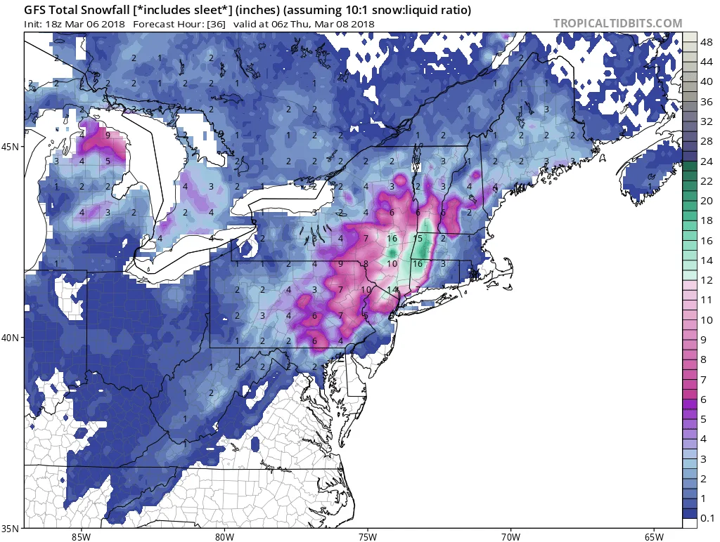
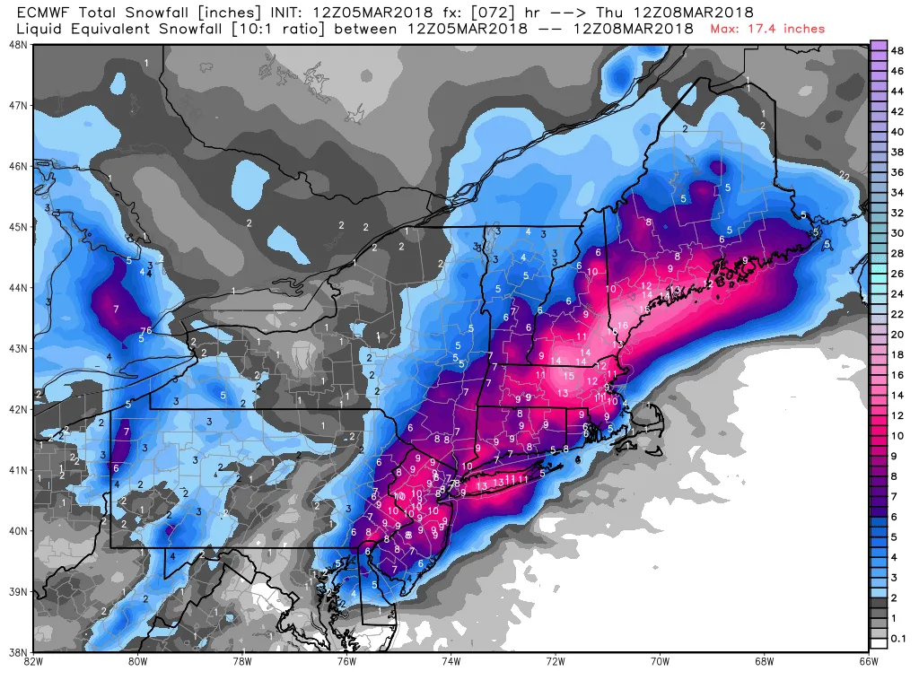
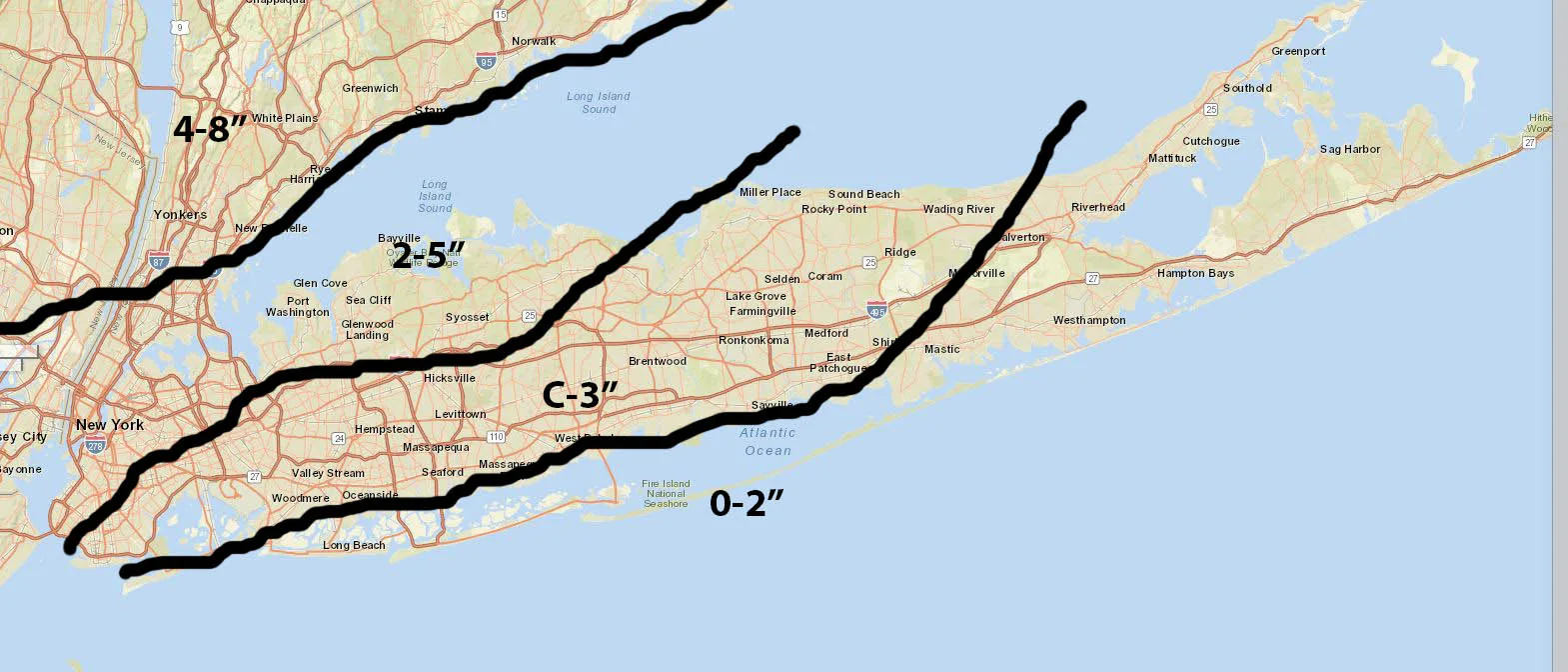
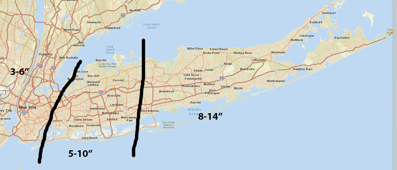
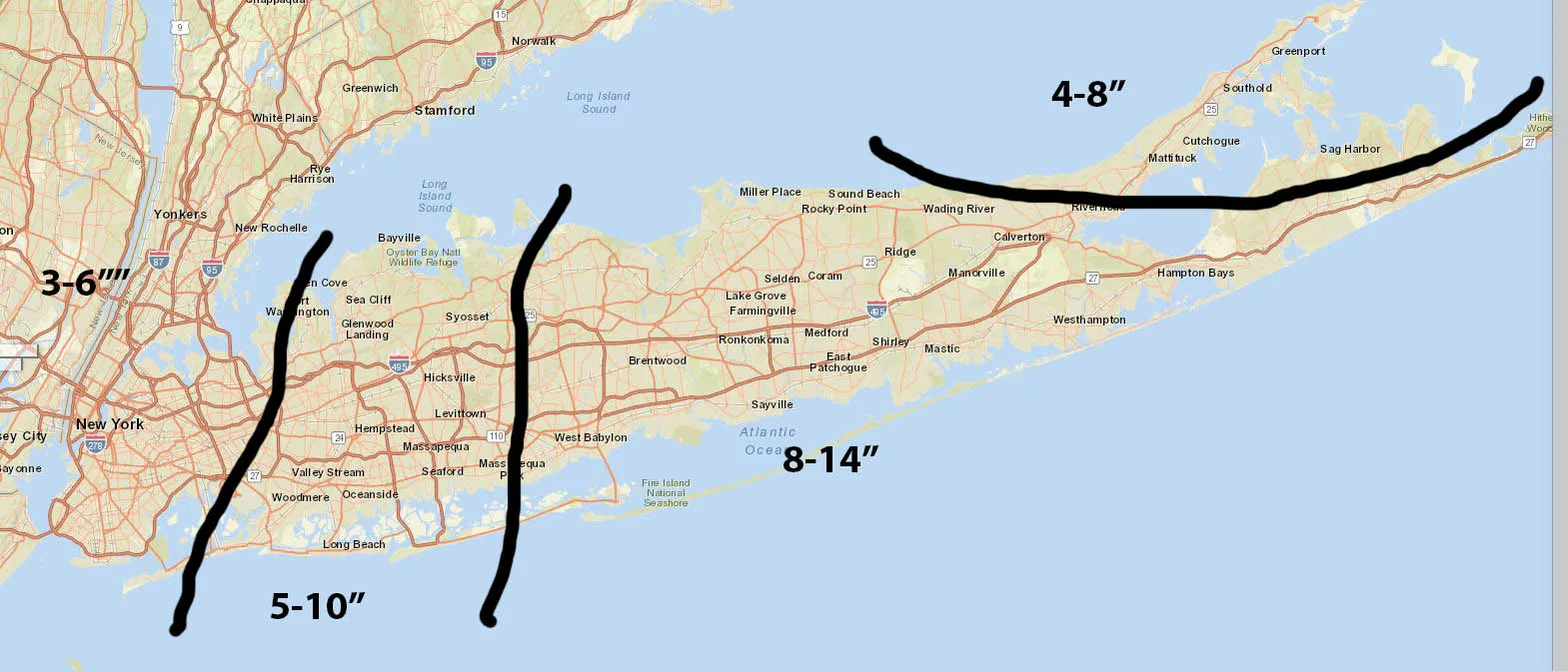
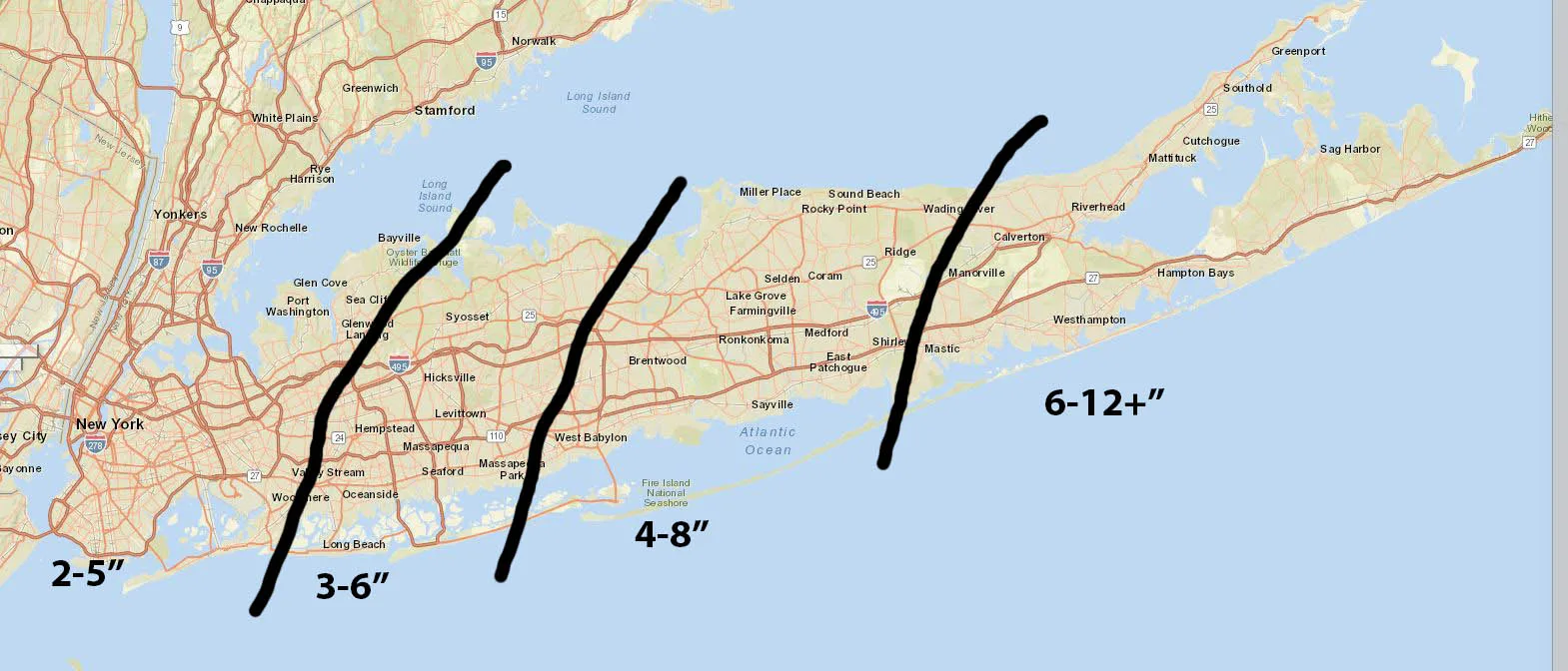
This forecast is proving to be extremely difficult, and I’m happy that I do this as a hobby and am not the National Weather Service this evening. There is still a significant amount of disagreement on the models. The range for Long Island is anywhere from 0″ to 14″+. At…
-
3/7/18 Storm Update- March Coming in Like a Lion
Sorry I’m late on this, but work has been keeping me busy: I really thought that I had made my last post about a snowstorm for the season, but unfortunately it’s looking like I was wrong. As of this afternoon, models are starting to come to some consensus in terms…
-
February 17-18 Storm Update
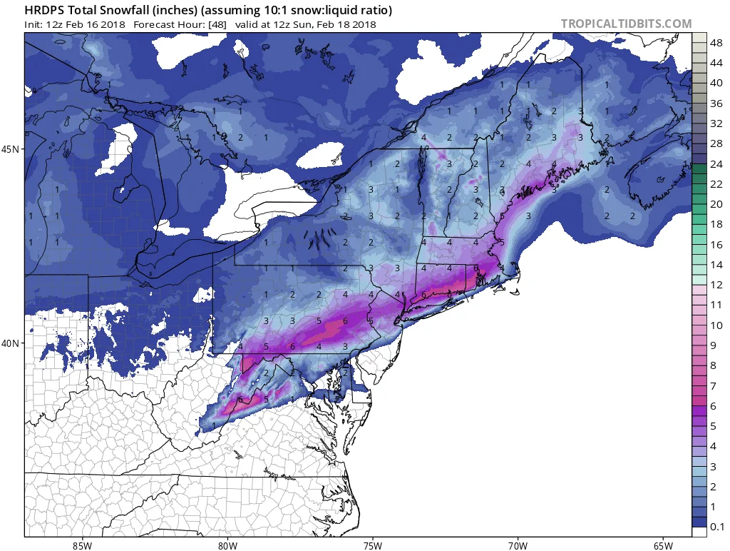
Tonight’s storm is proving to be a tricky one to forecast, a difference of 20-30 miles in the track of the storm will mean a significant difference in snowfall totals. As of now my forecast for tonight is as follows: Precipitation will overspread the region from West to East beginning…
-
February 17-18 Snow Event
It looks like our luck has run out and we are likely to see some snow overnight Saturday into Sunday. As of this afternoon, it is difficult to lock down exact totals, since our area is right on the border between rain and snow. It is likely that parts of…
-
1/4/2018 Storm Final Call
The snowstorm that will impact our region has formed and is already over performing in parts of the south. Based on current radar returns, the storm is staying close to the western edge of modeling. However, the models continue to shift back and forth by 25-50 miles, the latest NAM…
-
1/4/2018 Storm Updated Forecast
We’re finally starting to see something nearing consensus for tomorrow’s storm. Below find my second call for tomorrow’s storm, and I plan on posting one more later tonight once the 0Z models start rolling in. I do want to mention that for these totals it is possible that we will…
-
1/4/2018 Storm Update- MODEL MAYHEM
I’ve been asked by many for an update so here it is: The reality is at this point, there is still significant disagreement amongst the models and I can’t say with certainty how much to expect. As I said yesterday, the low is just forming and all the players are…
-
1/4/2018 Snowstorm First Call
Model disagreement continues this evening, with the models waffling back and forth by 50-100 miles. Which as I mentioned this afternoon can mean a significant difference in total snowfall. My forecast below is a first call and will very likely change by tomorrow evening. At this point, I’m thinking
-
1/4/2018 Storm Mid-Day Update
Just a quick update on where we stand as of mid-day today. Models continue to track a very strong low up the east coast beginning Wednesday evening. As of now, the snow will start in our area during the overnight hours before sunrise Thursday. How significant those impacts are exactly,…
-
1/4/18 Potential Snowstorm
I hate to be the bearer of bad news on this first day of 2018 (ok maybe I enjoy it a bit), but we are potentially in the path of a large storm for Thursday morning/day/night. As of this afternoon, the weather models are in two camps with the Global…