Goldberg Weather Live Updated 4:43 PM

All posts

1/4/2018 Snowstorm First Call
First Call 1 4 Storm

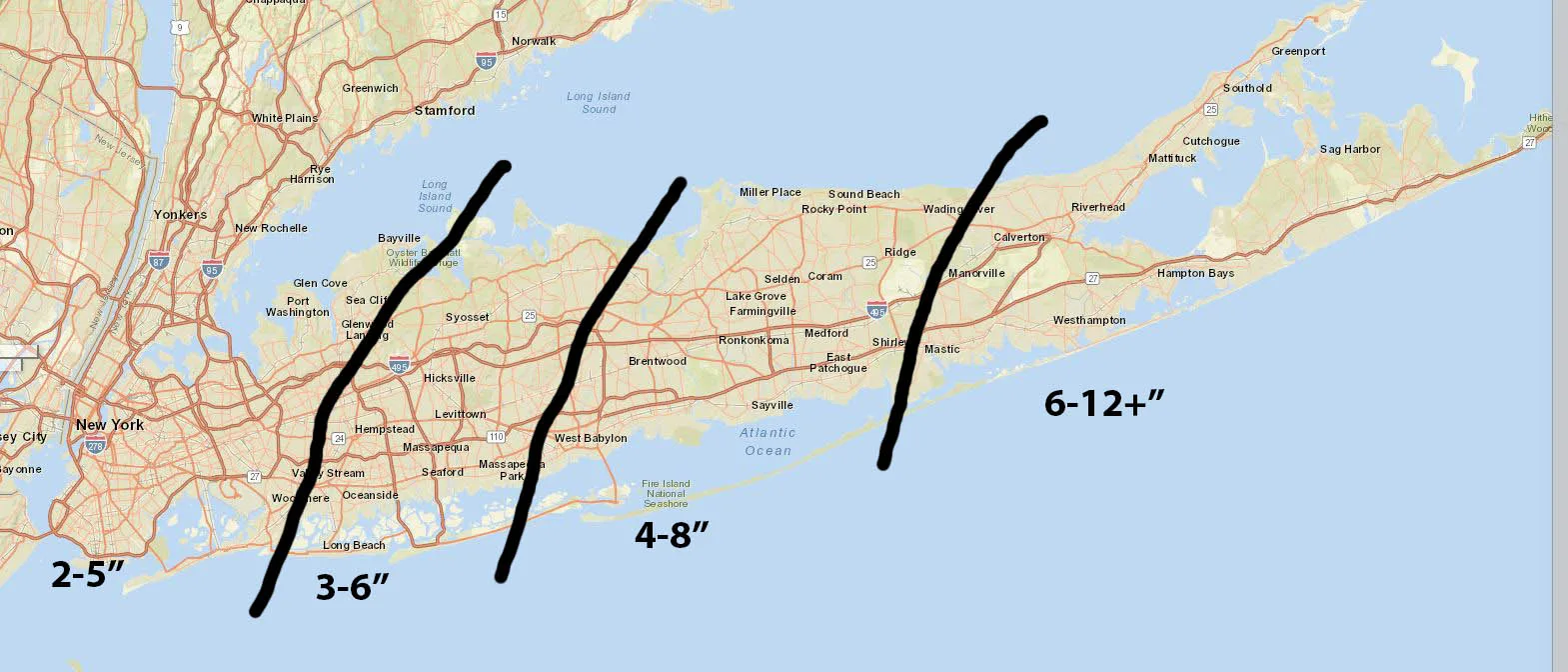
Model disagreement continues this evening, with the models waffling back and forth by 50-100 miles. Which as I mentioned this afternoon can mean a significant difference in total snowfall. My forecast below is a first call and will very likely change by tomorrow evening. At this point, I’m thinking that we’ll be impacted by a moderate snowfall region wide, with more snow the further east you go. The snow will begin before sunrise Thursday and continue through most of the day. Due to the strength of the storm, it likely will be fairly windy as well, and of course cold.

First Call Map:

First Call 1 4 Storm

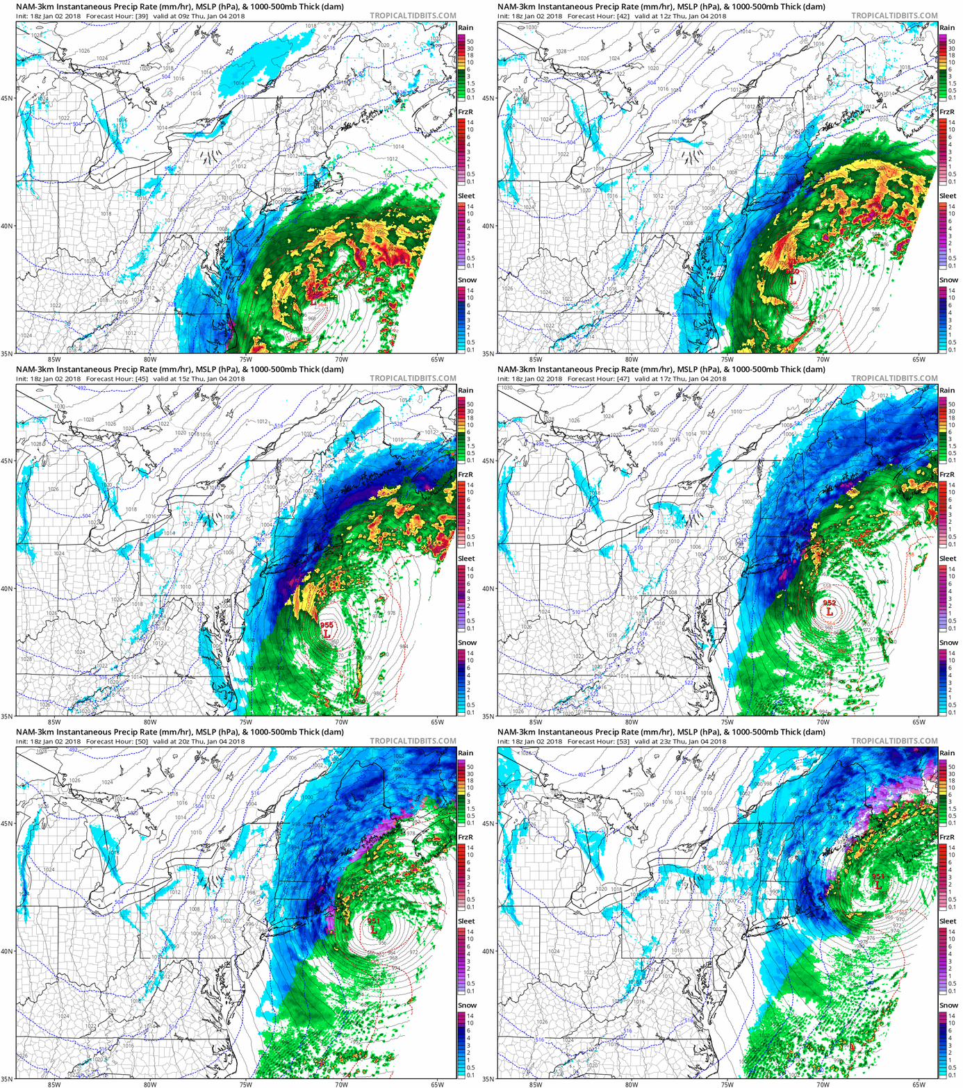
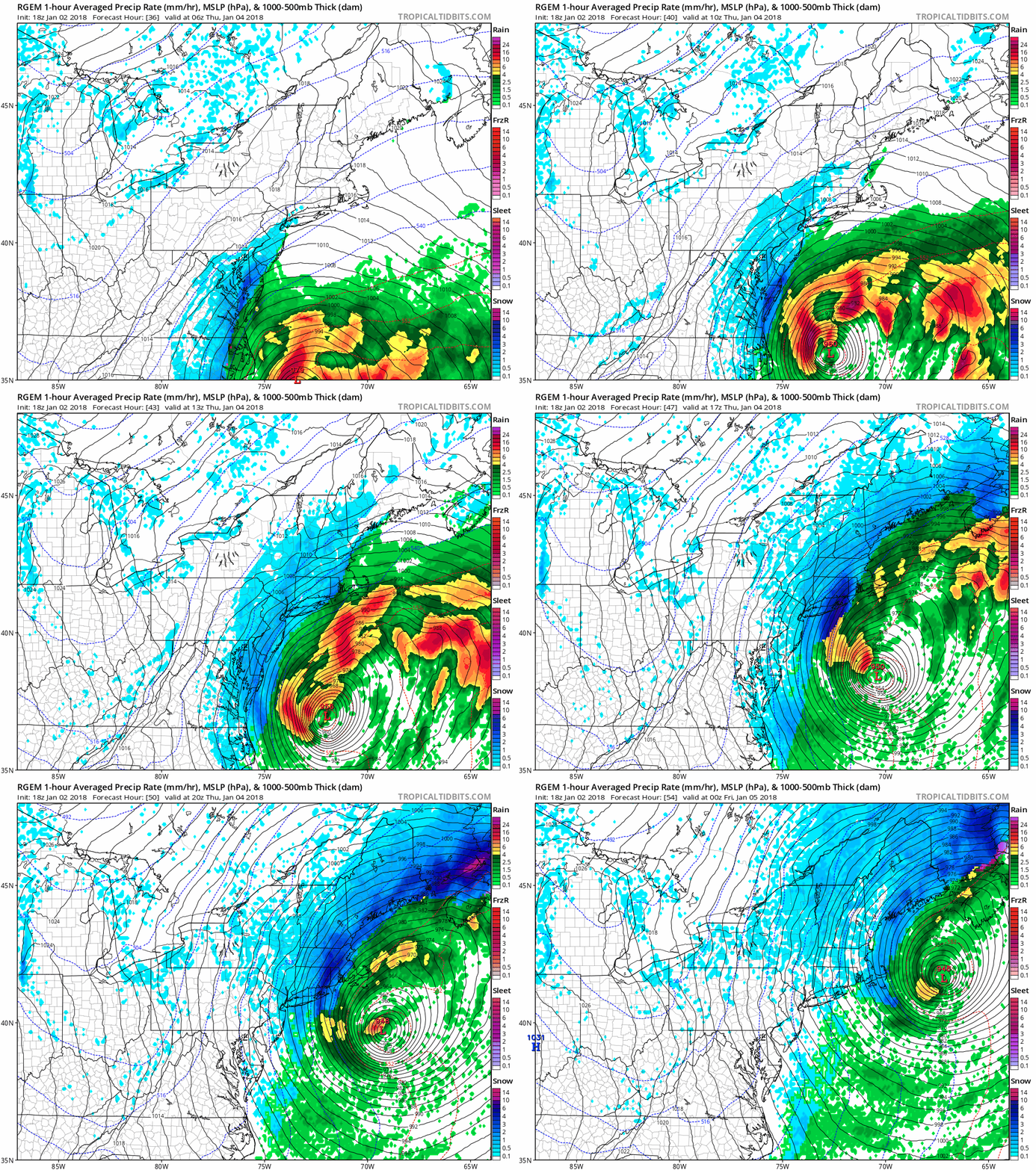
SIM Radars from RGEM and NAM:

nam3km mslp pcpn frzn neus fh39 53
rgem mslp pcpn frzn neus fh36 54

Follow on WhatsApp

All posts

My blend My forecast number: a weighted average of eight weather models, with more weight on the ones that have done best at Farmingdale.

Agreement How close the models are to each other. Close together means more confidence; far apart means the forecast could still change.

Confidence How sure I am about a call, from one dot (could easily change) to three (confident).

Bias-corrected Each model's recent habit, like running 2° too warm, is measured against what Farmingdale recorded and taken out before blending. It starts after two weeks of scored days.

Chance of rain From about 80 versions of the American and European models, each run with small tweaks. 7 in 10 means 7 of every 10 versions bring at least 0.04 in that day.