February 17-18 Snow Event
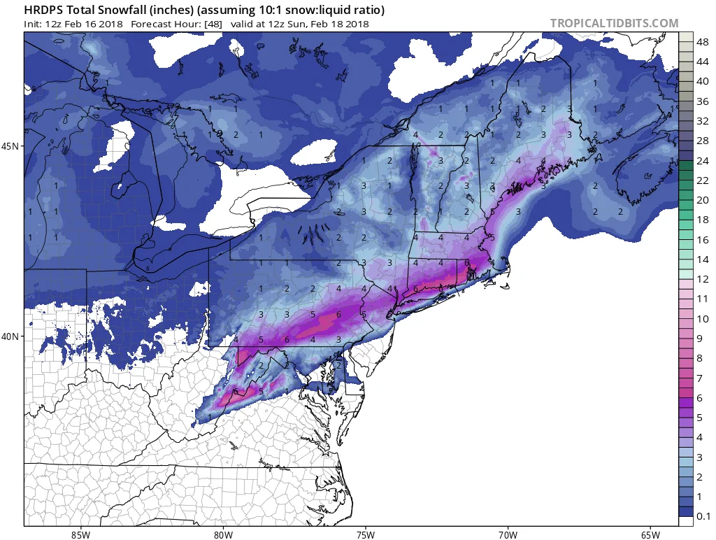
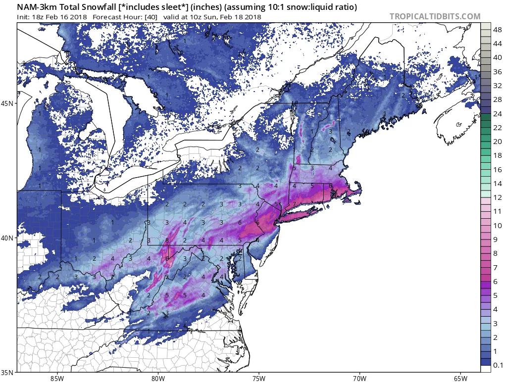
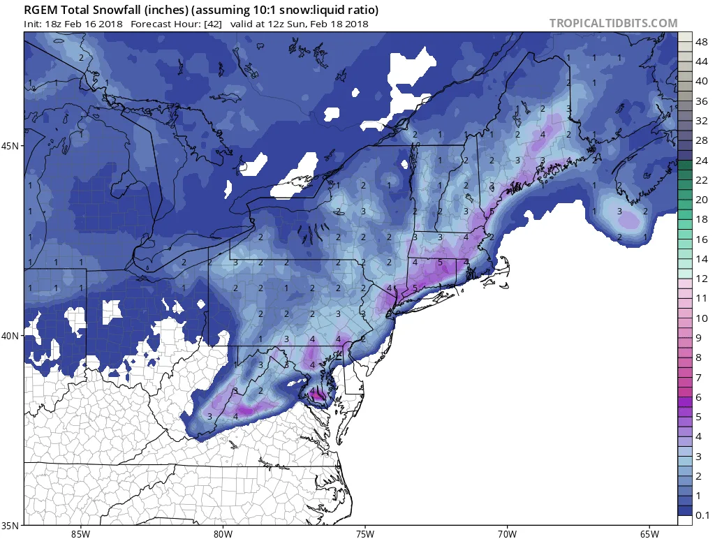
It looks like our luck has run out and we are likely to see some snow overnight Saturday into Sunday. As of this afternoon, it is difficult to lock down exact totals, since our area is right on the border between rain and snow. It is likely that parts of the North Shore of Long Island and Northern parts of NYC will be seeing heavy snow while the immediate South facing shores will be raining. As of now, my best forecast is that light snow and/or rain will overspread our area late Saturday night (8-11 PM time frame) and continue until around sunrise Sunday. Depending on the exact track of the low and strength, snowfall totals may end up being under an inch in some areas to as high as 5 or 6 in others. For now, the safe call is 2-4″ on the northern half of the Island, and 1-3″ on the Southern half. The other key factor in all of this is temperatures on Sunday and Monday will stay above freezing, and therefore whatever snow does fall will melt quickly. More updates to come tonight and tomorrow.
Below are a few examples of the potential snowfall, showing the wide variance in guidance:
Image no longer available