3/7/18 Storm Evening Update- Lot’s of Questions
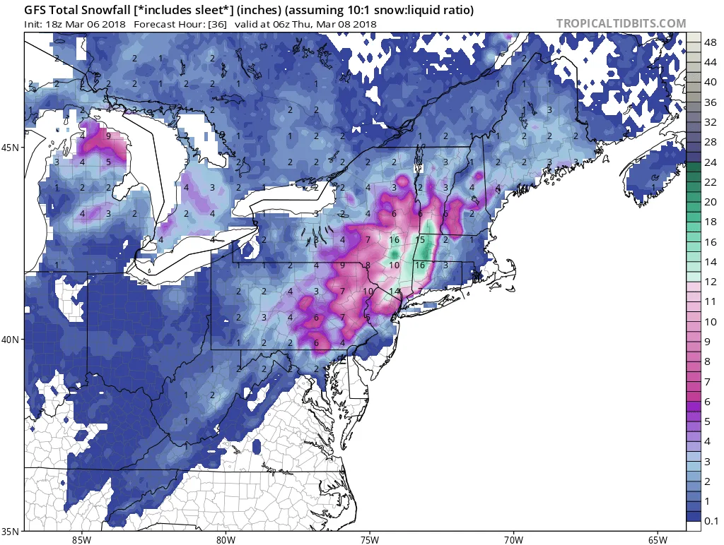
This forecast is proving to be extremely difficult, and I’m happy that I do this as a hobby and am not the National Weather Service this evening. There is still a significant amount of disagreement on the models. The range for Long Island is anywhere from 0″ to 14″+. At this point, I am leaning towards the solutions that show a mix of snow and rain for our area, with snow starting before day break, changing to rain for a period, and ending as snow late tomorrow afternoon/evening. In terms of accumulation, the further west on Long Island towards NYC you go the greater accumulations you will see. I most likely will have to update my forecast late tonight, as the hurricane hunters are flying into the developing system this evening and we will start to get a better idea of where the low is forming and will track.
Accumulations/Impacts:
No matter the accumulations, this storm will be impactful especially for the afternoon commute, since this is when it is most likely we will change back to snow if any areas change to rain. This changeover will feature extremely heavy snowfall rates.
Nassau and Queens: 3-6″ with a potential for more if the changeover does not happen. This will be a heavy/wet accumulation due to the rain and air temperatures
Western Queens, Brooklyn, Manhattan: 4-8″ but will be similar to Long Island with it being a wet snow depending on where the Rain/Snow line is.
Eastern Suffolk: 0-4″ of messy slop
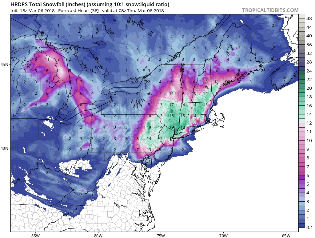
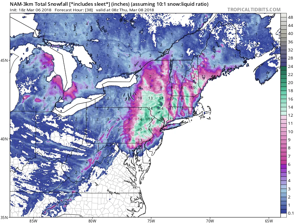
Image no longer available