1/4/2018 Storm Updated Forecast
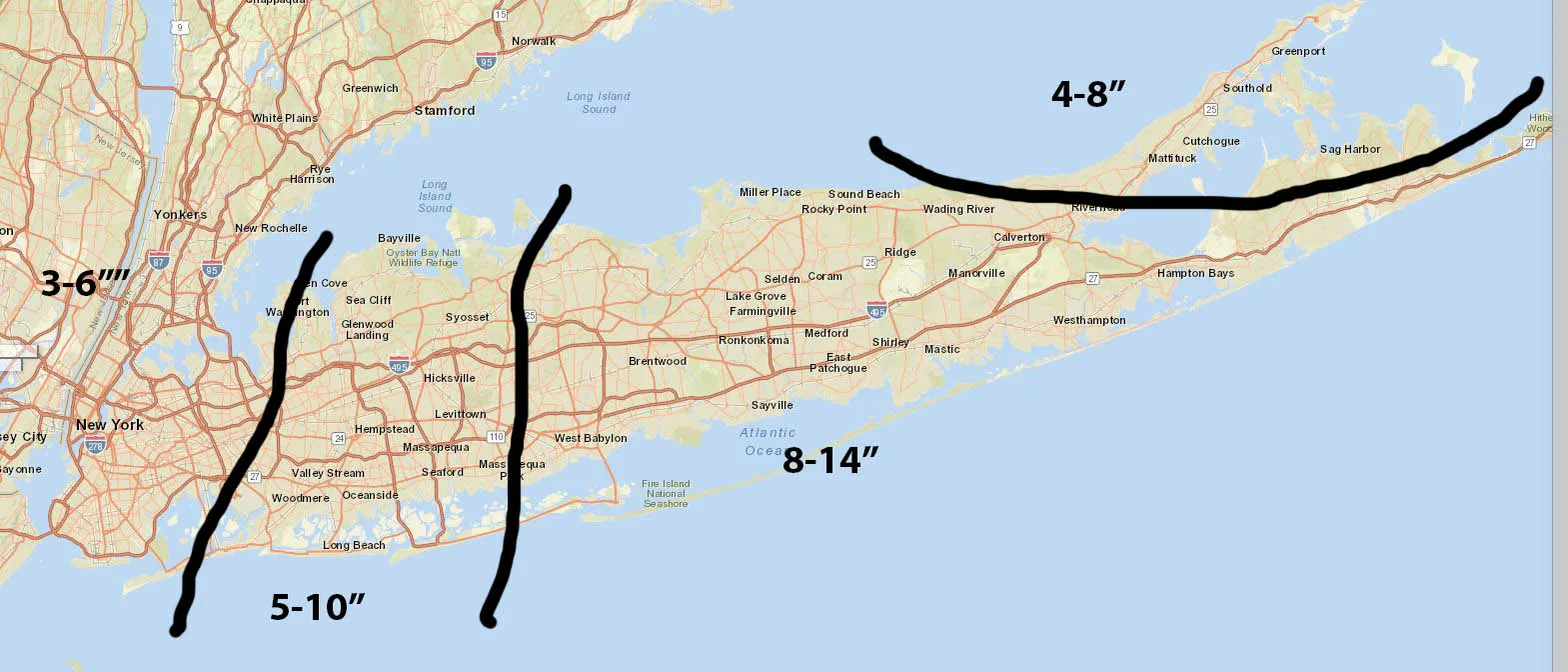
We’re finally starting to see something nearing consensus for tomorrow’s storm. Below find my second call for tomorrow’s storm, and I plan on posting one more later tonight once the 0Z models start rolling in. I do want to mention that for these totals it is possible that we will exceed the maximums, in Nassau and Suffolk depending on the track, and the city may end up below the minimum. (Yes I know typical weather person hedging their bets)
Snow is expected to begin between 2am and 5am Thursday morning. It will pick up in intensity during the morning, and continue until late afternoon. During the storm, snowfall rates may exceed 1-2″ per hour with winds gusting over 30 or 40mph, leading to blizzard conditions and drifting snow. While this storm will not feature the heaviest snowfall we have seen in the last few years, it will be very intense between the winds and the snowfall rates. Currently Suffolk County is under a Blizzard Warning and Nassau and the City are under Winter Storm Warnings. I expect the Blizzard Warnings to be extended to Nassau County if recent trends hold. More to come later.