1/4/2018 Storm Final Call
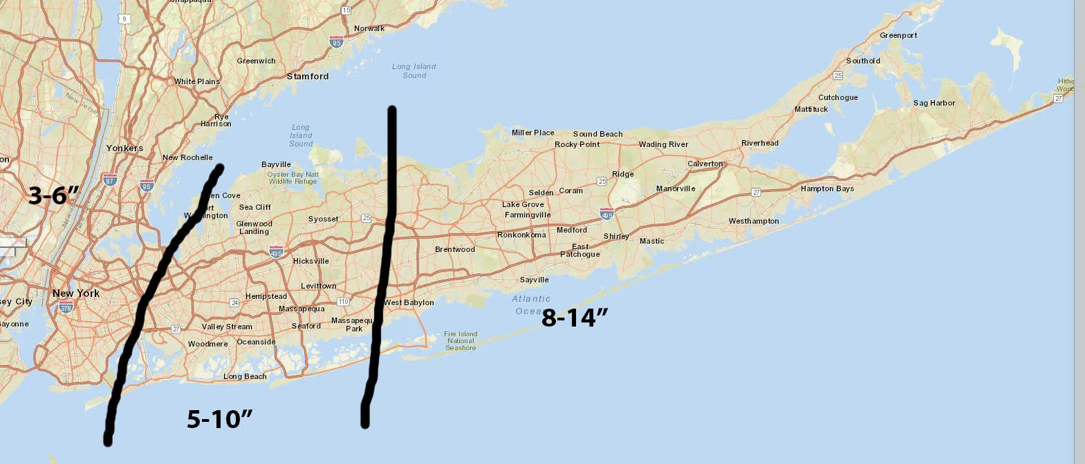
The snowstorm that will impact our region has formed and is already over performing in parts of the south. Based on current radar returns, the storm is staying close to the western edge of modeling. However, the models continue to shift back and forth by 25-50 miles, the latest NAM run shifted East a bit, while the RGEM shifted West.
What this means for all of us is that we’re all going to see moderate amounts of snow with some locations on Long Island potentially seeing over a foot. Snow will begin to overspread the area by about 4am, with the heaviest snow beginning around sunrise and continuing until the early afternoon. As I mentioned earlier, the snow may fall at 1-2″ inches per hour, with winds gusting over 30mph. It is likely many will see blizzard and whiteout conditions during the day tomorrow. The snow should end from West to East by mid-to-late afternoon tomorrow. I have outlined my final thoughts on total accumulations below. It is likely that we all will exceed the minimum forecast, and I would not be surprised if some exceed the maximum forecasted amounts.
After the storm exits the region, the coldest air of the season will come into our area, highs on Friday may not get get out of the low teens. The cold will remain through the weekend, but by early next week daytime highs should finally hit the 30’s
Final snowfall forecast:
Here are some radar and satellite shots of our developing storm:
Image no longer available
Image no longer available