Blog
-
Pi Day Storm Update- Blizzard Watch Issued- 3/11/2017
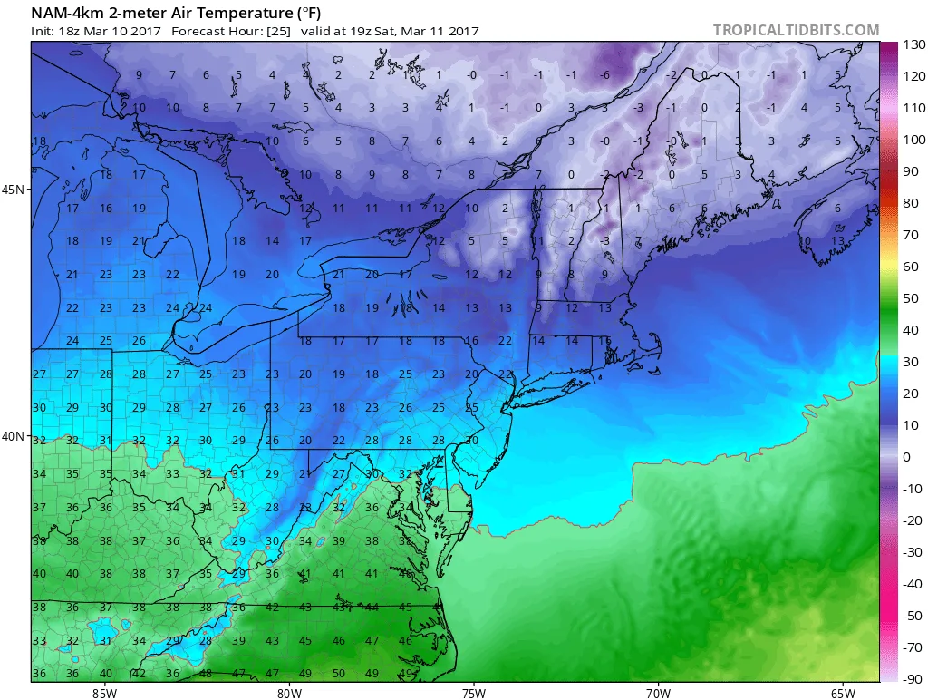
Breaking News: The National Weather Service has just issued a Blizzard Watch for our area! It continues to look like our region will be impacted by a significant winter storm starting early Tuesday. There is still SIGNIFICANT uncertainty in regards to the track of the storm. This afternoon’s Euro ru
-
Pi Day Storm Update
Today’s model runs continue the trend of a significant winter storm impacting our region on Tuesday and possibly Wednesday. The storm will begin forming in the deep South late Sunday and Monday and then make its way into our region. While I am not yet ready to get into specific…
-
The Return of Winter with a Vengeance
Tonight is the first in what is likely to be many updates on a possible snowstorm for next Tuesday. However, before I discuss that that storm further, let me briefly touch on the light snow for tomorrow. Snow will begin overnight before sunrise and continue through mid-day, tapering off by 1PM…
-
2/9/2017 Snowstorm
The snowstorm that we have been tracking is well underway throughout the area. Snow will continue to fall throughout the region until this afternoon. The storm will slowly begin to wind down from west to east throughout the afternoon. We continue to be on track for a 10-15″ snowfall throughout the…
-
2/9/2017 Storm- It’s Go Time
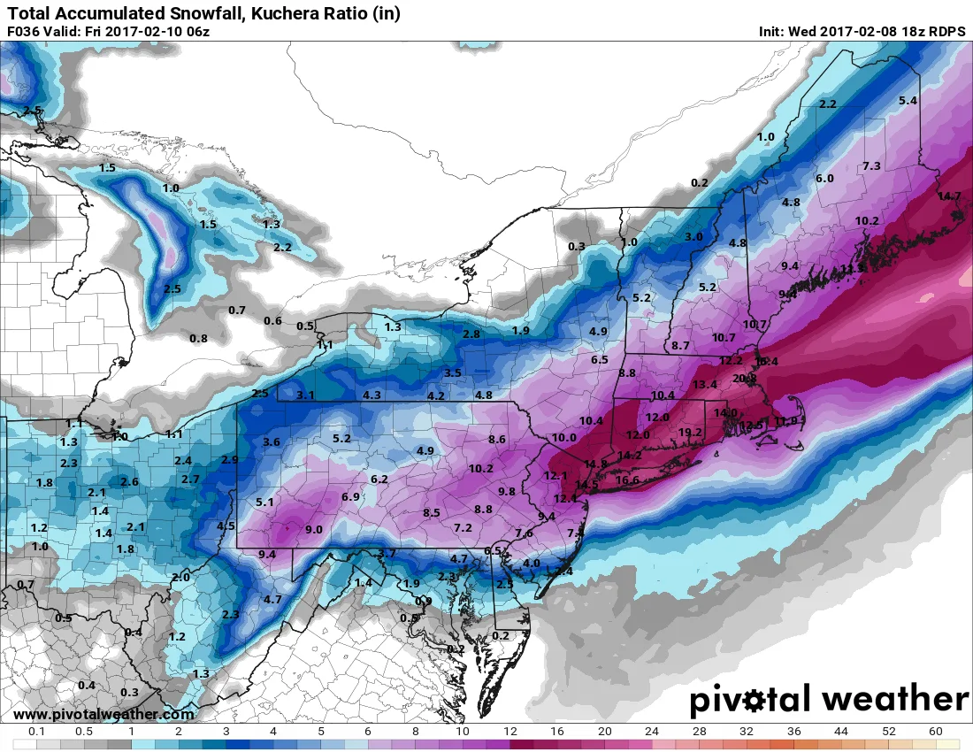
As of this afternoons model suite, we remain on track for a major snowstorm beginning tomorrow before sunrise. Snow will begin sometime after 2-3am and pick up in intensity by sunrise. Most areas can expect at least 10-15 inches of snow. However, there will be some areas that recieve over…
-
2-9-17 Storm – Lunch Update- ALERT ALERT
I’m afraid I’ve got some bad news (Thanks Berg), it looks like the storm is going to exceed my previous forecast. The models are continuing to increase snowfall totals throughout our region. The key to this is a stronger storm forming off the coast tomorrow morning. Based on latest guidance,…
-
2/9/17- Snowstorm Update
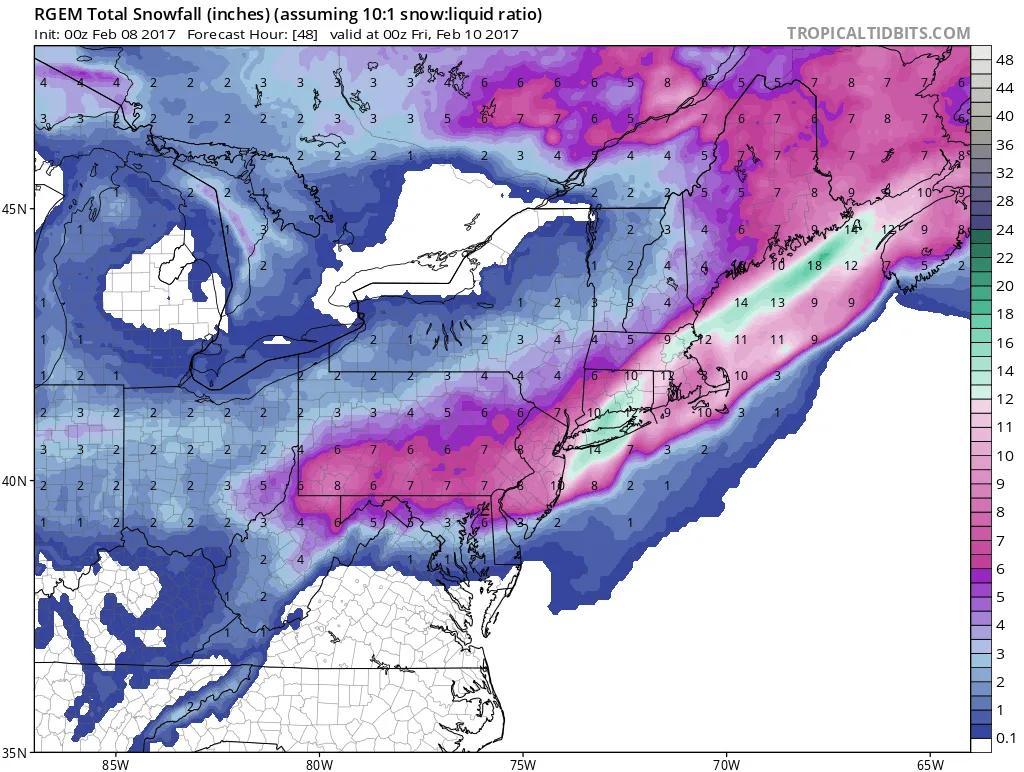
Models this evening continue to hold steady in regards to the expected snowfall. The NAM shows our area receiving anywhere from 8-12″ of snow, and the latest run of the RGEM shows some areas receiving over a foot of snow. For now I am holding steady with a forecast of…
-
2/9/2017 Snowstorm- It’s on Like Donkey Kong
For all those looking for a significant to major snowstorm for our area, it looks like you’re getting your wish. This mornings and early afternoons models are in and they ALL trended stronger. There is still plenty of room for the storm to trend stronger as well. Remember when I mentioned…
-
2/9/2017 Storm- It’s Coming!!
Quick morning update: All guidance trended stronger with the storm overnight. The storm still looks to start early Thursday morning and continue throughout the day. If current guidance holds we’ll be well inside the 5-6inch plus range. More detailed updates to come later today.
-
2/9/2017 Potential Snowstorm
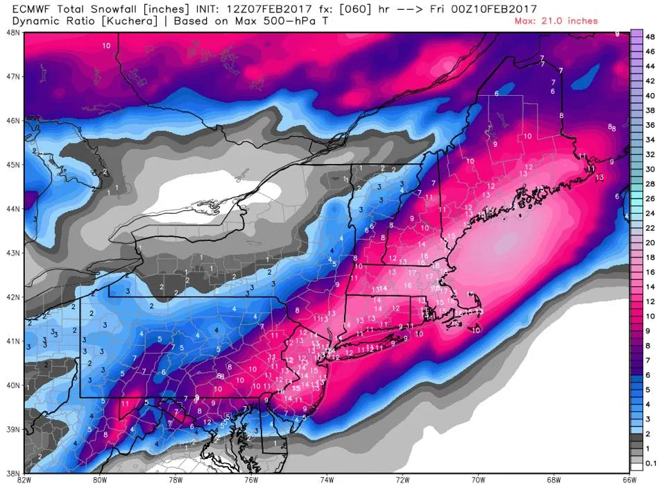
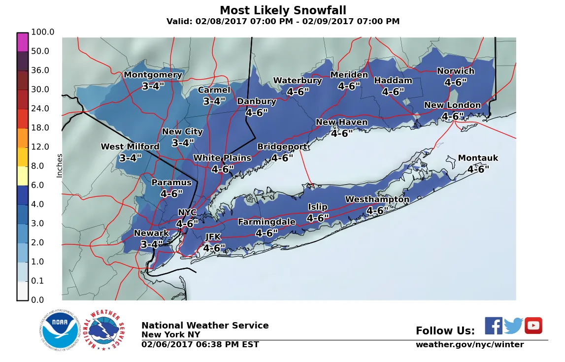
There is the potential for a significant snowstorm to impact the region on Thursday this week. There is still significant disagreement between models on exactly how much snow to expect. However, at this time the lowest amounts to expect are somewhere around 2-3″. The upper end could be 8-9″. At…