2/9/2017 Potential Snowstorm
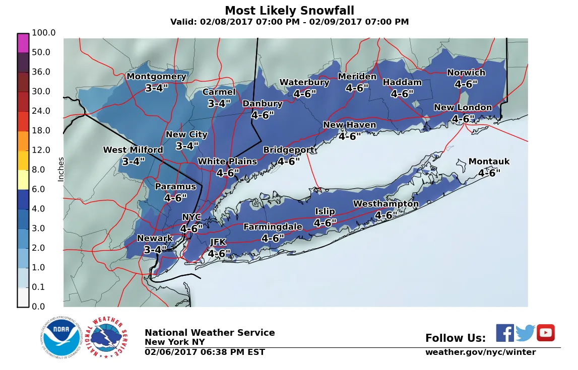
There is the potential for a significant snowstorm to impact the region on Thursday this week. There is still significant disagreement between models on exactly how much snow to expect. However, at this time the lowest amounts to expect are somewhere around 2-3″. The upper end could be 8-9″. At this time my very EARLY and preliminary guess is 3-6″ region wide. As of now models are showing precipitation overspreading the region early on Thursday morning, likely in the form of rain for much of the area. However, the rain will quickly change over to snow before sunrise and continue until the early afternoon (Yes teachers, this has the chance for a snow day).
Check back later tonight or tomorrow for further updates. This is one of those system where we will not know all the details until close to the start time, since the pieces of energy involved are diving down from Canada and coming in off the Pacific coast. Subtle changes to these pieces of energy could have a significant impact on the storm.
Below is the initial first guess from the NWS. Once we’re closer in, I’ll share snow maps as well.