Goldberg Weather Live Updated 4:43 PM

All posts

2/9/17- Snowstorm Update
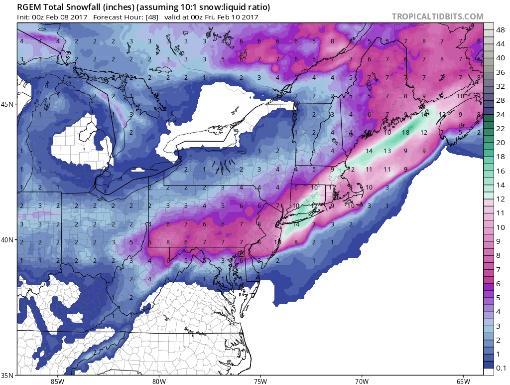
2 7 17 rgem

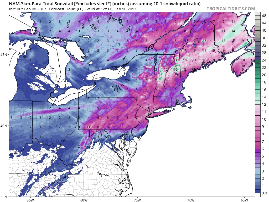
Models this evening continue to hold steady in regards to the expected snowfall. The NAM shows our area receiving anywhere from 8-12″ of snow, and the latest run of the RGEM shows some areas receiving over a foot of snow. For now I am holding steady with a forecast of 6-12″ throughout the area. I’ll post more localized specifics tomorrow once we’re closer to the start time. In terms of timing, the snow will begin before sunrise on Thursday, with the heaviest snow falling from 6am on. The snow should taper off from West to East by the mid-afternoon.

More updates to come.
Follow on WhatsApp

All posts

My blend My forecast number: a weighted average of eight weather models, with more weight on the ones that have done best at Farmingdale.

Agreement How close the models are to each other. Close together means more confidence; far apart means the forecast could still change.

Confidence How sure I am about a call, from one dot (could easily change) to three (confident).

Bias-corrected Each model's recent habit, like running 2° too warm, is measured against what Farmingdale recorded and taken out before blending. It starts after two weeks of scored days.

Chance of rain From about 80 versions of the American and European models, each run with small tweaks. 7 in 10 means 7 of every 10 versions bring at least 0.04 in that day.