2/9/2017 Storm- It’s Go Time
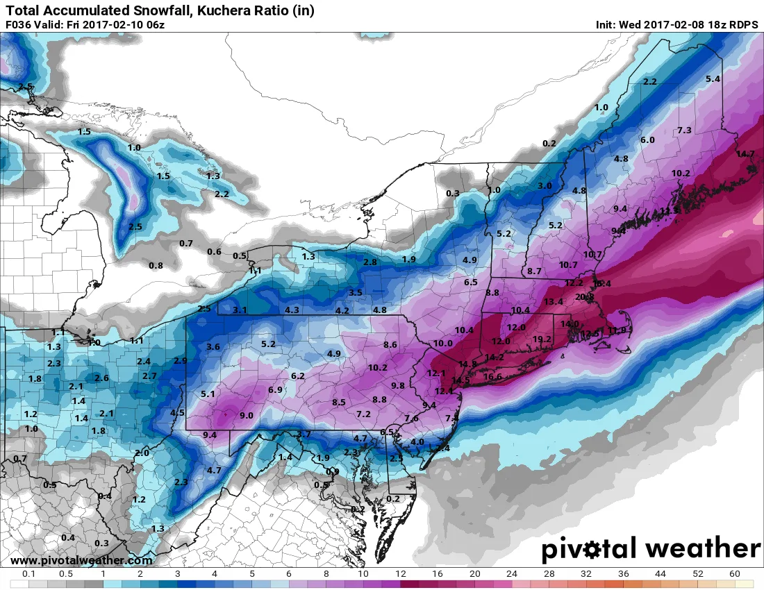
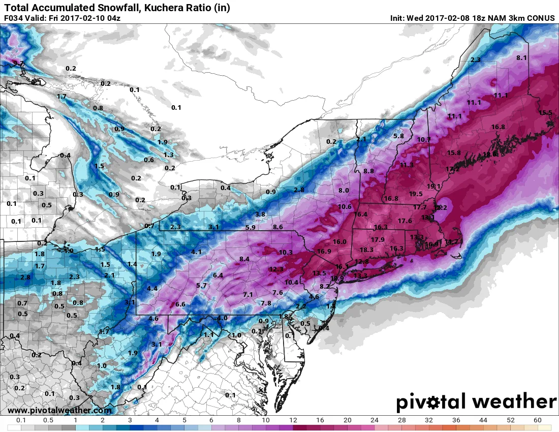
As of this afternoons model suite, we remain on track for a major snowstorm beginning tomorrow before sunrise. Snow will begin sometime after 2-3am and pick up in intensity by sunrise. Most areas can expect at least 10-15 inches of snow. However, there will be some areas that recieve over 18″ if they get into the heavier banding. The snow should begin to taper off by mid to late afternoon leaving behind very cold air. Temperatures on Friday may not get out of the teens.
I will update later tonight as the Hi-Res short range models continue to come into range. This is a storm that could easily outperform current forecasts due to the dynamics involved.
Edit: Special note per my family request: The city (Manhattan) can expect to see about a foot as well. The interesting piece to this event is this is likely to stick even on the avenues of Manhattan due to the rate at which the snow will be falling.
Below are the RGEM and NAM models, both of which have continued to increase snowfall totals over our area today.