Storm Update: Friday's Rain Trends Wetter for Long Island
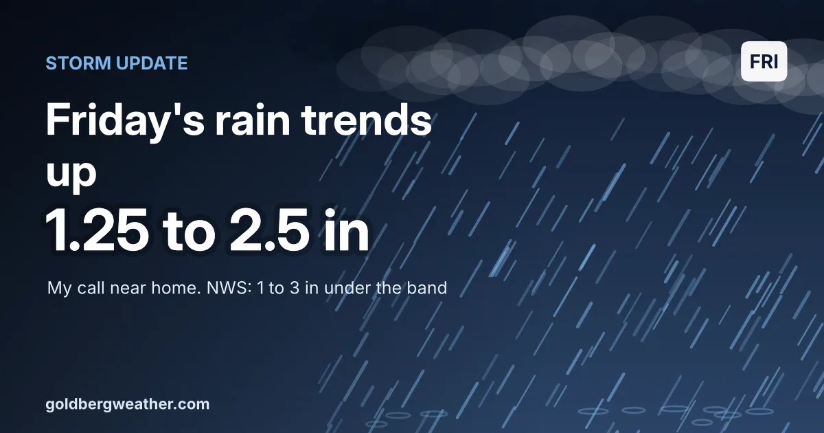
Following up on this morning's look at Friday's rain: the afternoon models nudged totals up, and four now put 2 inches or more on Farmingdale.
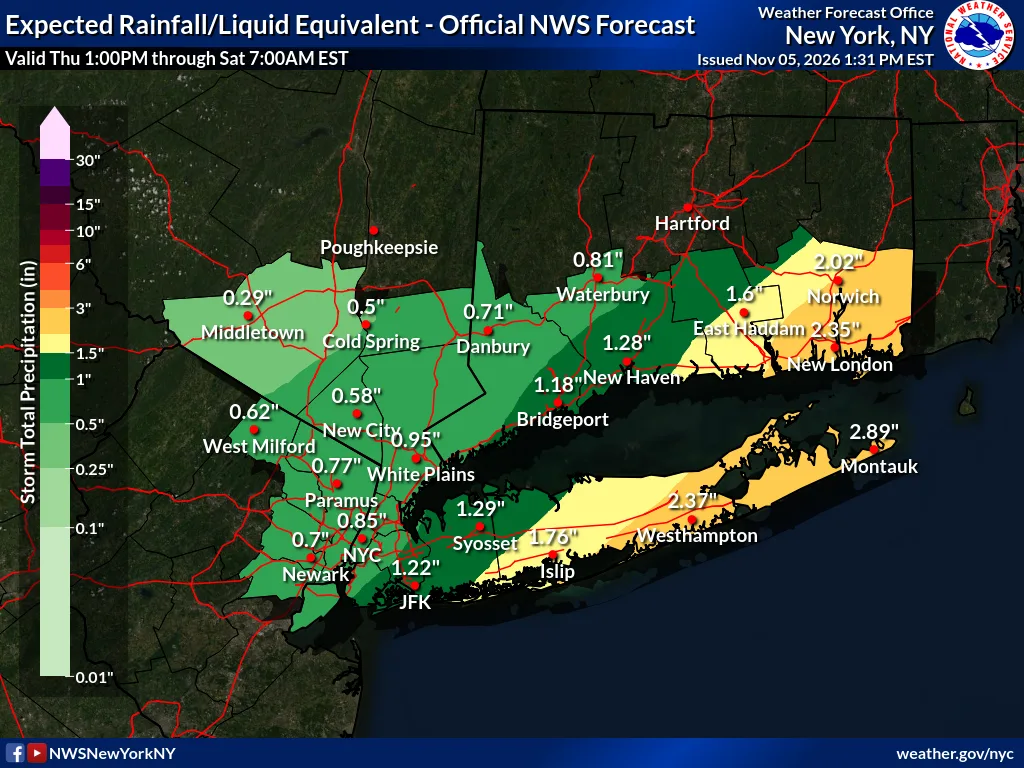
No watches or warnings for NYC, Long Island or Westchester as of 6 PM. Official word: NWS Upton.
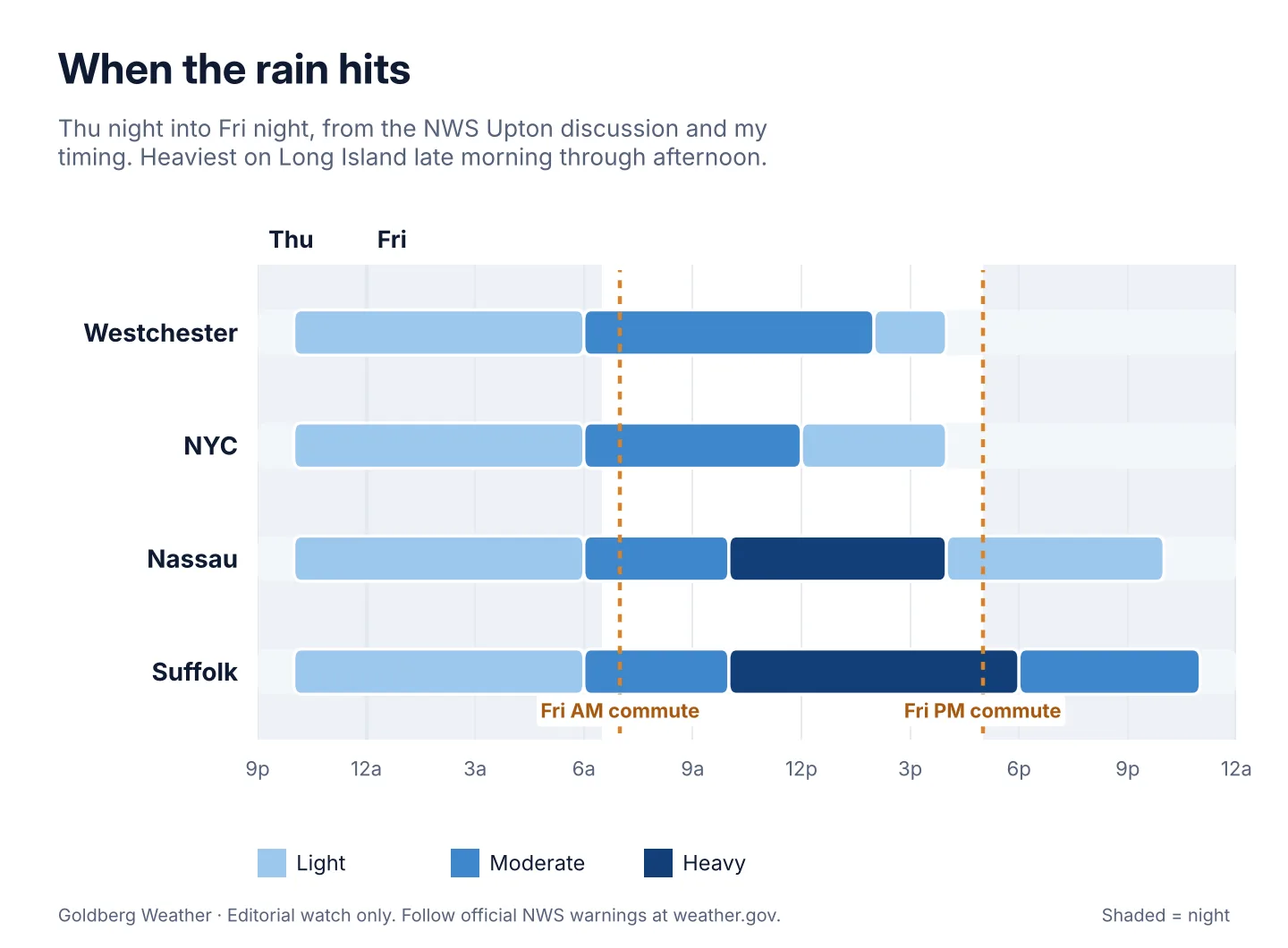
TLDR: Rain tonight, heaviest on Long Island late Friday morning through afternoon. I'm now at 1.25 to 2.5 inches near home, 2 to 4 on the East End, half an inch to 1.25 in the city. Ponding and a slow commute, not a major flood.
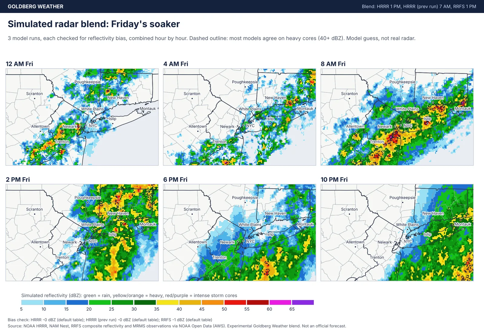
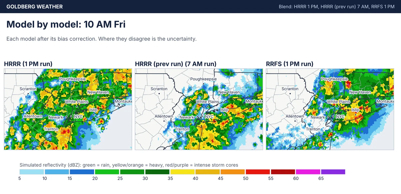
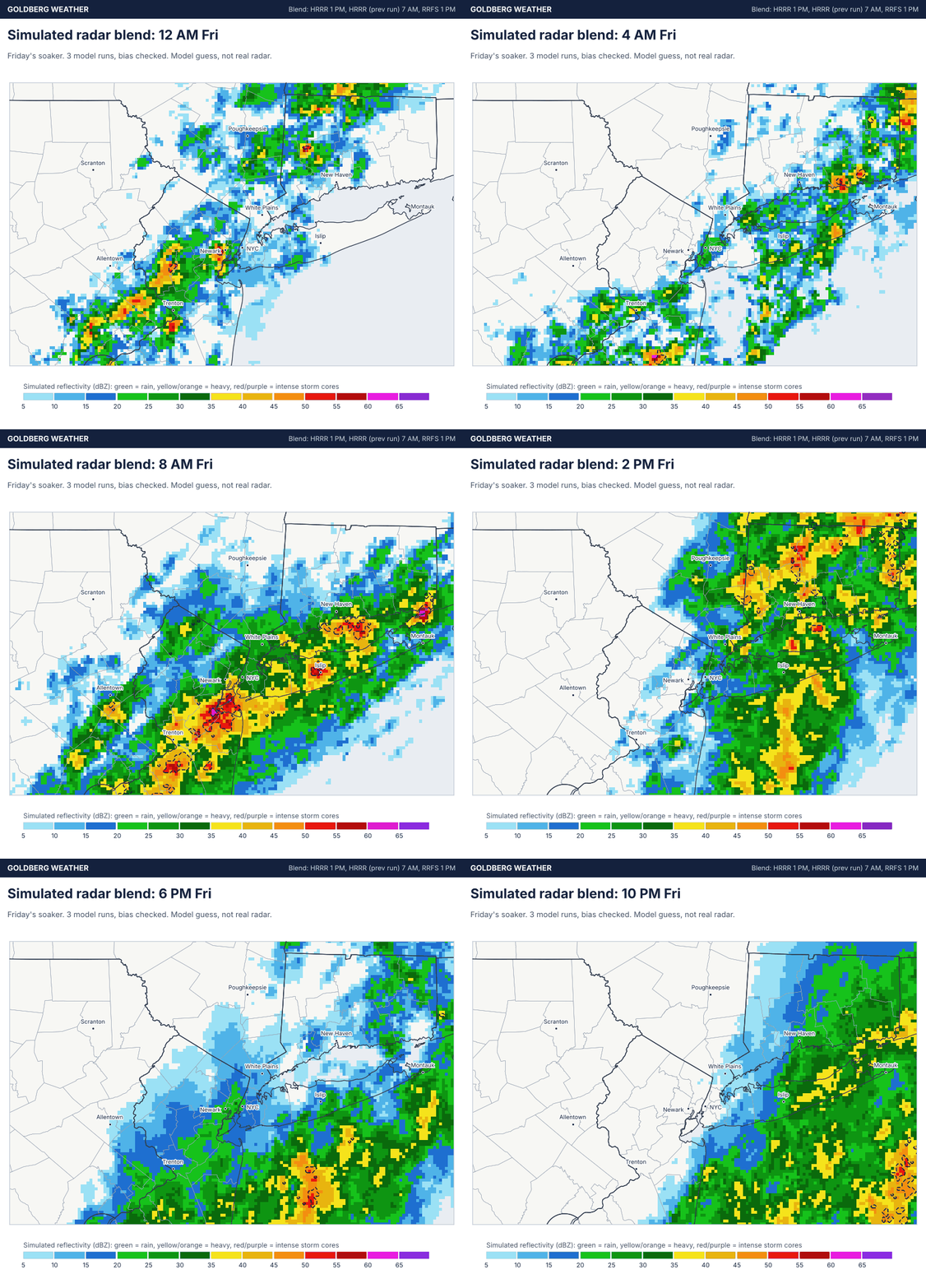 Loop
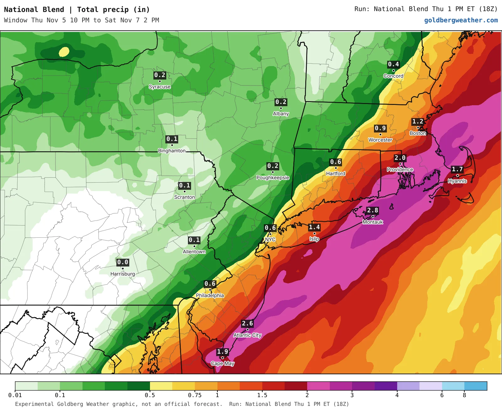
9 maps. Tap one to enlarge it and read its caption.
Credits: Goldberg Weather, NWS, WPC.
Showers develop tonight, then steady rain sets up Friday morning from the city east, with downpours near an inch an hour and maybe thunder out east. The city dries out by mid to late afternoon, everyone else by late evening. The leaves picked the perfect week to clog every drain on the Island.
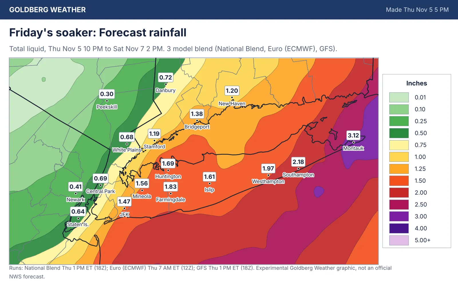
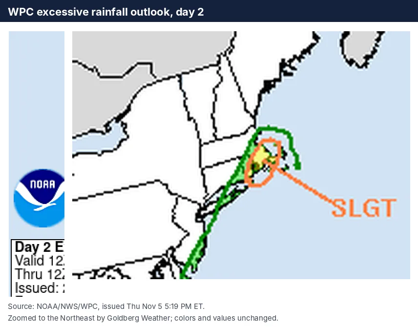
Upton has 0.85 inches for NYC, 1.76 in Islip and 2.89 in Montauk; our blend is close at 0.69 in Central Park, 1.83 in Farmingdale and 3.12 in Montauk. The Weather Prediction Center keeps Long Island in a Marginal flood risk.
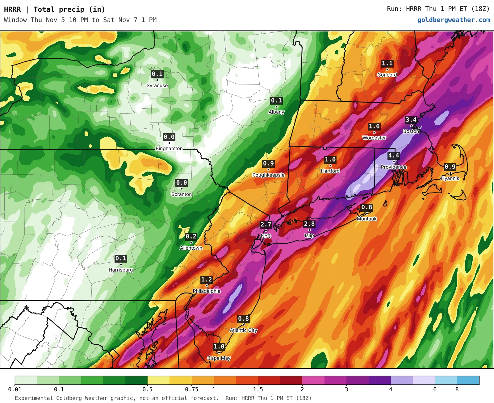
Farmingdale runs from 1.15 inches on the National Blend to 2.77 on the GFS, with the Euro, HRRR and RRFS bunched near the wet end. The wild card is the city: the HRRR dumps about 2.7 inches on Central Park while everything else has half an inch to an inch and a half. On simulated radar it spreads heavy rain farther west than the RRFS Friday morning. For now I'm filing that under the HRRR being the HRRR.
Clear your storm drain tonight and give yourself extra time Friday.
Bottom line: the best model agreement yet for a real soaker on Long Island, with the city on the edge.
Editorial watch only. Follow official NWS warnings at weather.gov.