Thursday-Friday Coastal Low: Earlier Start, Smaller Totals
Following up on Sunday's look at the coastal low for the end of the week. Today's runs trimmed the totals and pulled the first rain into Thursday afternoon.
No NWS watches, warnings or advisories are up for NYC, Long Island or Westchester as of 6 PM Monday. Official word: NWS Upton.
TLDR: Dry through Wednesday with highs near 59. Rain arrives Thursday afternoon and comes and goes into Friday, maybe into early Saturday. Most of us land near 0.4 inch, a bit more on the East End, with gusts 25 to 35 mph. A 1.5 inch, 45 to 50 mph worst case is still on the table, but fading.
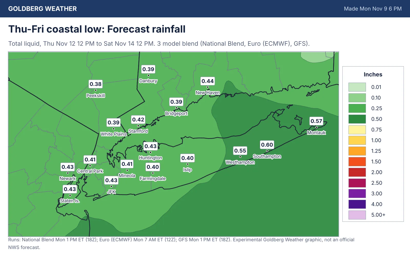
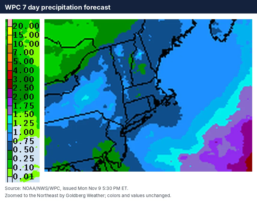
2 maps. Tap one to enlarge it and read its caption.
Credits: Goldberg Weather, WPC.
Upton's 3:27 PM discussion lays out two paths. A flatter wave brings light rain Thursday into Friday morning, then clears out. Or the low reorganizes just south of Long Island and the rain comes back Friday night into Saturday morning. Either way, Upton sees limited impacts and no wind advisory conditions for now.
Our blend has 0.41 inch in Central Park, 0.40 at Farmingdale, 0.39 in White Plains and 0.55 to 0.60 from Westhampton to Southampton. That is down from about 0.6 at Farmingdale in Sunday's blend, matching WPC's 7 day map of roughly half to three quarters of an inch.
The GFS is still the wet one: 1.24 inches at Montauk and 0.62 at Farmingdale, with its heaviest rain now on Thursday. The Euro is down to 0.38 at Farmingdale and 0.36 at Montauk. And the Canadian, which was bone dry yesterday, now spits out 3.4 inches. I am treating it like a fortune cookie: fun to read, not a plan.
Plan on a damp Thursday evening commute and keep Friday outdoor plans flexible.
Bottom line: this is trending toward an ordinary raw, wet stretch, not a storm.
Editorial watch only. Follow official NWS warnings at weather.gov.