Storm Update: The Euro Blinked on Friday's Rain
Following up on last night's update on Friday's soaker: the Euro pulled most of its rain out to sea overnight, and the models are barely on speaking terms.
No watches or warnings for NYC, Long Island or Westchester as of 6 AM Wednesday. Official word: NWS Upton.
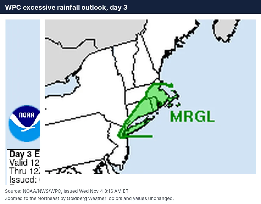
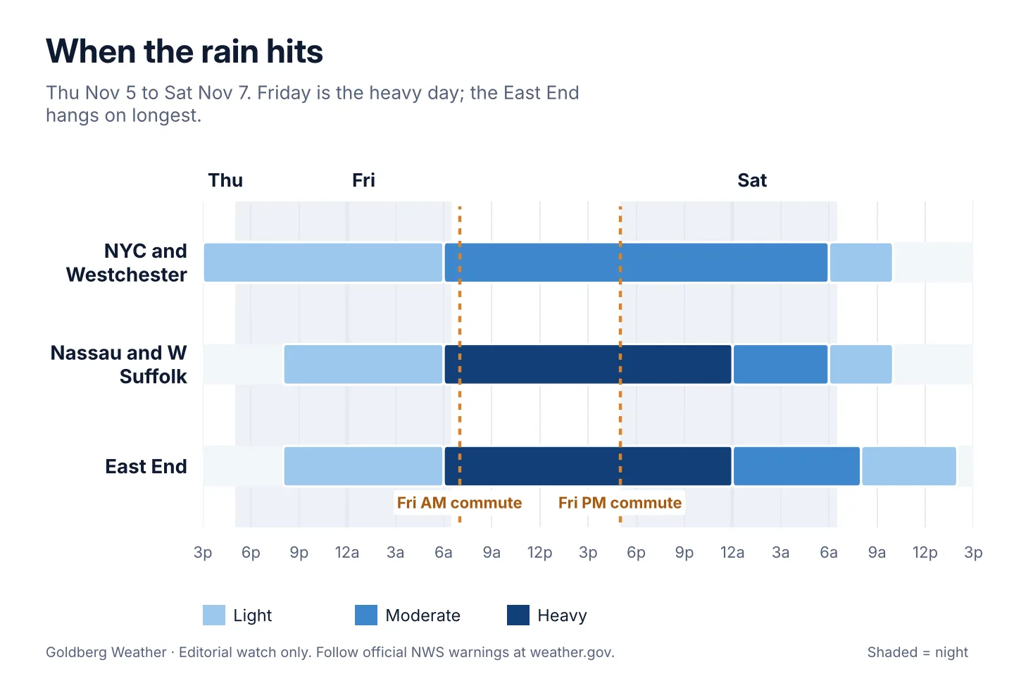
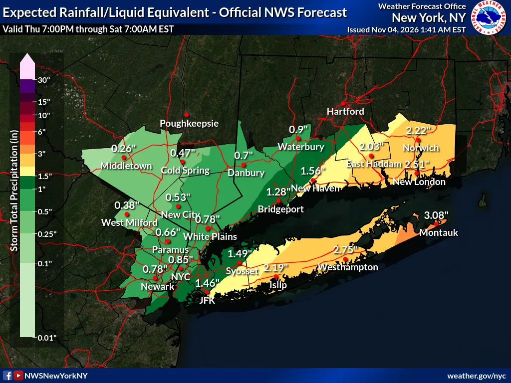
TLDR: Rain Thursday night to Saturday morning, heaviest Friday. Upton still has 2 to 3 inches on eastern Long Island. I'm trimming my lean to 0.75 to 1.5 inches for most of Long Island, worst case 3 to 4. Flood risk is low end (Marginal, 1 of 4).
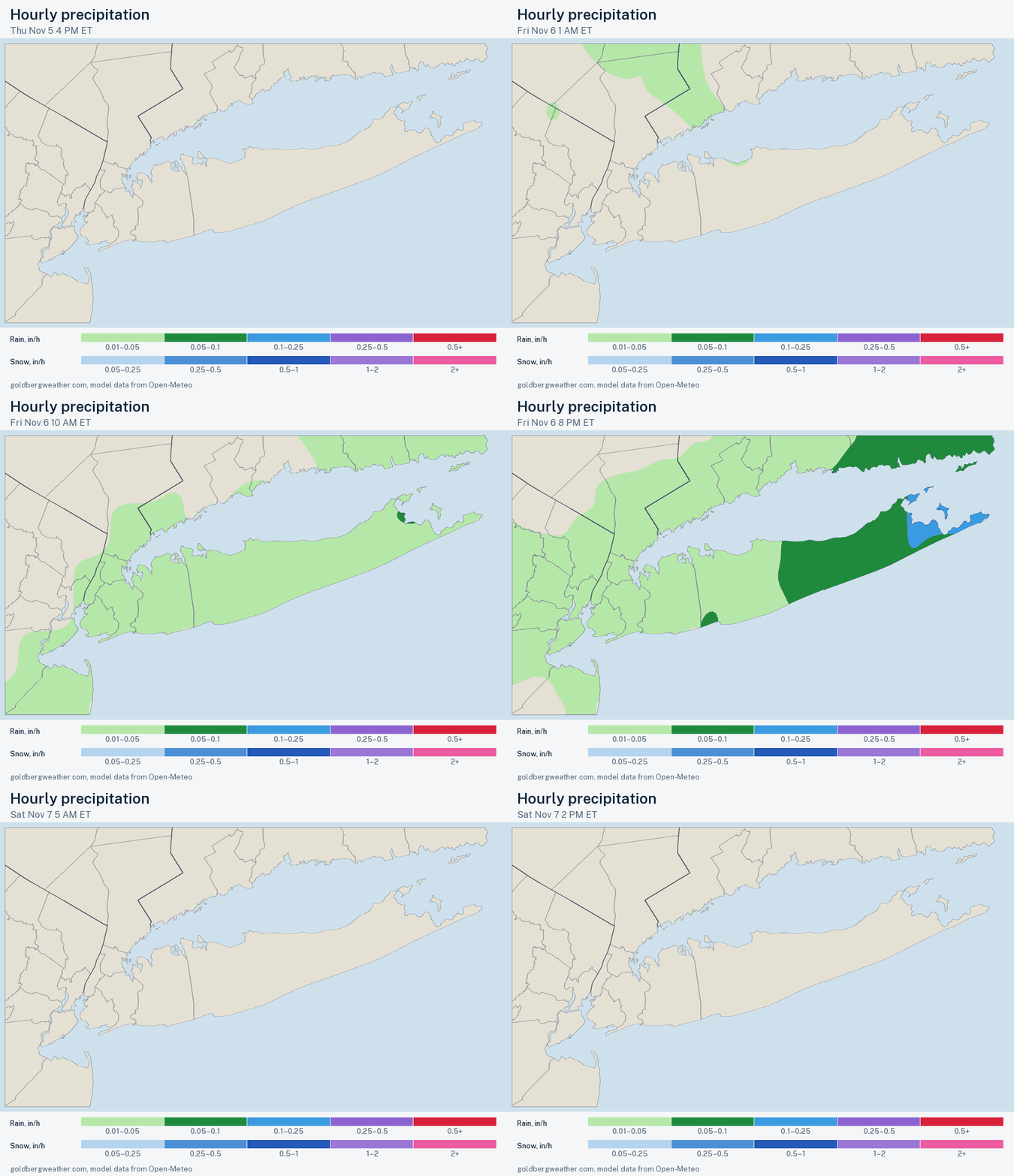 Loop
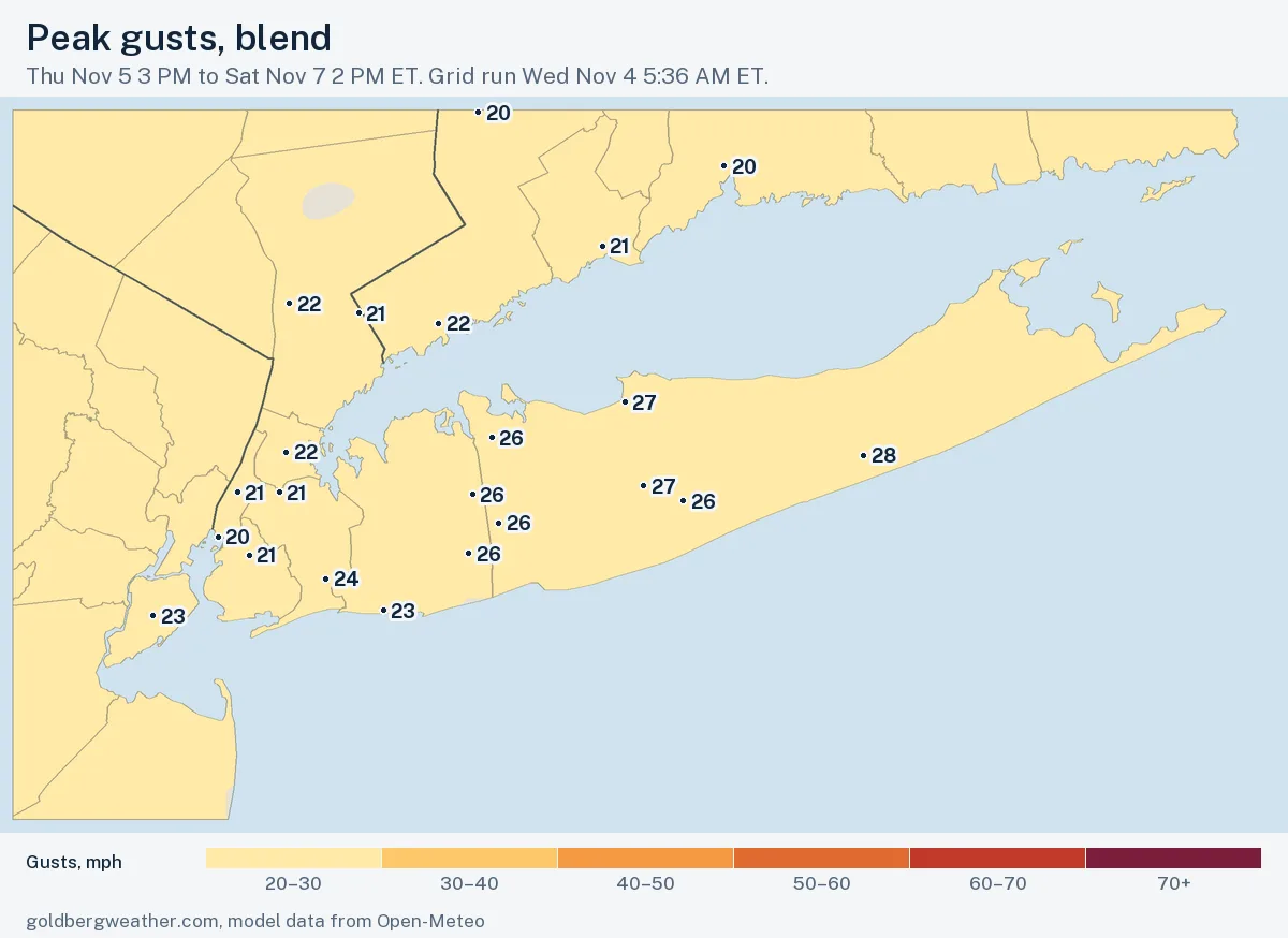
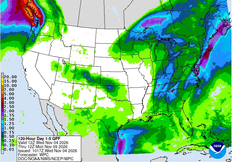
12 maps. Tap one to enlarge it and read its caption.
Credits: Goldberg Weather, NWS, WPC, NOAA GFS open data, ECMWF open data.
Showers reach Westchester and the city Thursday afternoon, steady rain fills in Thursday night, and Friday is the heavy day, both commutes included. The East End hangs on into Saturday morning.
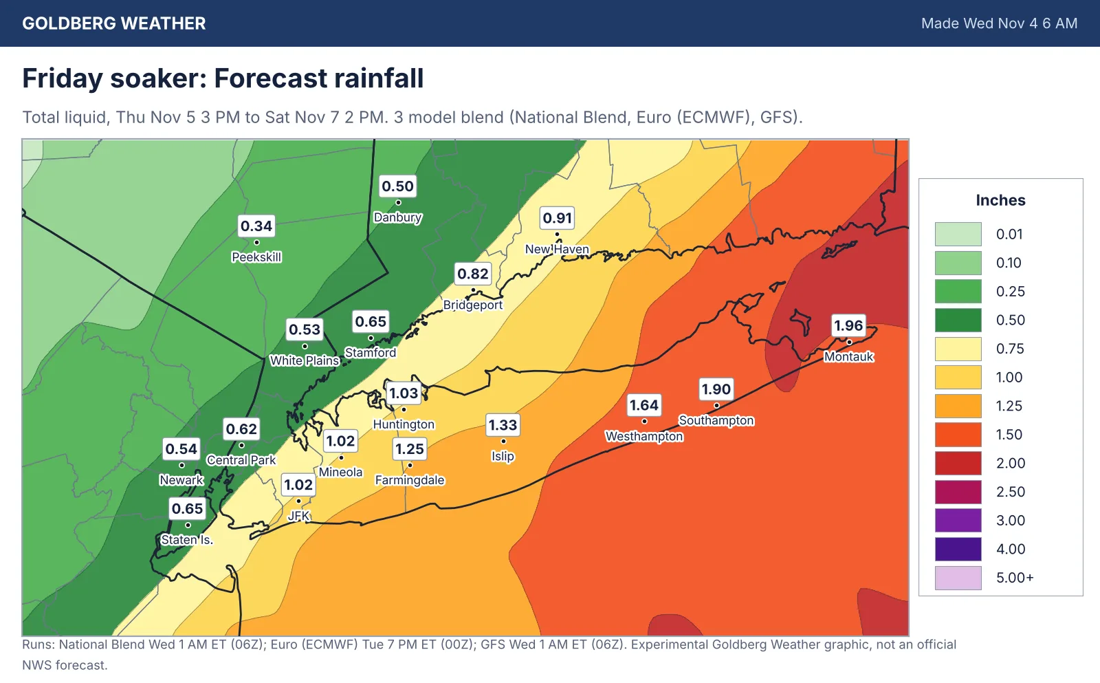
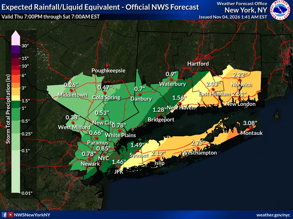
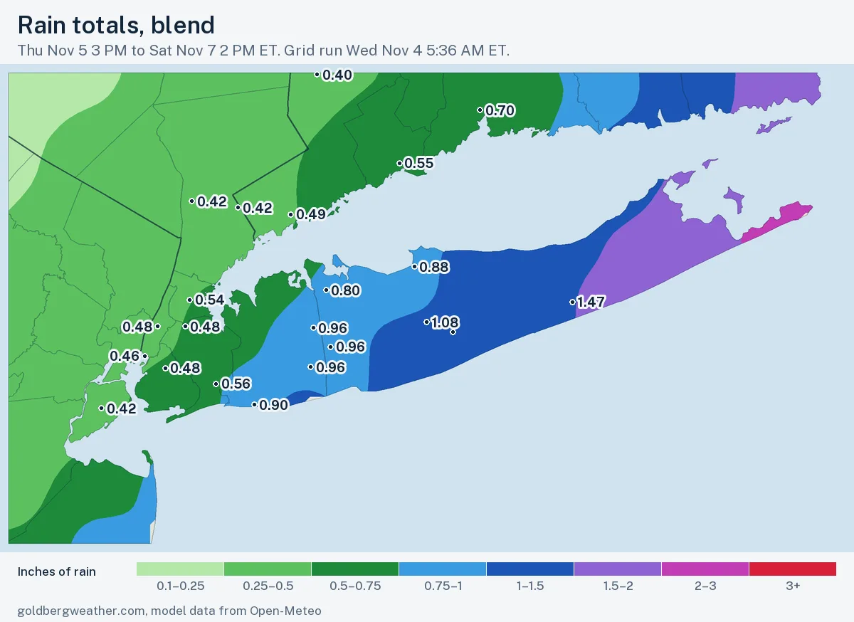
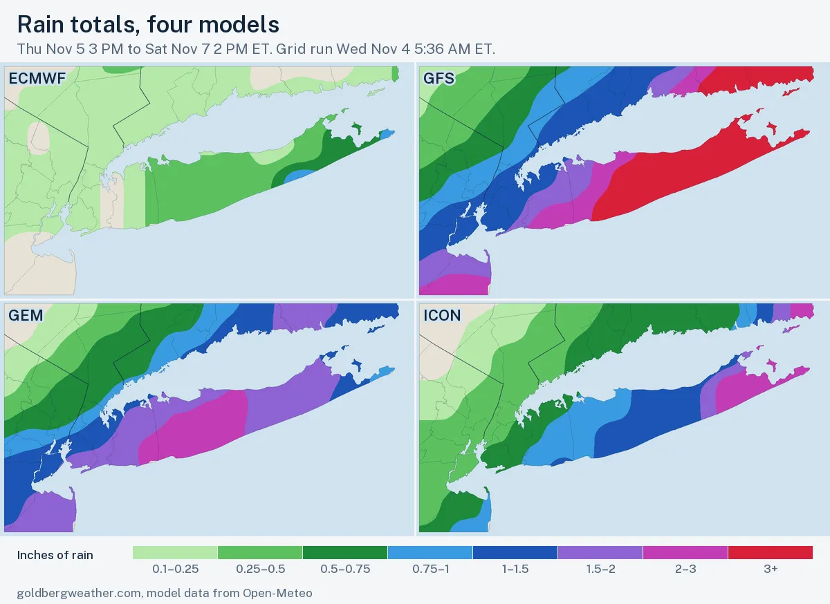
Our blend has 0.62 inches in Central Park, 1.25 in Farmingdale, 1.33 in Islip and about 2 at Montauk, roughly a third below Upton's map (2.19 at Islip, 3.08 at Montauk). Dry ground means ponding and clogged drains more than real flooding.
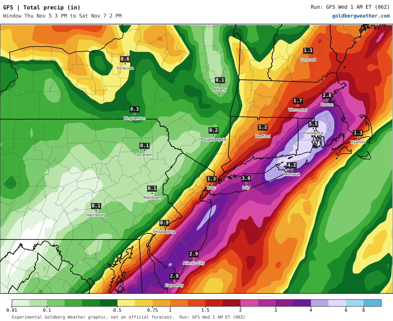
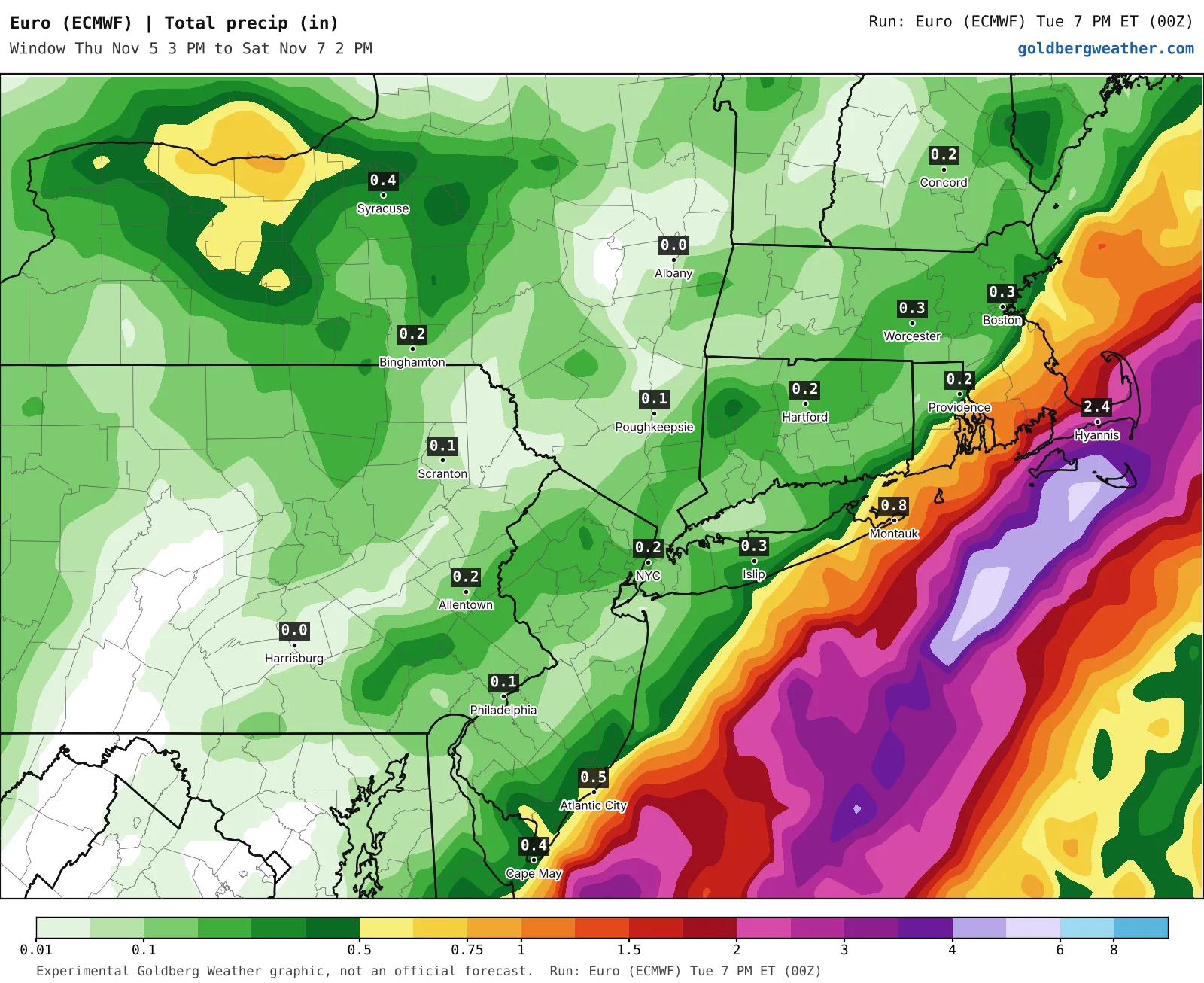
Now the fight. The GFS drops 3.0 inches on Islip and 4.2 at Montauk. The Euro has 0.3 at Islip and parks the heavy band offshore. A day ago the Euro was the wet one, so it's either onto something or having a rough night. I'd love to say I saw this coming. I did not. I suspect the GFS is overdoing it and the truth lands near an inch, where the National Blend sits. The midday runs will show whether the Euro's cut sticks.
Clear the leaves off your storm drain Thursday and leave extra time Friday, LIRR and Metro North included.
Bottom line: Friday is still wet, but this looks more like an inch than three, with the East End most likely to overperform.
Editorial watch only. Follow official NWS warnings at weather.gov.