Sunday Night Coastal Low: The GFS Is Back, and the Euro Joined In
Heads up, the Sunday soaker that vanished from the GFS yesterday came roaring back with the overnight runs.
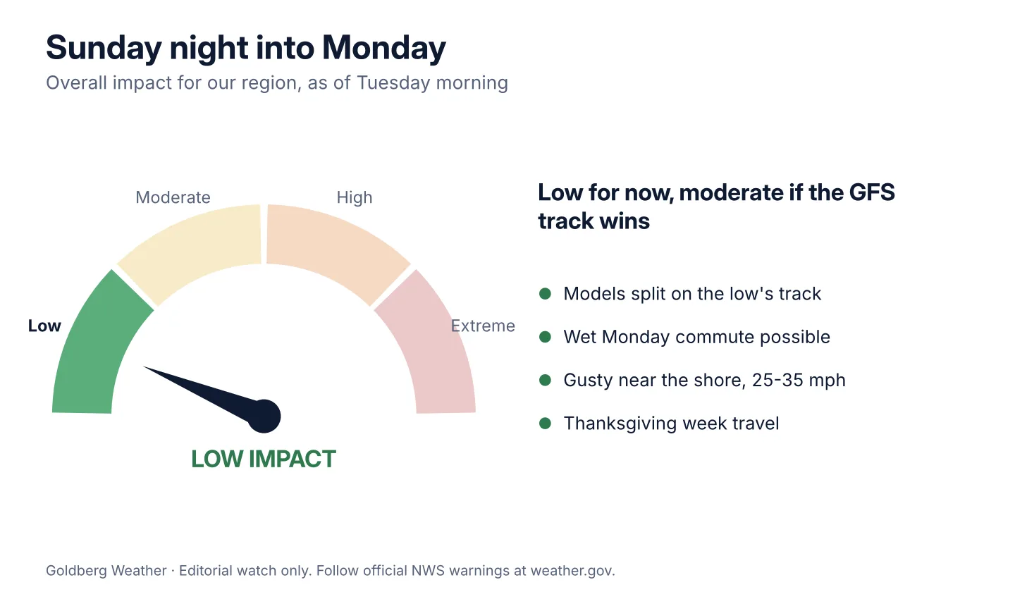
No watches, warnings or advisories are up for our region. Upton's overnight discussion says the trend is up for rain Sunday, but it's "not a lock." Official word lives at NWS Upton.
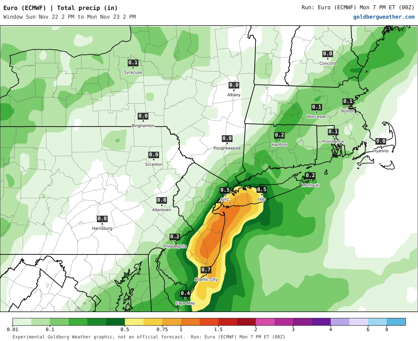
TLDR: A coastal low could bring a soaking rain and gusty wind Sunday afternoon into Monday morning, steadiest Sunday night. My range for home is 0.3-1.2", with a worst case of 2"+ if the low hugs the coast.
5 maps. Tap one to enlarge it and read its caption.
Credits: Goldberg Weather, WPC.
Nothing happens before then. The week stays dry and mild. If the low comes up the coast, rain arrives Sunday afternoon, peaks Sunday night and winds down Monday morning, which puts the Monday commute in play. Gusts look like 25-35 mph for most of us, stronger out east in the wetter runs.
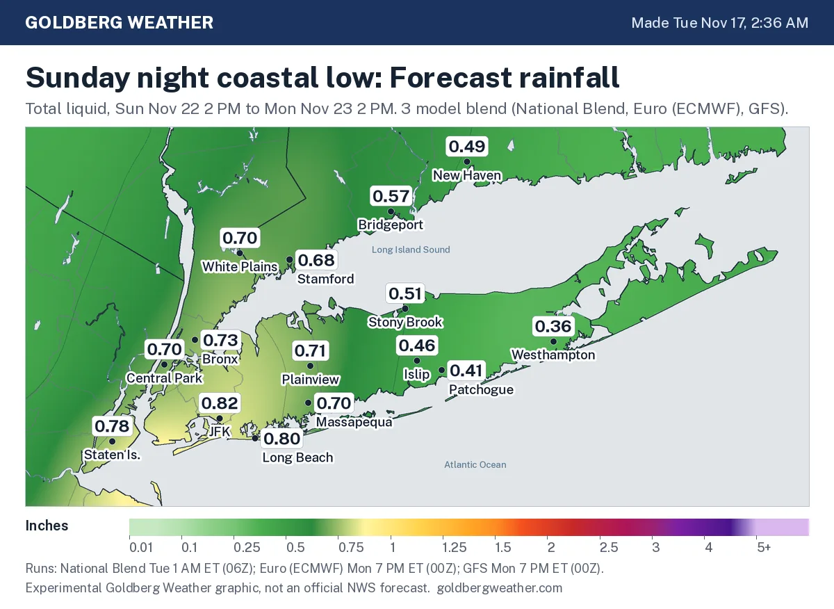
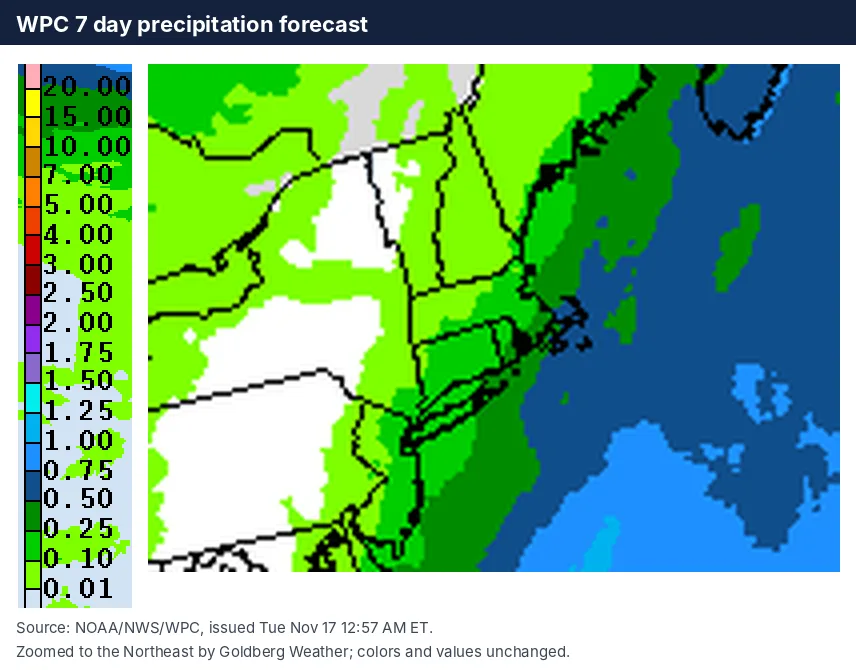
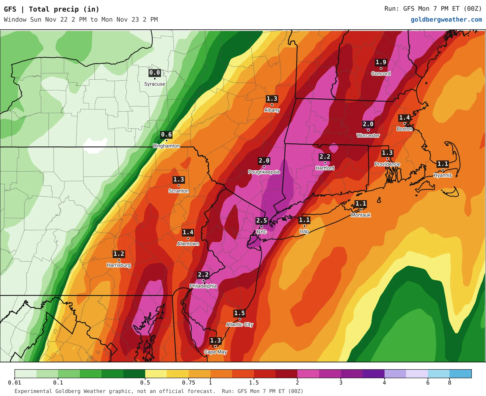
GFS / Canadian are the aggressive pair, both flipping from dry to about 2" overnight with gusts in the mid 40s at Montauk. The GFS has bounced between offshore and up the coast all week, so I'm not marrying it. The bigger news is the Euro, bone dry yesterday and now painting a narrow band of up to an inch along the south shore of western LI. The National Blend is still shrugging at a tenth. Mix them together and our blend lands around 0.7" for the city and western LI, less on the east end.
I'm leaning toward a modest rain event, not a washout. The low has to thread the needle between two jet streams, and models are bad at that six days out. If the Euro keeps trending wetter and the ensembles follow, I'll bump this up. If the GFS slides offshore again, it's back to leaf raking.
With Thanksgiving week travel starting, keep Sunday night plans flexible.
Bottom line: the signal is real now, the details are not. Stay tuned.
Editorial watch only. Follow official NWS warnings at weather.gov.