Sunday Night Storm: Everyone Has Rain, Nobody Agrees on the Track
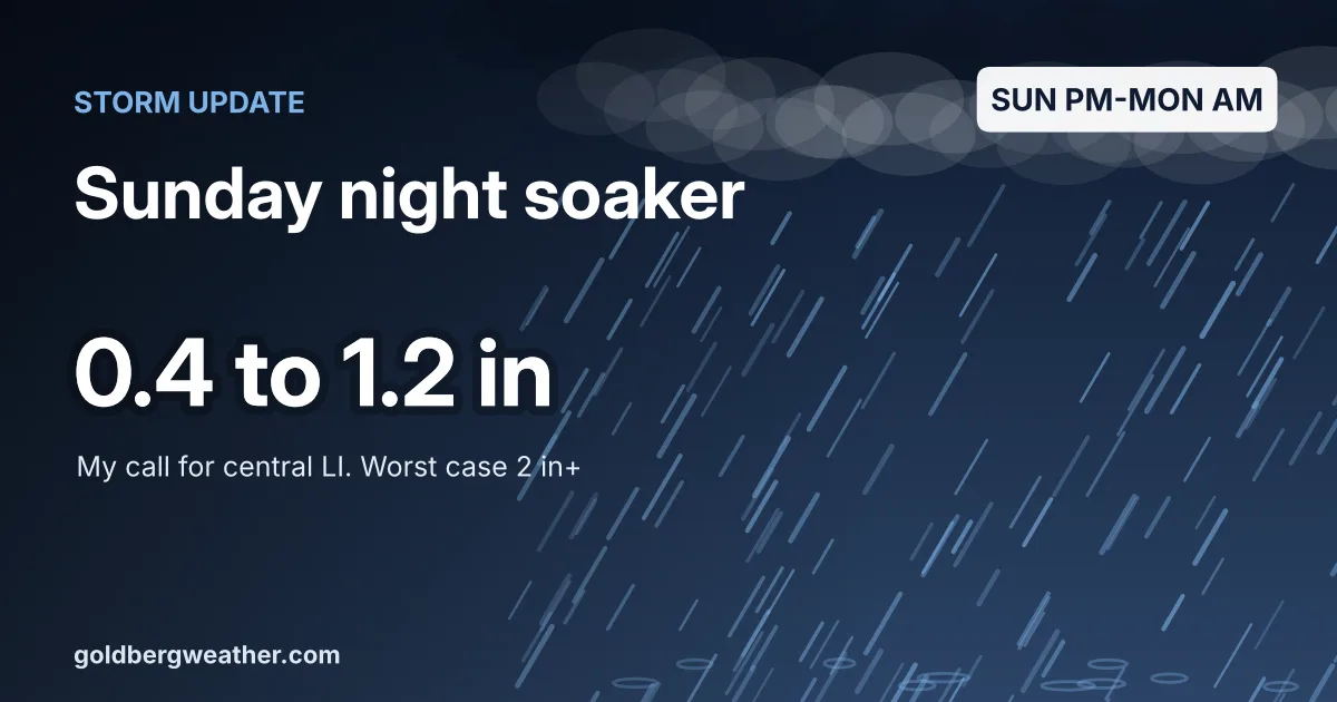
Following up on Tuesday's post about the Sunday night coastal low: the Euro was the last holdout, and it caved.
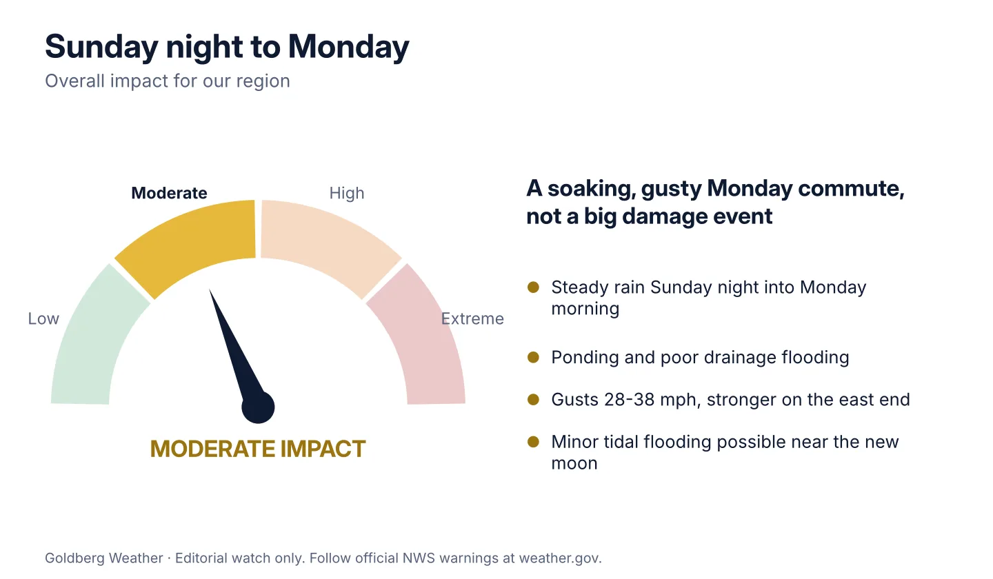
TLDR: A windswept soaking moves in Sunday afternoon or evening, is steadiest Sunday night, and wraps up by Monday midday. My call for central LI is 0.4-1.2" with gusts 28-38 mph, and 2" or more is on the table if the low tracks right over us.
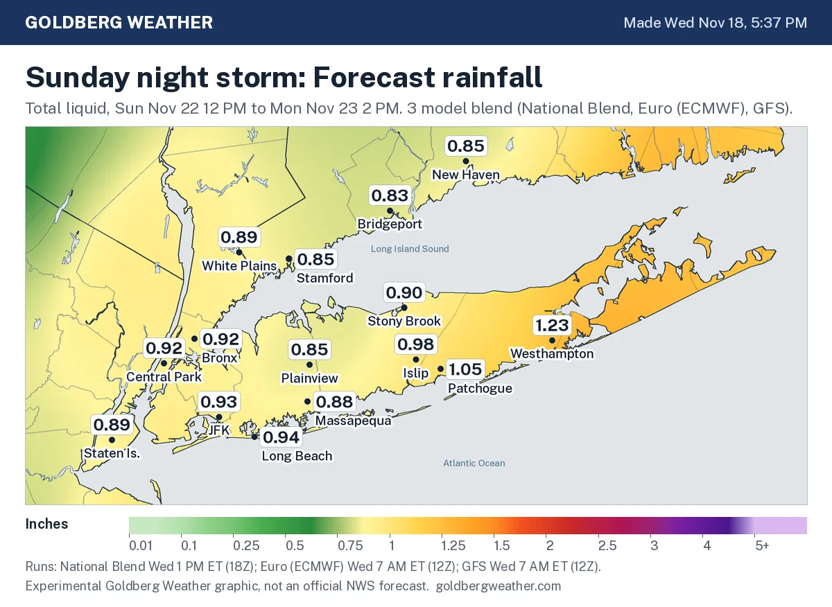
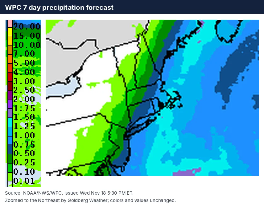
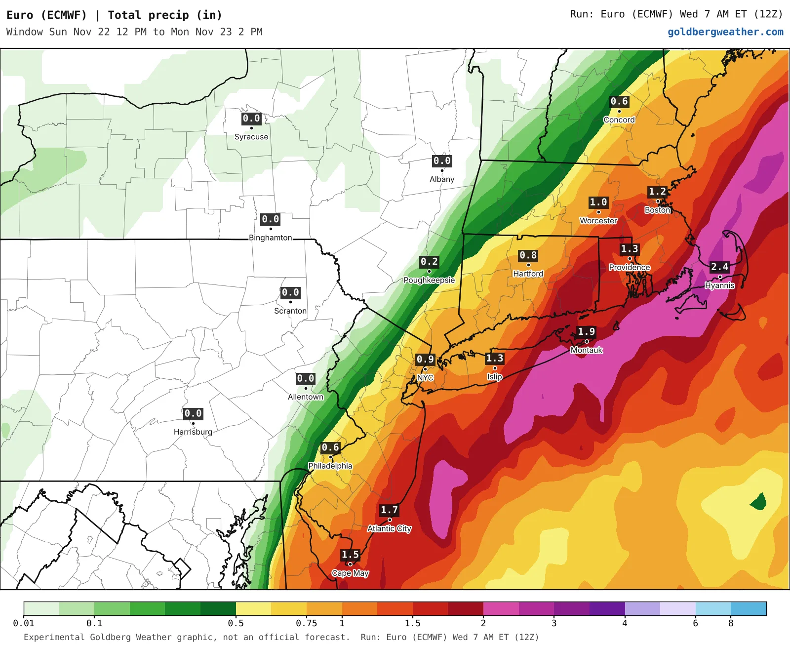
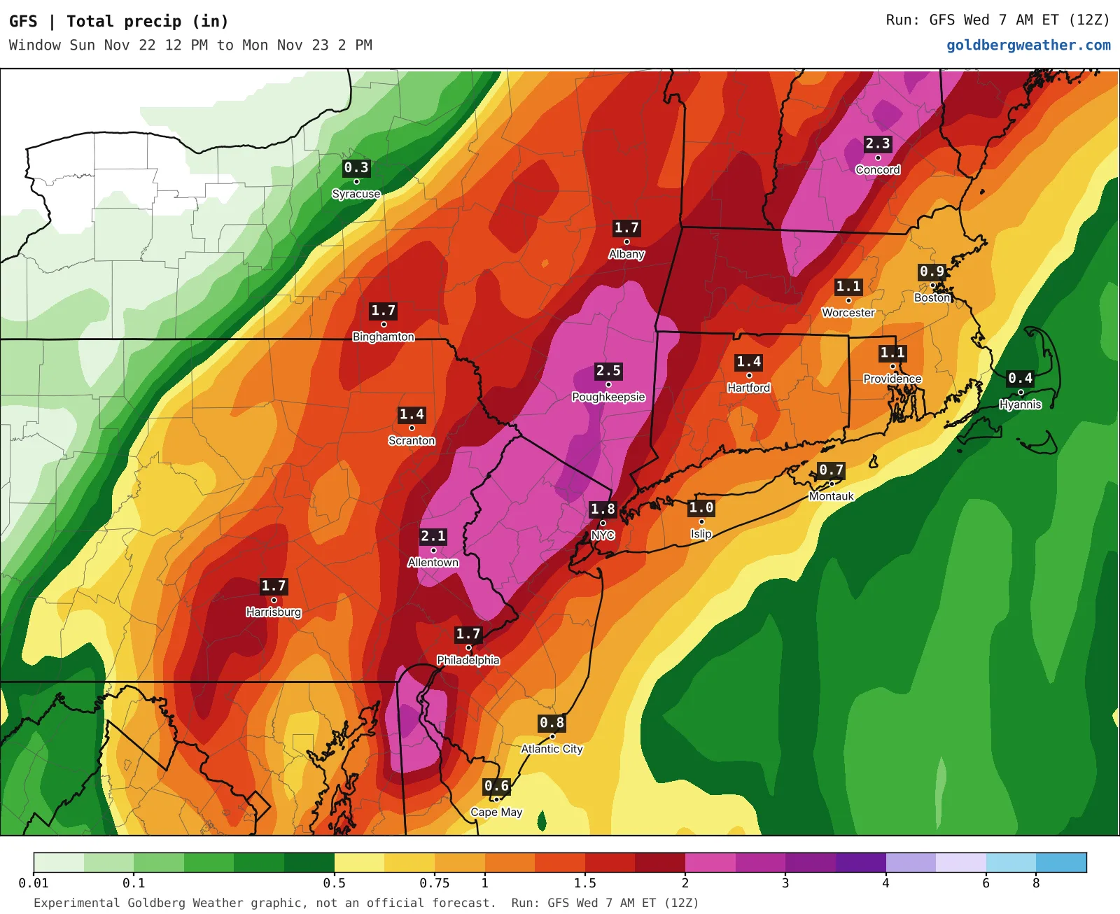
5 maps. Tap one to enlarge it and read its caption.
Credits: Goldberg Weather, WPC.
Saturday stays dry and mild, so bag the leaves while they're still crunchy and not papier-mâché.
The National Weather Service in Upton now mentions a windswept soaking Sunday afternoon into Monday morning, with a low and localized flash flood risk and some minor coastal flooding possible near the new moon. No watches or warnings are out.
Every model has rain now; the fight is over where the heavy band lands. The Euro keeps the low farther east and pins the heaviest rain on the east end, close to 2" around Westhampton and under an inch in the city. The GFS brings the low in closer and flips that around, nearly 2" in the city and north and west, under an inch out east. The Euro and GFS rainfall maps show the whole argument. The AI models are the wettest of the bunch and the National Blend is the stingiest, which is what happens when you average a track split.
Our blend of the National Blend, Euro and GFS lands near an inch almost everywhere, a bit more on the south fork. That's the top half of my range. Four days out, the track still runs from over us to well southeast, and the Euro just moved more than an inch in a single run. If the Euro and GFS hold through tomorrow, I'll push toward an inch or more. If both trim back, so will I.
It's Thanksgiving week, so if you're flying or riding the LIRR or Metro-North Monday morning, build in extra time.
Bottom line: the rain is coming, the track decides whether it's a nuisance or a real soaker.
Editorial watch only. Follow official NWS warnings at weather.gov.