Thursday Storm Update: Thunder Odds Slip, the Rain Does Not
Following up on Monday's post about the end of week coastal low: Thursday's thunder idea took a step back this afternoon. The rain did not.
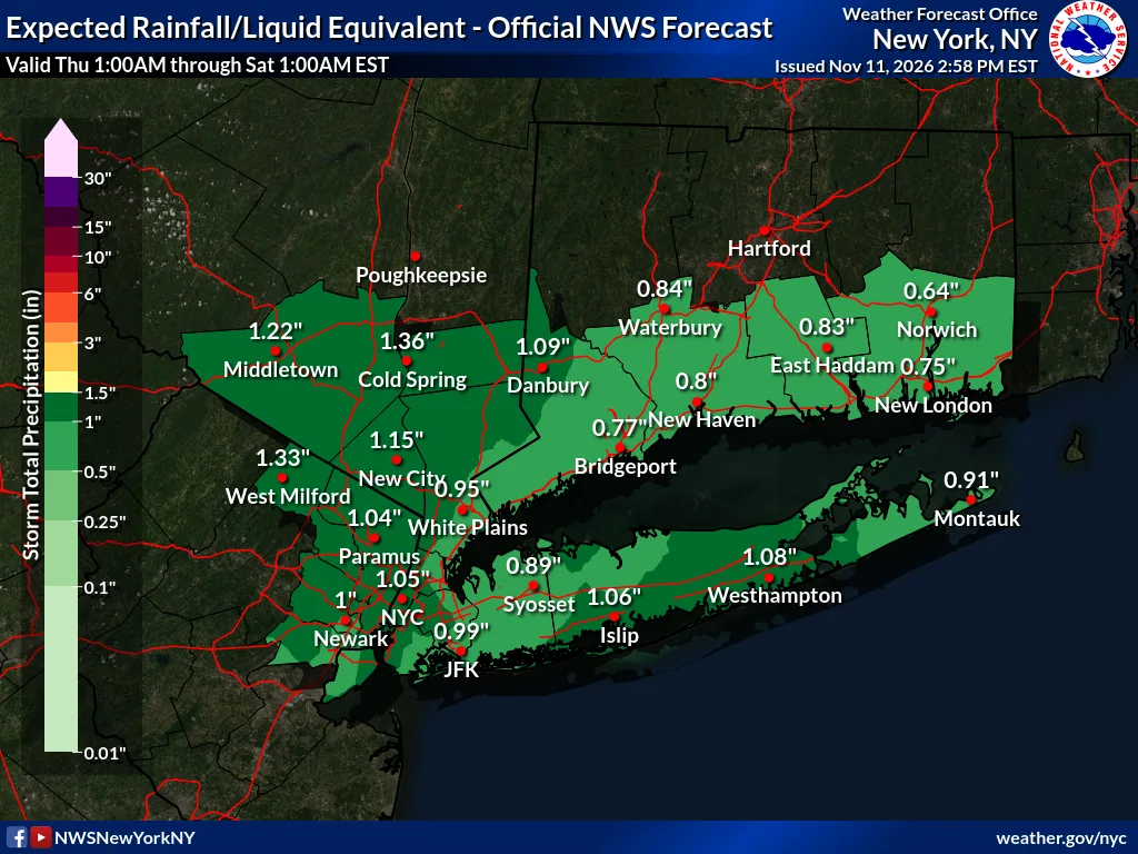
No NWS watches or warnings for NYC, Long Island or Westchester as of 3 PM. Upton does have a Coastal Flood Statement for southern Nassau (1:31 PM): up to half a foot of water at vulnerable shoreline spots around Thursday morning's high tide. Details at NWS Upton.
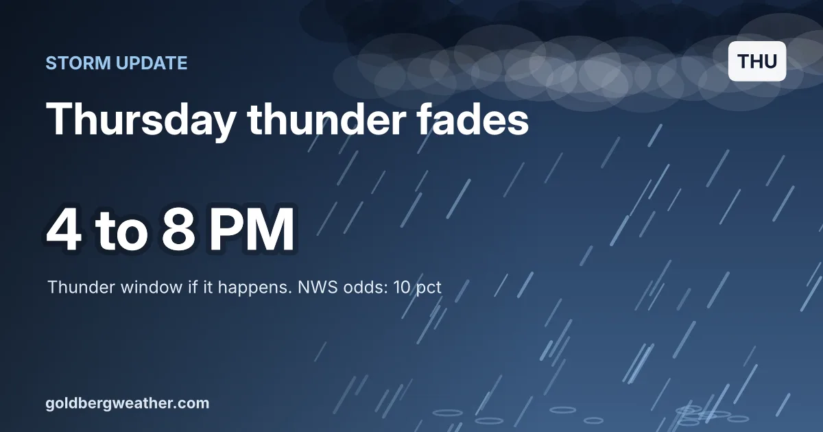
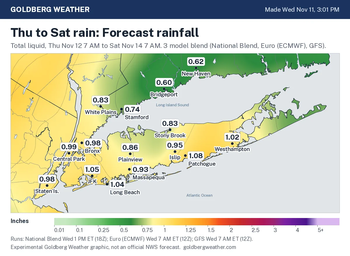
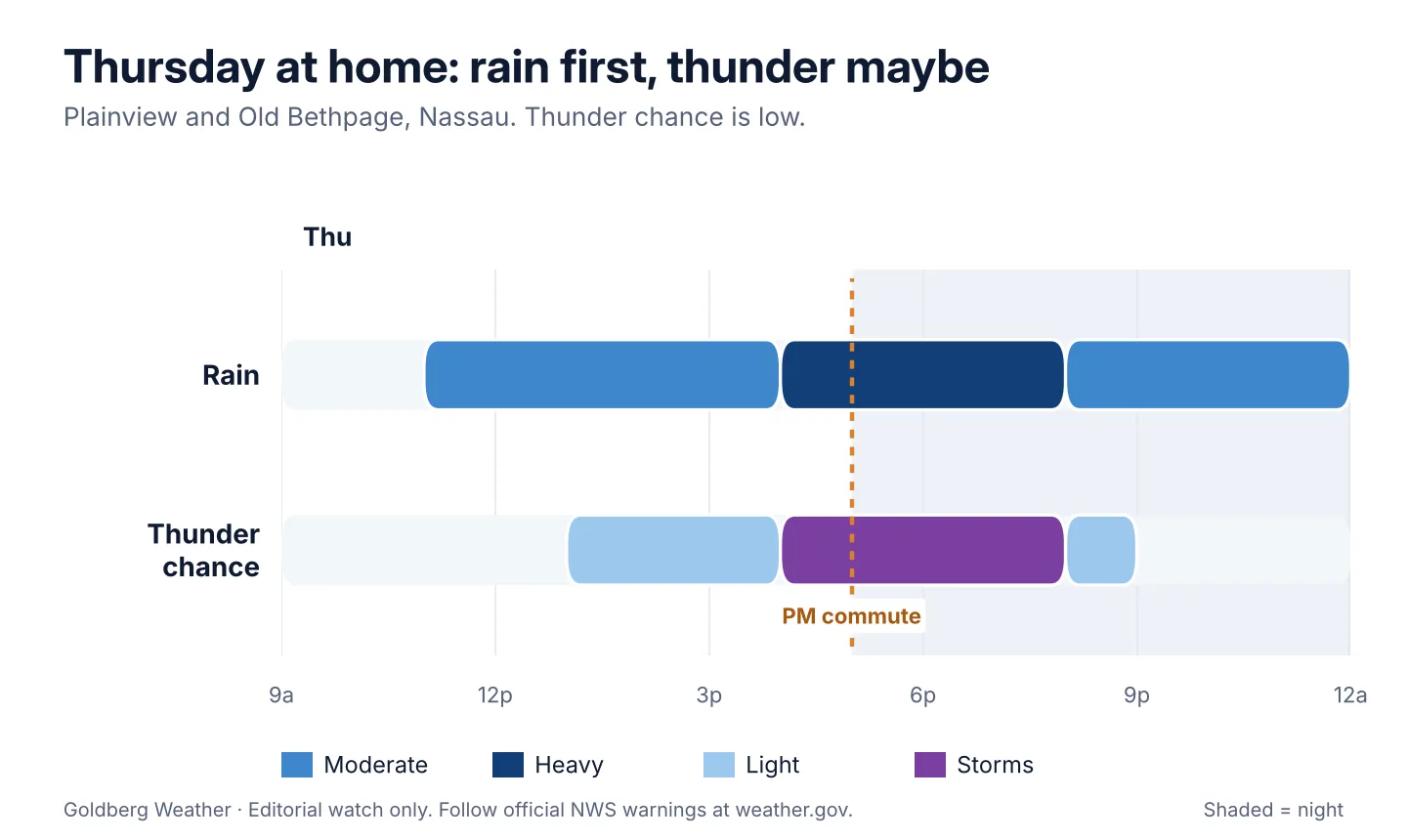
TLDR: Rain arrives late Thursday morning, heaviest late afternoon into the evening commute. Thunder near home is a long shot, most likely 4 to 8 PM if it happens. Figure 0.4 to 0.8 inches at home Thursday, worst case 1.5.
 Loop
8 maps. Tap one to enlarge it and read its caption.
Credits: NOAA HRRR, NOAA HRRR and RRFS via NOAA Open Data, NOAA NBM and GFS, NWS, Goldberg Weather, NOAA HRRR via NOAA Open Data, NOAA GFS via NOAA Open Data.
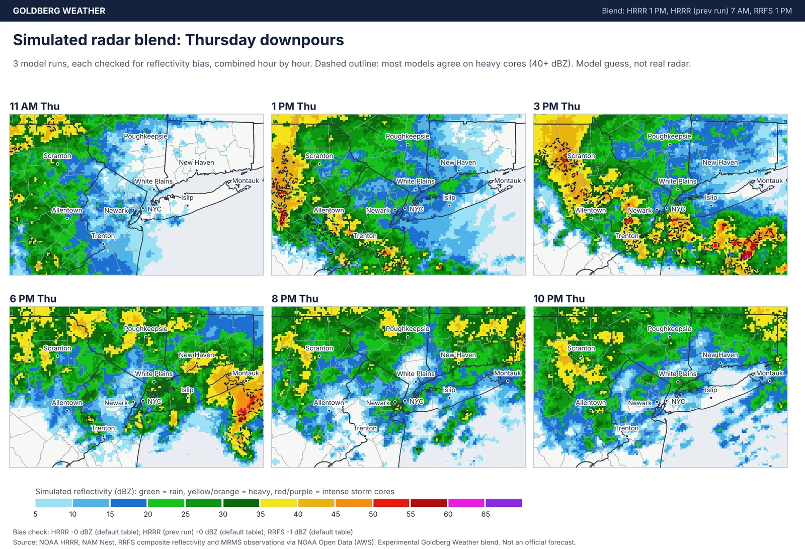
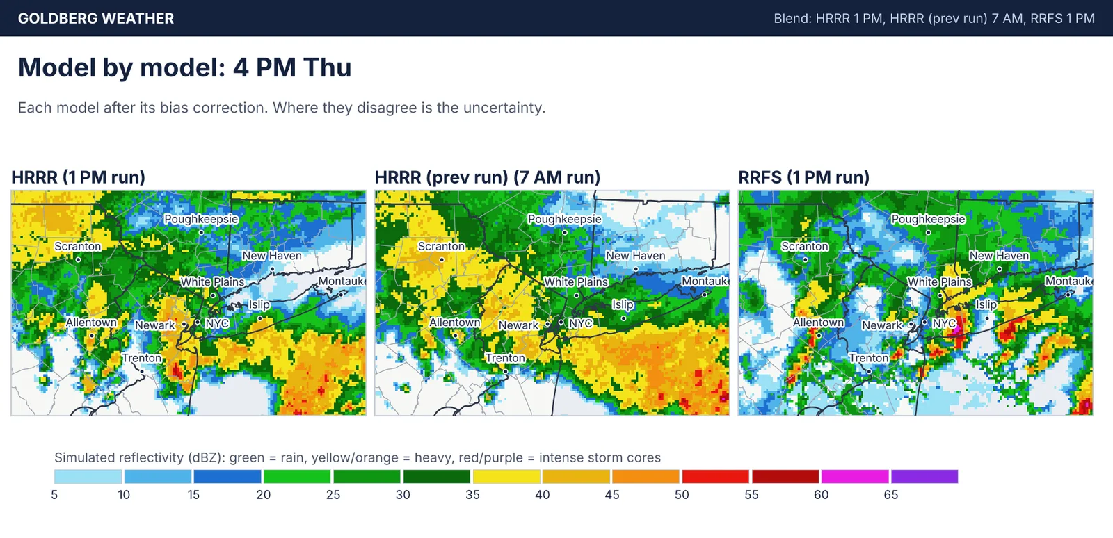
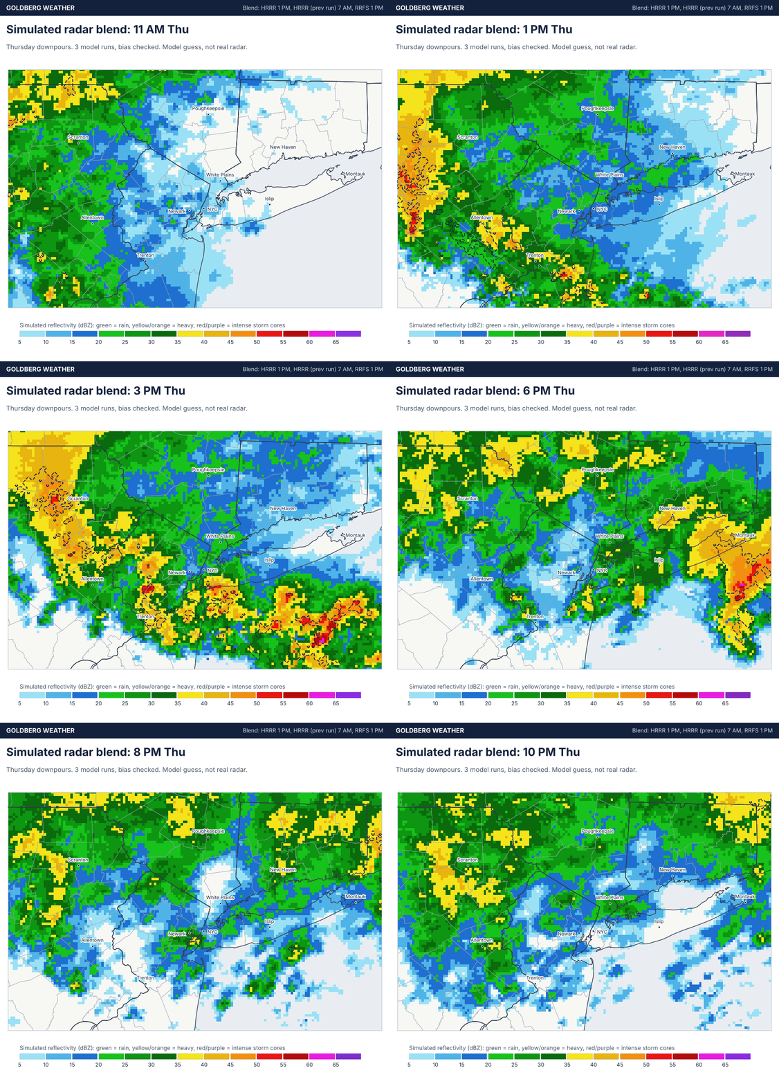
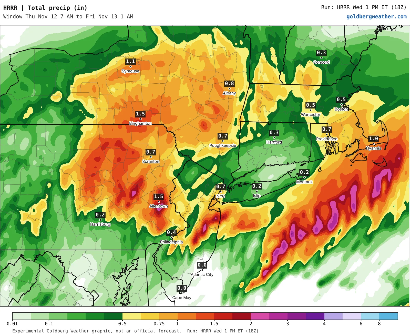
Timing: the simulated radar blend has the strongest cores near the city and western Long Island around 3 to 5 PM, sliding to eastern Suffolk by 6 PM. At 4 PM the RRFS parks its cores over the city, while both HRRR runs keep the heaviest rain south of Long Island.
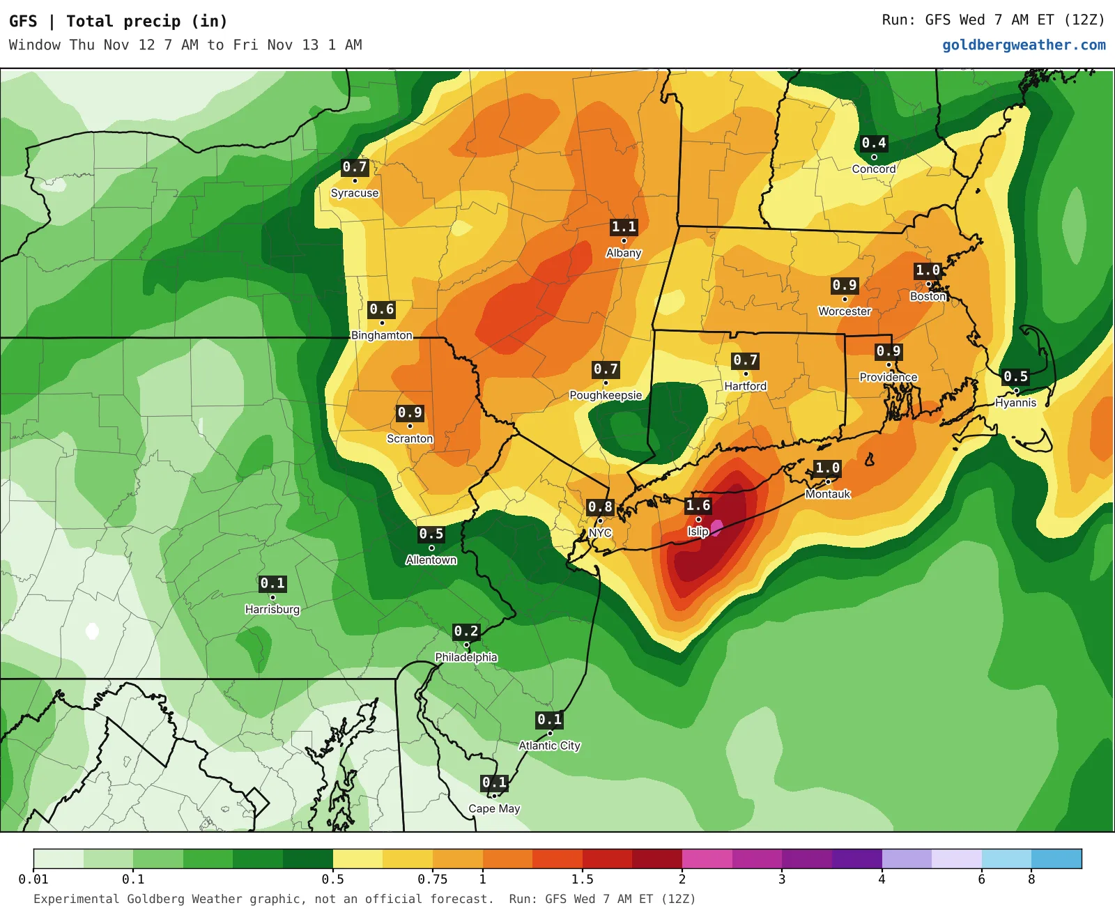
Amounts: Upton's total through early Saturday is about 1.05 inches for NYC, 0.89 for Syosset, 1.06 for Islip and 0.95 for White Plains. My blend agrees (0.86 Plainview, 0.99 Central Park). Gusts 25 to 30 mph Thursday night into Friday.
Thunder: the NWS grid cut the chance from 20 percent to 6 to 10 percent, and Upton keeps the storm fuel offshore. I lean a touch higher because the RRFS still has storms at home 4 to 9 PM, but it tends to overcook storms, and the HRRR and National Blend have nothing. Even the rain splits: HRRR 0.16 inches at Islip, GFS 1.6. The models agree it will rain, and that is about it.
Leave extra time on the LIRR, Metro-North and roads Thursday evening, and head inside if you hear thunder.
Bottom line: a wet, slow commute day, with thunder a maybe at best.
Editorial watch only. Follow official NWS warnings at weather.gov.