Tropical Storm Hermine- 9/2/2016 Afternoon Update
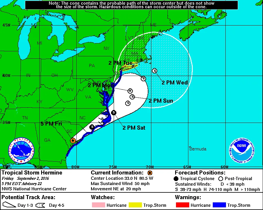
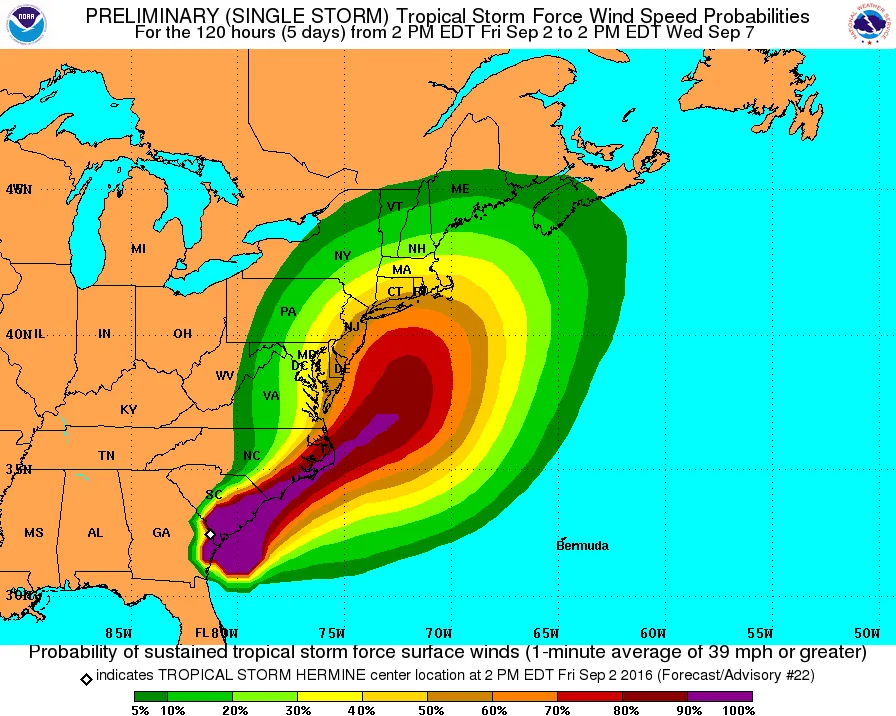
Summary: Hermine continues to pose a threat to our region in the Sunday to Monday timeframe. As of now, at minimum we can expect windy conditions with rain showers. Depending on track, these winds could exceed 50-60mph with heavy rain. Significant uncertainty remains.
Discussions:
As of this afternoon, Hermine continues to make its way across the deep south on its way up the East Coast. Modeling continues to indicate that Hermine will strengthen once it is back over open water. This is about where the model agreement ends.
Some models are showing Hermine re-strengthening to a weak Hurricane while others show Hermine becoming a Tropical Storm. Additionally, the potential track of Hermine continues to be vary. Some models (NAM/GFS) only bring Hermine up as north as Southern Jersey. While the Euro and some others bring Hermine further north to Mid Jersey. Needless to say, the forecast is complicated at best.
What this means for our region is the difference between a breezy Sunday and Monday with some light rain or a day featuring wind gusts over 60mph with heavy rain squalls passing through. We likely won’t have any model consensus until Saturday afternoon at the earliest. No matter the track there is sure to be significant flooding along the coast, mainly in the same areas that were impacted by Sandy.
The timing of the arrival of winds, and rain is just as variable as the rest of the forecast. Some models show Sunday being a salvageable day for a barbecue. While others show both Sunday and Monday to be a washout. At this point everyone should be keeping a close eye on the forecast and depending on the model runs tonight and tomorrow, be prepared to implement storm preparation plans.
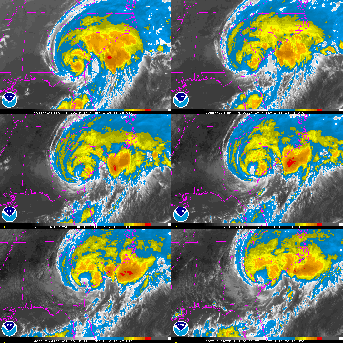 Loop
3 images. Tap one to enlarge it and read its caption.