Tropical Storm Hermine- Morning Update 9/3/2016
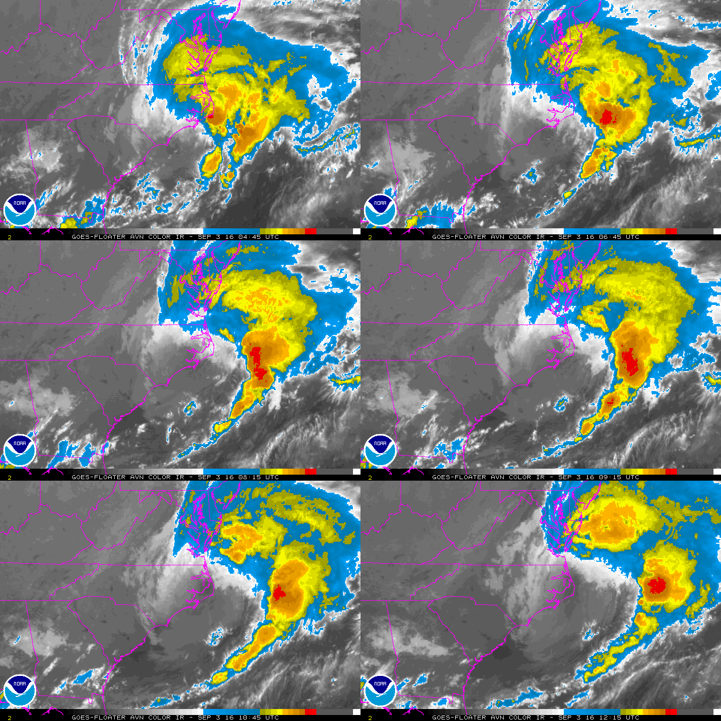
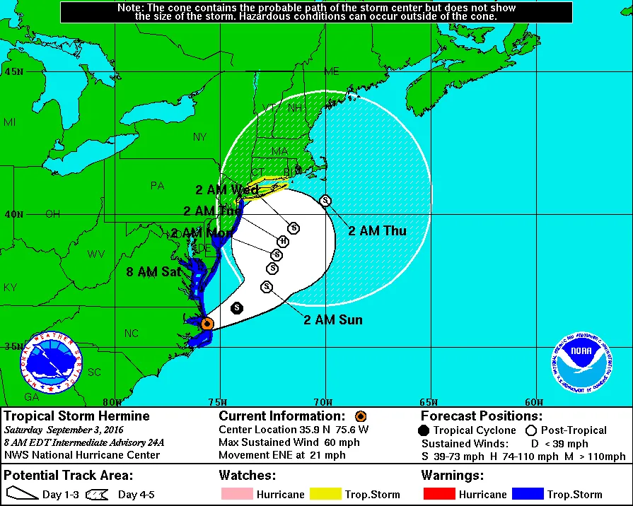
Summary: Models continue to show Hermine tracking up the coast in the vicinity of our region. The good news is that they are starting to cluster around a track off shore of our area. What this means for us is less rain and wind for Sunday and Monday. However, it will still be windy with wind gusts over 40mph. I will caution that this is still subject to change. A track 100 miles further West, would mean tropical storm conditions for our area.
Discussion:
As of this morning the center of Hermine is off the Coast of Virgina and heading Northeast at about 20mph. Hermine will continue on this general track through Monday, slowing down as it comes up the coast. It is expected that by late Sunday or early Monday Hermine will make its closest approach to our area and possibly stall out. As of now models are trending away from the tucked in strong solution that I was discussing yesterday. However, this does not mean that we’ll have nice weather on Sunday and Monday. Windy conditions with occasional rain should be expected over the next two days and possibly more depending on where Hermine tracks. I do need to mention that any track closer to the coast would mean more significant rains and wind. While the chances of this track have decreased, it still is possible that the storm could shift further North and West as it comes up the coast.
For those close to the shores, there is still a significant coastal flooding risk. While Hermine is tracking further out to sea, the storm will still be pushing pushing water against the shore for an extended period of time. This will likely lead to moderate coastal flooding along the lines of a strong NorEaster. You should be making appropriate plans to prepare for this potential flooding risk.
 Loop
2 images. Tap one to enlarge it and read its caption.