Goldberg Weather Live Updated 4:25 PM

All posts

January 18th Minor Snow Event
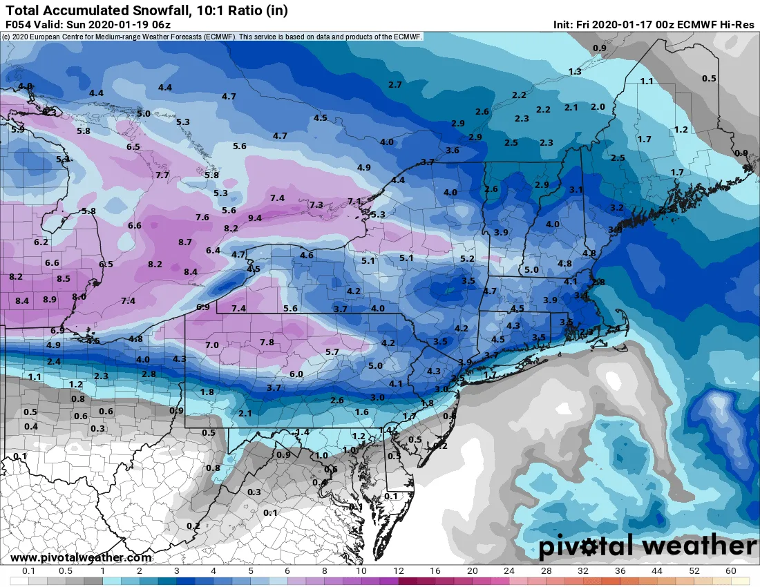
EURO 6Z 1 17

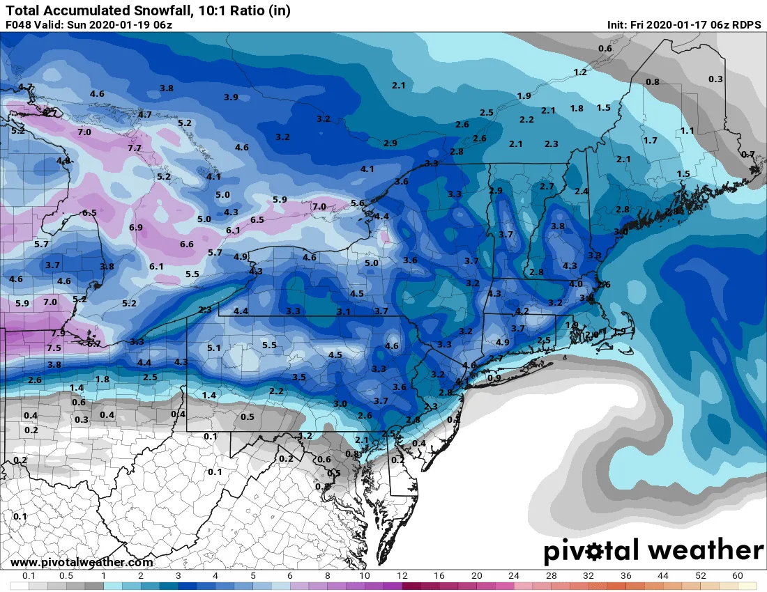
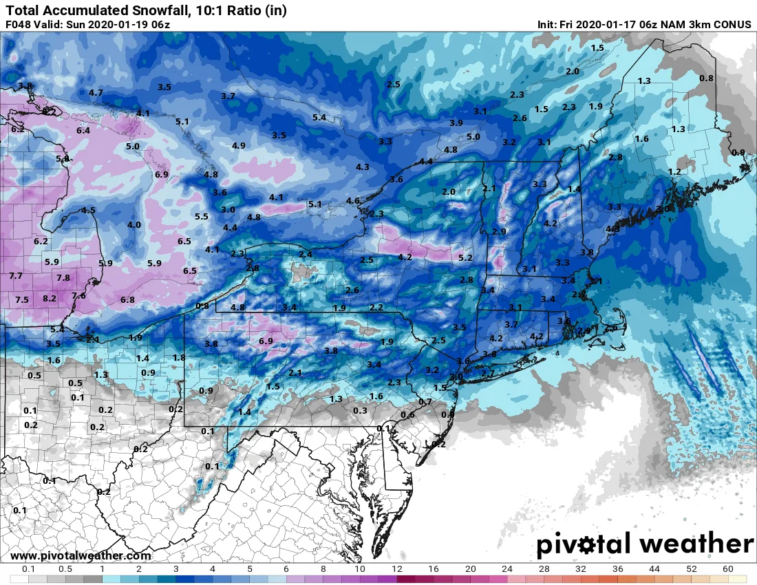
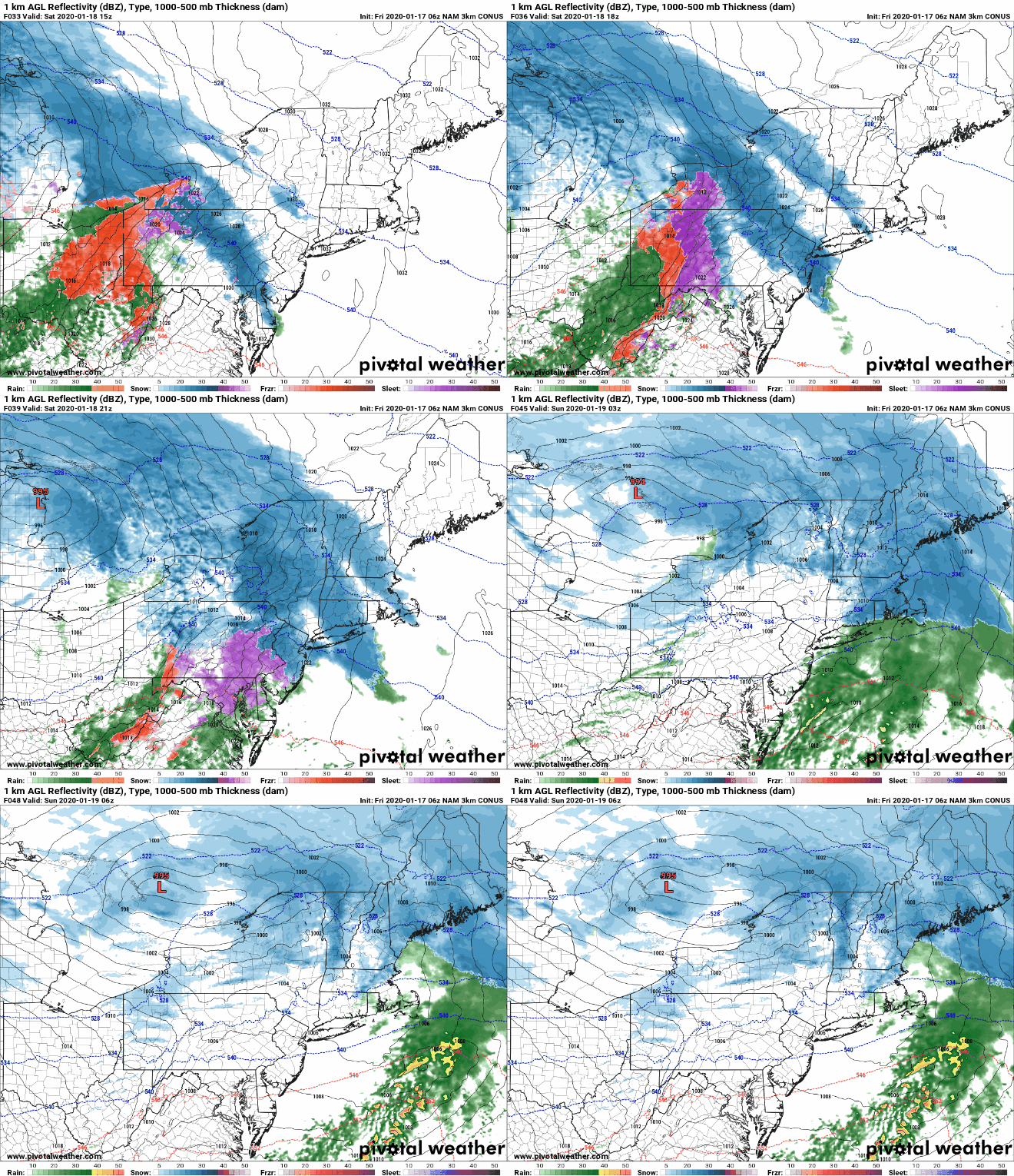
Overall this year has been relatively quiet when it comes to major snow storms, and that trend looks to continue in the near future. However, we are expecting a minor snowfall tomorrow throughout the region. As of this morning, it appears that this will be a low impact event, likely ending with some light drizzle. Snow will be begin mid-late morning as light to moderate snow, which will continue into the afternoon. By the late afternoon and early evening, temperatures will begin to rise and whatever precipitation falls during that time period will likely be in the form of light sleet or rain. By the conclusion of the event, you can expect a coating to two inches.

Temperatures should warm into the upper 30’s on Sunday which should help some of the snow melt. However, overnight Sunday into Monday temperatures will drop into the 20’s leading to the remaining snow and standing water to freeze.
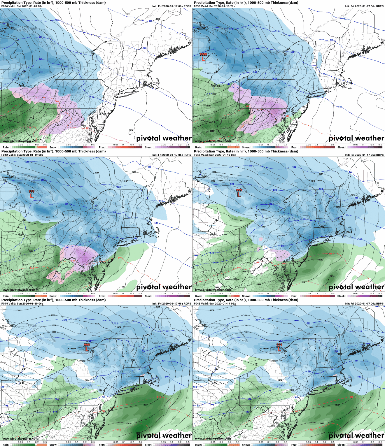
floop rdps 2020011706.prateptype.us ne
floop nam4km 2020011706.ref1km ptype.us ne
EURO 6Z 1 17
HRDPS 6Z 1 17
NAM 6Z 1 17

Follow on WhatsApp

All posts

My blend My forecast number: a weighted average of eight weather models, with more weight on the ones that have done best at Farmingdale.

Agreement How close the models are to each other. Close together means more confidence; far apart means the forecast could still change.

Confidence How sure I am about a call, from one dot (could easily change) to three (confident).

Bias-corrected Each model's recent habit, like running 2° too warm, is measured against what Farmingdale recorded and taken out before blending. It starts after two weeks of scored days.

Chance of rain From about 80 versions of the American and European models, each run with small tweaks. 7 in 10 means 7 of every 10 versions bring at least 0.04 in that day.