Goldberg Weather Live Updated 4:43 PM

All posts

2/12/2019 Winter Weather Event
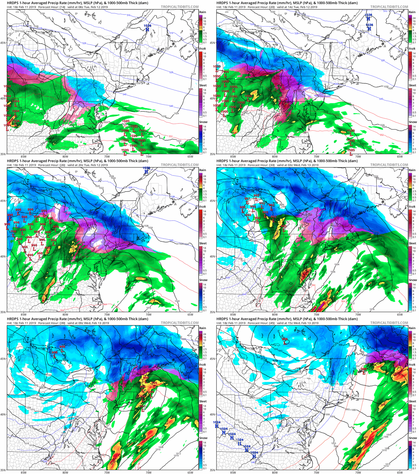
hrdps mslp pcpn frzn neus fh14 45

Image no longer available

I have not posted much about tomorrows event, simply because I’m not that impressed by it. Overall, we’re looking at a minor winter weather event for the area. Snow will begin tomorrow morning between 7 AM and 9 AM. Snow will continue throughout the morning before changing to sleet sometime around mid-day. Finally in the late afternoon or early evening the sleet will change over to rain. The further East you are the earlier the earlier the changeover to rain, the further North and West, the longer the sleet/snow will hold on.

Snow totals will be somewhere in the neighborhood of a coating to 2 inches, more West and less East. Additionally, we may see half an inch to an inch of sleet accumulation. The sleet accumulation will be highly dependent on surface temperatures and on how cold the lower and mid-levels of the atmosphere can stay.
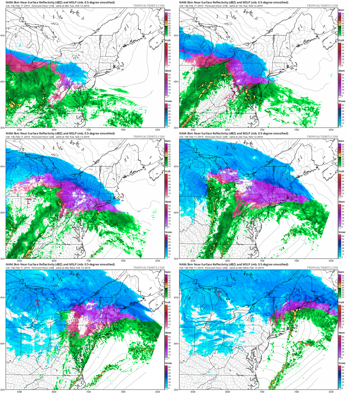
nam3km ref frzn neus fh14 39
hrdps mslp pcpn frzn neus fh14 45

Follow on WhatsApp

All posts

My blend My forecast number: a weighted average of eight weather models, with more weight on the ones that have done best at Farmingdale.

Agreement How close the models are to each other. Close together means more confidence; far apart means the forecast could still change.

Confidence How sure I am about a call, from one dot (could easily change) to three (confident).

Bias-corrected Each model's recent habit, like running 2° too warm, is measured against what Farmingdale recorded and taken out before blending. It starts after two weeks of scored days.

Chance of rain From about 80 versions of the American and European models, each run with small tweaks. 7 in 10 means 7 of every 10 versions bring at least 0.04 in that day.