And We’re Back- Early Season Storm to Impact Region on Thursday 11/15/18
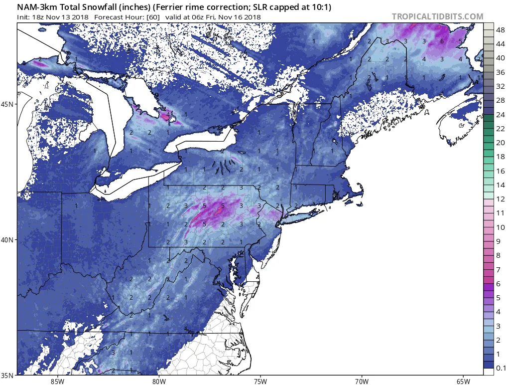
I’m sorry to be the bearer of bad news, but I have to open up shop early for the 2018-2019 Winter Season. As of this afternoon, it looks likely that our region will be impacted by a minor winter weather event on Thursday afternoon. Currently, it appears that snow will overspread the region starting mid-day on Thursday and continue into the early evening hours, with snow changing to rain from East to West.
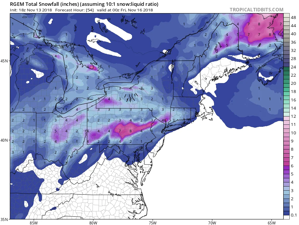
In terms of totals, as of now I am forecasting a dusting to 2″ area wide, with more to the west and less to the east. It is possible that areas of NYC may see closer to 4″ depending on timing and when the changeover to rain occurs. I would expect more accumulation on grass and cars then on roadways as temperatures throughout will be just below freezing.
More updates to come…
2 images. Tap one to enlarge it and read its caption.