Goldberg Weather Live Updated 4:43 PM

All posts

3/20/-3/22/2018 Storm Update
gfs asnow neus 8

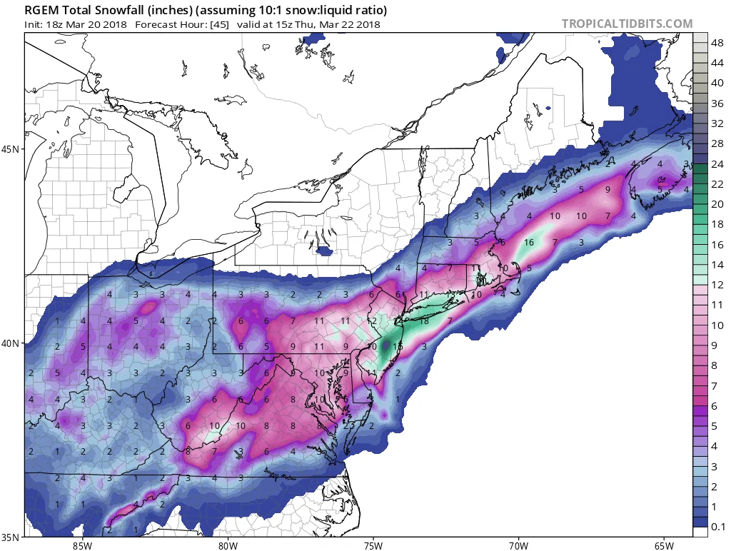
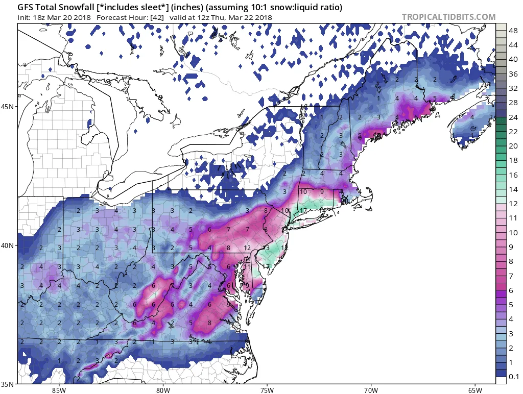
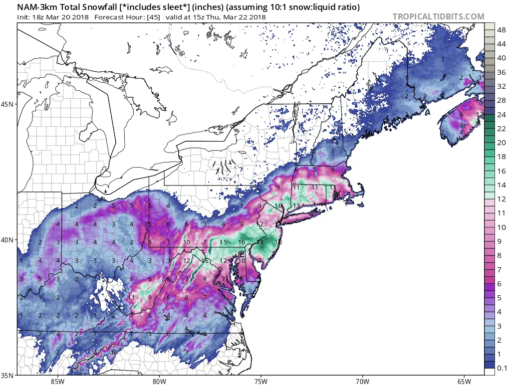
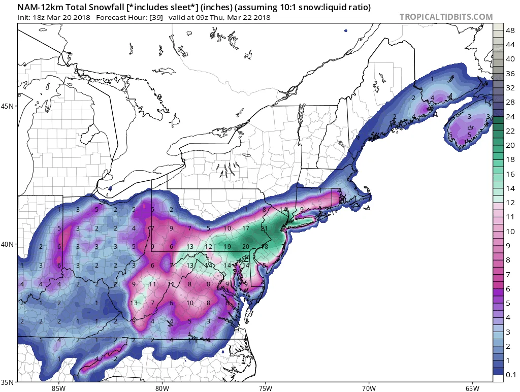
As I mentioned earlier today, we will be experiencing a significant winter storm over the next day and a half. Right now many may be experiencing sleet and other mixed precipitation. This will taper off tonight, and lead to a lull until around sunrise. Snow will pick up in intensity during the morning and continue as heavy snow into tomorrow evening. The models are showing the storm ending anywhere between 1- 7am on Thursday. To start, the snow will be the heavy wet snow that we saw during the last storm, but as the day goes on it will become lighter and more powdery as the upper atmosphere cools. By the end of the storm, you can expect anywhere from 8-14″ of snow, with some areas actually falling in the 12-16″ range depending on where the banding sets up during the day tomorrow.
gfs asnow neus 8
nam3km asnow neus 46
namconus asnow neus 14
rgem asnow neus 45

Follow on WhatsApp

All posts

My blend My forecast number: a weighted average of eight weather models, with more weight on the ones that have done best at Farmingdale.

Agreement How close the models are to each other. Close together means more confidence; far apart means the forecast could still change.

Confidence How sure I am about a call, from one dot (could easily change) to three (confident).

Bias-corrected Each model's recent habit, like running 2° too warm, is measured against what Farmingdale recorded and taken out before blending. It starts after two weeks of scored days.

Chance of rain From about 80 versions of the American and European models, each run with small tweaks. 7 in 10 means 7 of every 10 versions bring at least 0.04 in that day.