Friday and Saturday Storm Updates
There are two storms that we are tracking over the next few days. The first is for Friday morning: Snow will overspread the region overnight tonight and end by Friday morning between 9 and 11am. Total snowfall for the Friday storm will be 1-3 inches throughout the area. While not a significant event, it will be enough to cause headaches during the morning commute.
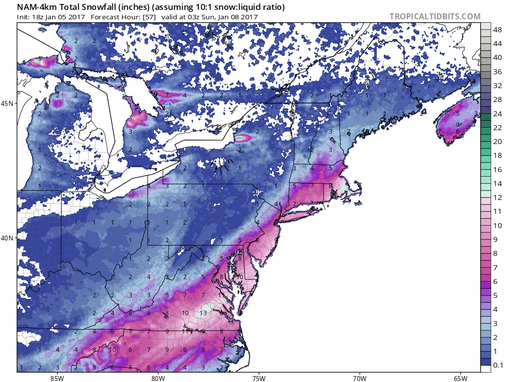
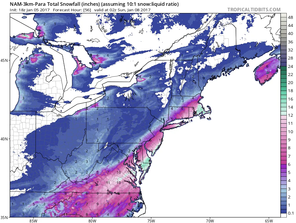
The more significant potential storm for our area comes mid-day on Saturday. As of now some models have it skirting just offshore, but the NAM has it impacting our region. The models that have it offshore continue to trend closer to the coast. At this time, I am leaning towards a minor event, but the NAM did get one of our surprise storms last winter correct. If the NAM is correct, we could see over 6″ of snow by the end of the storm.
The big wild card with this storm is the strength of an area of energy dropping in from the North Pole. As of now there is limited data on this energy since it is in a data sparse region. If the energy comes in stronger than modeled, the storm will track closer to the coast and be stronger than modeled. By this time tomorrow the energy will be much better sampled and we’ll have a good idea of what to expect during the day Saturday.
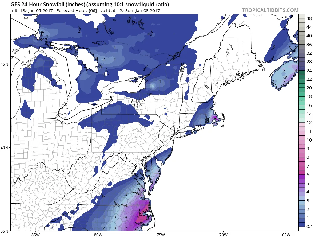
As of now here is a model roundup for Saturday:
NAM: 6″ Plus
GFS: Just off the coast
RGEM: Skirting the area with a few inches
EURO: Comes close to the area and a few possible inches
3 images. Tap one to enlarge it and read its caption.