Potential Snow Event Early Friday Morning
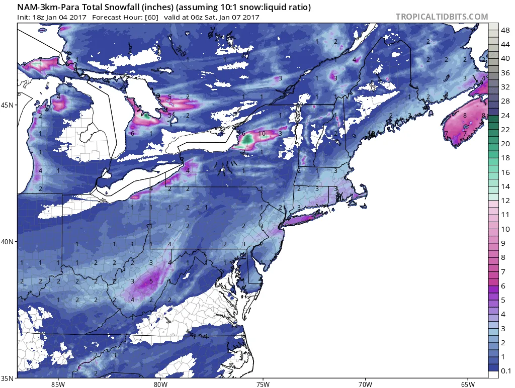
Models are beginning to hint at a potential snow event for early Friday morning. This event could have a significant impact on the Friday morning commute. As of now we can expect anywhere from 1-6 inches of snow, an unusually wide range for a prediction.
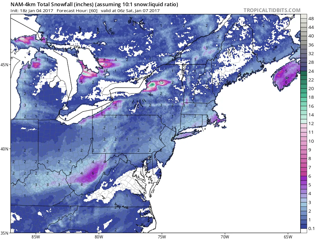
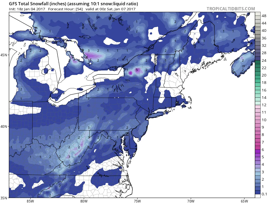
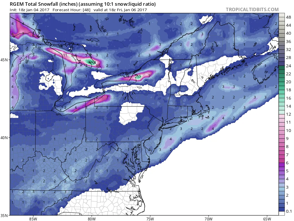
The reason for this wide range is the variability on the models. The Hi-Res short range models are beginning to show snow amounts over 4 inches. While the global models are sticking to less than 3 inches at most. We will have to continue to monitor this potential event and hopefully by tomorrow afternoon, we’ll have a better idea of the true impact.
Oh and also the global models have a fairly significant storm just off the coast on Sunday. Some bring some snow into the area, but there’s great uncertainty regarding this storm as of now.
Updates to come on both events…
Below are some of the model storm totals as of this afternoon:
4 images. Tap one to enlarge it and read its caption.