Goldberg Weather Live Updated 4:43 PM

All posts

3/12-3/13/18 Storm Update
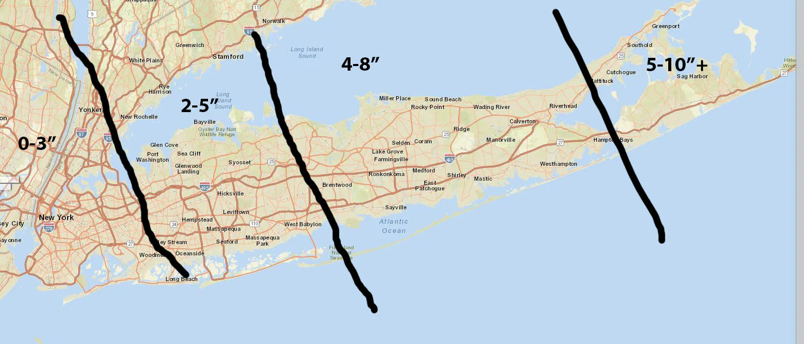
3 12 18 Storm

We are on track for a light to moderate snowfall across the area. Snow will begin over night and continue through the morning. There is still some uncertainty in regards to snowfall totals, but for now I’m leaning towards the lower end of my below forecast. The low appears to be tracking slightly further east than earlier modeled, which would reduce snowfall totals for our area. Additionally, short-range high-resolution modeling has not been enthusiastic with snowfall totals. The biggest impact from this storm will be the snow occurring during the morning commute, especially for Long Island drivers. At minimum by the time you get up in the morning all surfaces will be coated so certainly allow extra time for your morning commute.

Forecast:

3 12 18 Storm

Follow on WhatsApp

All posts

My blend My forecast number: a weighted average of eight weather models, with more weight on the ones that have done best at Farmingdale.

Agreement How close the models are to each other. Close together means more confidence; far apart means the forecast could still change.

Confidence How sure I am about a call, from one dot (could easily change) to three (confident).

Bias-corrected Each model's recent habit, like running 2° too warm, is measured against what Farmingdale recorded and taken out before blending. It starts after two weeks of scored days.

Chance of rain From about 80 versions of the American and European models, each run with small tweaks. 7 in 10 means 7 of every 10 versions bring at least 0.04 in that day.