Goldberg Weather Live Updated 4:43 PM

All posts

3/7/18 Update- Game On
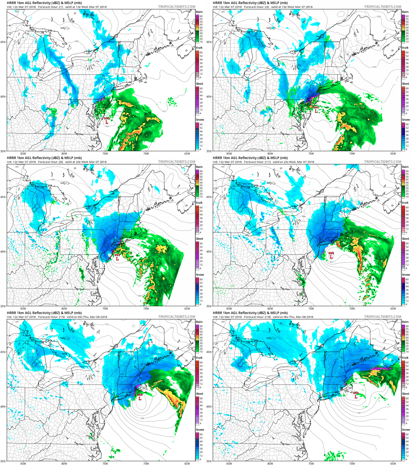
hrrr ref frzn neus fh1 18

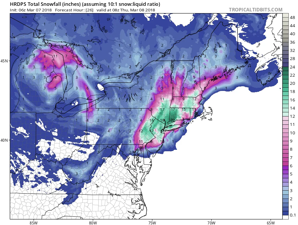
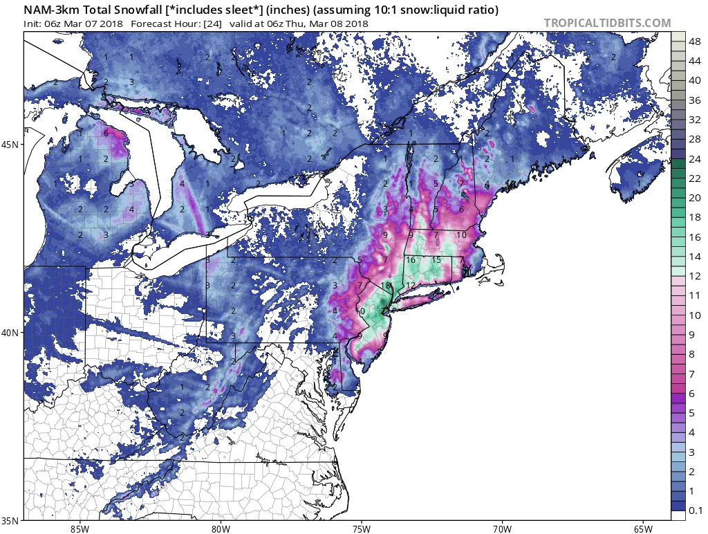
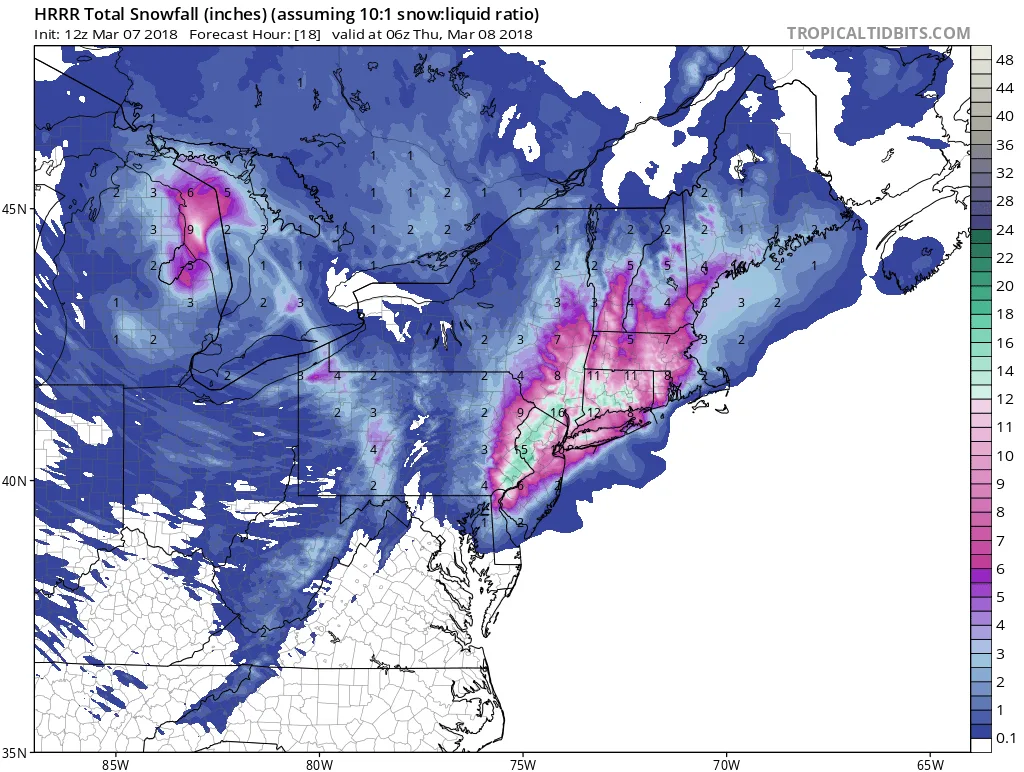
As I’ve been alluding to a slight shift East could make a significant difference in snowfall totals. Well, it happened and it looks like the storm will track slightly East of earlier modeling. What this means is increased totals for all. Suffolk and possibly parts of Nassau will see a mixture during the day, but Queens West will stay all snow.

The next round of precipitation will begin to overspread the area between now and noon. By 2-3PM the whole region will be in heavy snow bands with rates of 2-3″ per hour. The snow will end late tonight into early tomorrow from West to b East. Additionally, don’t be surprised to hear some thunder if you end up in bed one of the heavy bands.

Totals:

Eastern Suffolk: 2-5

Western Suffolk: 4-8

Nassau : 5-10

City: 6-12+
hrrr ref frzn neus fh1 18
hrrr asnow neus 18
hrrr ref frzn neus fh1 18
hrdps asnow neus 26
nam3km asnow neus 25

Follow on WhatsApp

All posts

My blend My forecast number: a weighted average of eight weather models, with more weight on the ones that have done best at Farmingdale.

Agreement How close the models are to each other. Close together means more confidence; far apart means the forecast could still change.

Confidence How sure I am about a call, from one dot (could easily change) to three (confident).

Bias-corrected Each model's recent habit, like running 2° too warm, is measured against what Farmingdale recorded and taken out before blending. It starts after two weeks of scored days.

Chance of rain From about 80 versions of the American and European models, each run with small tweaks. 7 in 10 means 7 of every 10 versions bring at least 0.04 in that day.