Saturday Storm- Friday Evening Update
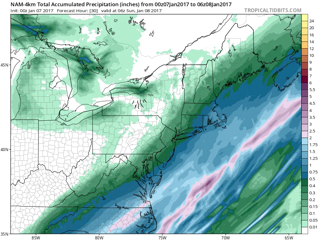
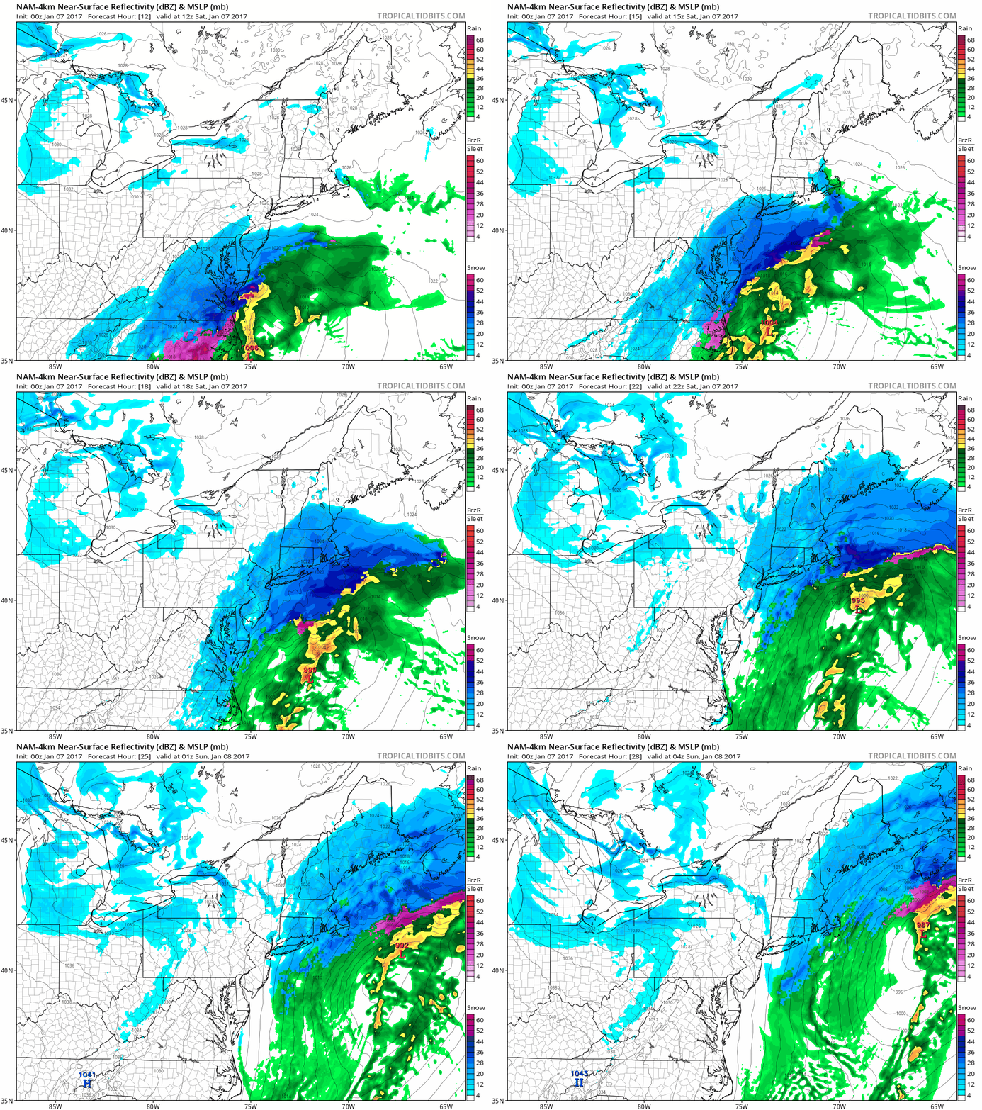
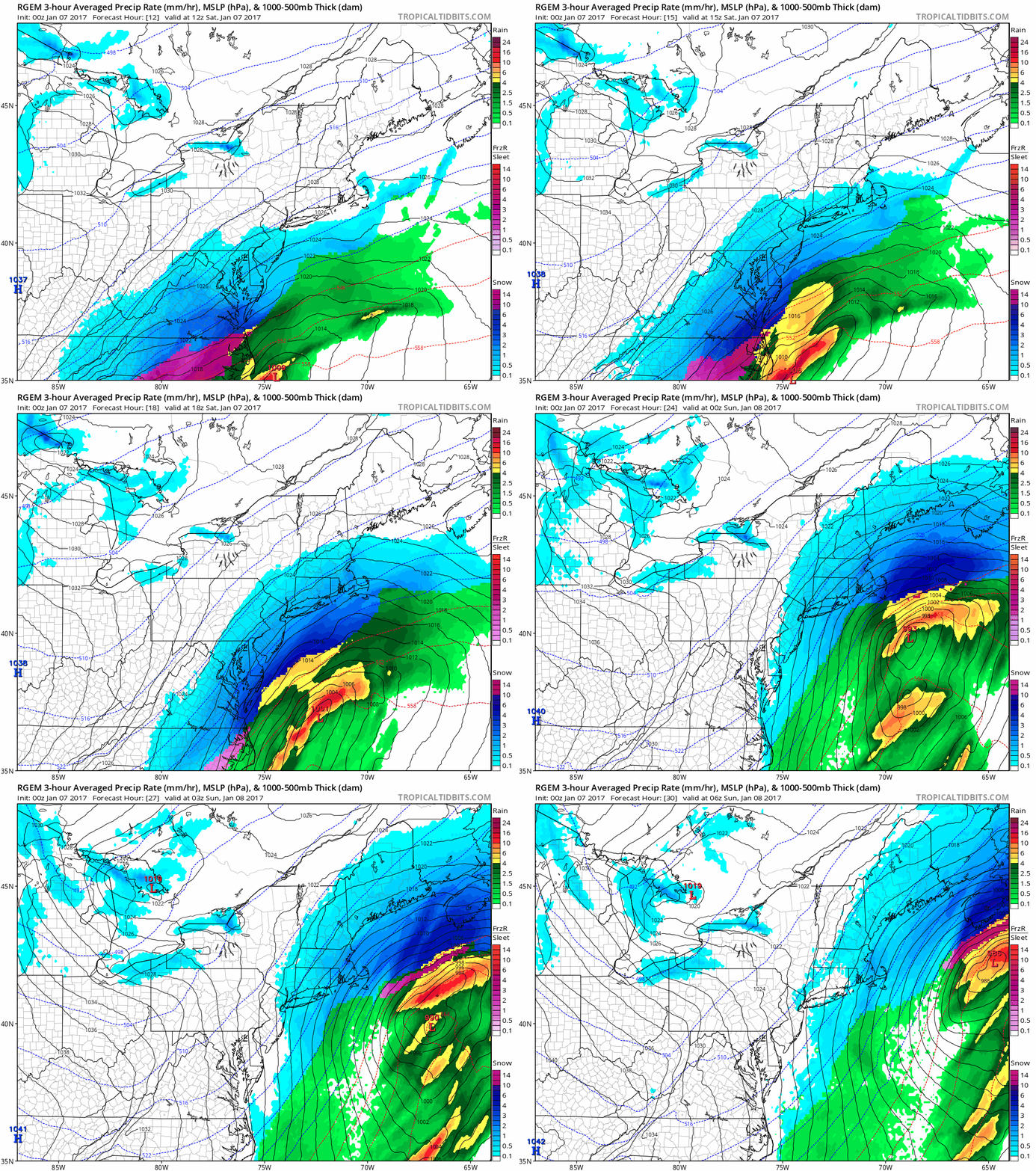
Tonights model runs continue the theme of a moderate snowfall for the region tomorrow. The snow will overspread the region between 8 and 10 am tomorrow. It will continue throughout the day, heavy at times. Snow should begin to taper off sometime between 5 and 7PM tomorrow evening. Most models have come into agreement that snowfall will be somewhere in the 3-6″ range. However, I caution that we could see up to 8″ depending on ratios. (Usually we calculate 10:1, 10 inches for every inch of liquid, but when it becomes extra cold in the atmosphere this can go up to 15:1 or 20:1).
The further East on Long Island you are, the more snow you will see. The East End may every well see a foot of snow by the time the storm pulls away. For NYC you can expect about 2-4″, but the ratio comment above applies to NYC as well.
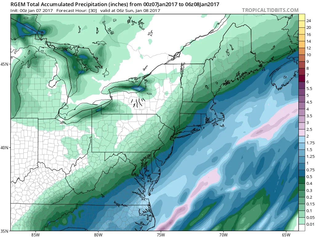
Here’s a current summary of liquid amounts that models are showing in NYC (Remember multiple these by 10/12/15/20 to get actual snowfall amounts). These liquid amounts increase as you go further East:
SREF: 0.45
NAM (regular): 0.35- 0.45
NAM (Hi-Res): 0.4-0.5
GFS: 0.10 – 0.15
RGEM: 0.40 – 0.45
GGEM: 0.30 – 0.35
 Loop
 Loop
4 images. Tap one to enlarge it and read its caption.